world.wikisort.org - USA
Como is an unincorporated community in Park County in the Rocky Mountains of central Colorado, United States. According to the 2010 census, the population of zip code 80432 is 439, including surrounding subdivisions in a 15 mile radius. Metropolitan Como proper usually has a population of 12 to 15 residents, within the Como plat.[3]
This article needs additional citations for verification. (February 2011) |
Como, Colorado | |
|---|---|
Unincorporated community | |
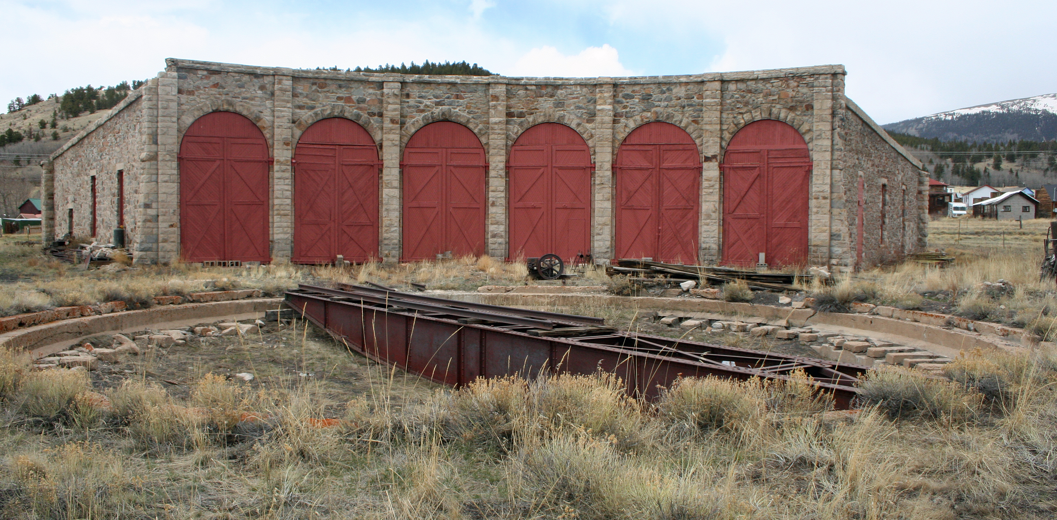 Como Roundhouse is the only narrow-gauge roundhouse still standing in Colorado. Until 1937, it handled repairs on the railroads. In 1938, the remaining tracks were removed. | |
 Como, Colorado Location within the state of Colorado | |
| Coordinates: 39°18′57″N 105°53′32″W | |
| Country | |
| State | |
| County | Park County[1] |
| Elevation | 9,813 ft (2,991 m) |
| Population (2010) | |
| • Total | 439 |
| Time zone | UTC-7 (MST) |
| • Summer (DST) | UTC-6 (MDT) |
| ZIP Code[2] | 80432 |
History

It is believed the town was named by miners from Como, Italy, who worked the coal fields of the area. In 1879, the town became the location of a depot of the Denver, South Park and Pacific Railroad, which was extended over Kenosha Pass to reach the silver mining areas during the Colorado Silver Boom. Later, the town served as a division point for trains going northward over Boreas Pass and southward toward Garos and over Trout Creek Pass at the western end of South Park. The town has many historic weathered structures, including the roundhouse, hotel, and depot and has the air of a ghost town that is still nevertheless populated, by twenty people. It has a small commercial district consisting of a post office, gallery, hotel. The depot has been renovated with plans to make it an area tourist attraction.[4]
Geography

Como is located at the northern end of South Park, Como is an historic railroad settlement. It sits approximately one-half mile (1 km) west of U.S. Route 285 and some nine miles (15 km) northeast of the county seat of Fairplay. Como is accessible by a paved County Road 33, which becomes gravel inside the town. Boreas Pass Road runs northwest over Boreas Pass to Breckenridge. The mountains northwest of Como form a dramatic background to the site of the town on the flank of Little Baldy Mountain.
Notable people
See also
- List of cities and towns in Colorado
- Front Range Urban Corridor
References
- "US Board on Geographic Names". United States Geological Survey. 2007-10-25. Retrieved 2008-01-31.
- "ZIP Code Lookup". United States Postal Service. December 22, 2006. Archived from the original (JavaScript/HTML) on September 3, 2007. Retrieved December 22, 2006.
- "2010 Census Population for ZIP Code 80432". zip-coedes.com. Retrieved February 4, 2014.
- Laura King Van Dusen, "Como High School: An Unplanned Time Capsule of Earlier Days, Artifacts Uncovered from Como's Heyday," Historic Tales from Park County: Parked in the Past (Charleston, South Carolina: The History Press, 2013), ISBN 978-1-62619-161-7, pp. 163-169.
- Laura King Van Dusen, "The Short, Tragic Life of Anna Blythe Speas: Belle of Boulder, Suspected Criminal in Como, Dead in Denver at Twenty-eight", Historic Tales from Park County: Parked in the Past, pp. 113-125.
External links
![]() Media related to Como, Colorado at Wikimedia Commons
Media related to Como, Colorado at Wikimedia Commons
Municipalities and communities of Park County, Colorado, United States | ||
|---|---|---|
County seat: Fairplay | ||
| Towns |
|  |
| CDPs | ||
| Unincorporated communities | ||
| Ghost towns | ||
| ||
Authority control | |
|---|---|
| General |
|
| National libraries | |
| Other |
|
Другой контент может иметь иную лицензию. Перед использованием материалов сайта WikiSort.org внимательно изучите правила лицензирования конкретных элементов наполнения сайта.
WikiSort.org - проект по пересортировке и дополнению контента Википедии