world.wikisort.org - USA
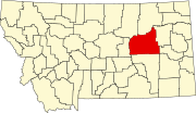
Cohagen is an unincorporated community in southeastern Garfield County, Montana, United States. It lies along Highway 59 southeast of the town of Jordan, the county seat of Garfield County.[1] Its elevation is 2,720 feet (829 m).[2]
Cohagen, Montana | |
|---|---|
Unincorporated community | |
 Cohagen Bar in Cohagen, Montana | |
 Cohagen  Cohagen | |
| Coordinates: 47°3′16″N 106°37′3″W | |
| Country | United States |
| State | Montana |
| County | Garfield |
| Elevation | 2,720 ft (830 m) |
| Time zone | UTC-7 (Mountain (MST)) |
| • Summer (DST) | UTC-6 (MDT) |
| ZIP codes | 59322 |
| GNIS feature ID | 806931 |
History
Cohagen's post office, with the ZIP code of 59322,[3] opened on August 18, 1905.[4] The town name is the mother's maiden name of the first postmaster Harry Harris.[5]
In September 2020, Cohagen was evacuated due to wildfire threat.[6]
Climate
According to the Köppen Climate Classification system, Cohagen has a semi-arid climate, abbreviated "BSk" on climate maps.[7]
| Climate data for Cohagen, Montana (1991–2020) | |||||||||||||
|---|---|---|---|---|---|---|---|---|---|---|---|---|---|
| Month | Jan | Feb | Mar | Apr | May | Jun | Jul | Aug | Sep | Oct | Nov | Dec | Year |
| Average high °F (°C) | 30.7 (−0.7) |
34.1 (1.2) |
46.1 (7.8) |
56.9 (13.8) |
66.7 (19.3) |
76.1 (24.5) |
85.8 (29.9) |
85.1 (29.5) |
73.8 (23.2) |
58.3 (14.6) |
43.7 (6.5) |
32.9 (0.5) |
57.5 (14.2) |
| Daily mean °F (°C) | 18.7 (−7.4) |
21.9 (−5.6) |
32.8 (0.4) |
42.9 (6.1) |
52.6 (11.4) |
61.9 (16.6) |
69.8 (21.0) |
68.4 (20.2) |
57.7 (14.3) |
44.3 (6.8) |
30.9 (−0.6) |
20.9 (−6.2) |
43.6 (6.4) |
| Average low °F (°C) | 6.8 (−14.0) |
9.8 (−12.3) |
19.4 (−7.0) |
28.8 (−1.8) |
38.5 (3.6) |
47.8 (8.8) |
53.8 (12.1) |
51.8 (11.0) |
41.5 (5.3) |
30.3 (−0.9) |
18.2 (−7.7) |
9.0 (−12.8) |
29.6 (−1.3) |
| Average precipitation inches (mm) | 0.31 (7.9) |
0.28 (7.1) |
0.42 (11) |
1.11 (28) |
2.33 (59) |
2.27 (58) |
1.61 (41) |
1.12 (28) |
1.12 (28) |
1.06 (27) |
0.40 (10) |
0.31 (7.9) |
12.34 (312.9) |
| Average snowfall inches (cm) | 5.2 (13) |
3.8 (9.7) |
3.4 (8.6) |
2.1 (5.3) |
0.6 (1.5) |
0.0 (0.0) |
0.0 (0.0) |
0.0 (0.0) |
0.0 (0.0) |
1.2 (3.0) |
3.1 (7.9) |
5.2 (13) |
24.6 (62) |
| Source: NOAA[8] | |||||||||||||
References
- McNally, Rand (2008). The Road Atlas '08. Chicago: Rand McNally. p. 61.
- U.S. Geological Survey Geographic Names Information System: Cohagen, Montana
- "Zip Code Lookup". Archived from the original on 2011-06-15.
- U.S. Geological Survey Geographic Names Information System: Cohagen Post Office
- "Cohagen". Montana Place Names Companion. Montana Historical Society. Retrieved 2 April 2021.
- "Alert for Garfield (Montana) Issued by the National Weather Service". September 2, 2020.
- "Climate Summary for Cohagen, Montana".
- "NOAA NCEI U.S. Climate Normals Quick Access". NOAA. Retrieved July 7, 2022.
Municipalities and communities of Garfield County, Montana, United States | ||
|---|---|---|
County seat: Jordan | ||
| Town |
|  |
| Unincorporated communities |
| |
| ||
This Garfield County, Montana state location article is a stub. You can help Wikipedia by expanding it. |
Текст в блоке "Читать" взят с сайта "Википедия" и доступен по лицензии Creative Commons Attribution-ShareAlike; в отдельных случаях могут действовать дополнительные условия.
Другой контент может иметь иную лицензию. Перед использованием материалов сайта WikiSort.org внимательно изучите правила лицензирования конкретных элементов наполнения сайта.
Другой контент может иметь иную лицензию. Перед использованием материалов сайта WikiSort.org внимательно изучите правила лицензирования конкретных элементов наполнения сайта.
2019-2025
WikiSort.org - проект по пересортировке и дополнению контента Википедии
WikiSort.org - проект по пересортировке и дополнению контента Википедии