world.wikisort.org - USA
Clifton is a census-designated place (CDP) and post office in and governed by Mesa County, Colorado, United States.
Clifton, Colorado | |
|---|---|
Census-designated place | |
 F Road (U.S. Route 6) in Clifton looking toward Grand Mesa. | |
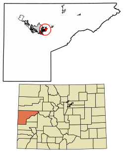 Location of the Clifton CDP in Mesa County, Colorado. | |
 Clifton Location of the Clifton CDP in the United States. | |
| Coordinates: 39°04′35″N 108°27′38″W[1] | |
| Country | |
| State | |
| County | Mesa County |
| Government | |
| • Type | unincorporated town |
| Area | |
| • Total | 6.089 sq mi (15.771 km2) |
| • Land | 6.016 sq mi (15.582 km2) |
| • Water | 0.073 sq mi (0.189 km2) |
| Elevation | 4,724 ft (1,440 m) |
| Population (2010) | |
| • Total | 19,889 |
| • Density | 3,306/sq mi (1,276/km2) |
| Time zone | UTC-7 (MST) |
| • Summer (DST) | UTC-6 (MDT) |
| ZIP Code[3] | 81520 |
| Area code | 970 |
| GNIS feature[2] | Clifton CDP |
Description
The CDP is a part of the Grand Junction, CO Metropolitan Statistical Area. The Clifton post office has the ZIP Code 81520.[3] At the United States Census 2010, the population of the Clifton CDP was 19,889, while the population of the 81520 ZIP Code Tabulation Area was 13,447.[4]
History
The Clifton Post Office has been in operation since 1900.[5] The community was named for cliffs near the town site.[6]
Geography
The Clifton CDP has an area of 3,897 acres (15.771 km2), including 47 acres (0.189 km2) of water.[1]
Demographics
| Year | Pop. | ±% |
|---|---|---|
| 1970 | 5,223 | — |
| 1980 | 6,597 | +26.3% |
| 1990 | 12,671 | +92.1% |
| 2000 | 12,238 | −3.4% |
| 2010 | 19,889 | +62.5% |
| 2020 | — | |
| Source: United States Census Bureau | ||
The United States Census Bureau initially defined the Clifton CDP for the 1980 United States Census.
See also
- List of census-designated places in Colorado
References
- "State of Colorado Census Designated Places - BAS20 - Data as of January 1, 2020". United States Census Bureau. Retrieved December 24, 2020.
- "U.S. Board on Geographic Names: Domestic Names". United States Geological Survey. Retrieved December 24, 2020.
- "Look Up a ZIP Code". United States Postal Service. Retrieved December 24, 2020.
- "2010: DEC Summary File 1". United States Census Bureau. Retrieved December 24, 2020.
- "Post offices". Jim Forte Postal History. Archived from the original on 6 March 2016. Retrieved 24 June 2016.
- Dawson, John Frank. Place names in Colorado: why 700 communities were so named, 150 of Spanish or Indian origin. Denver, CO: The J. Frank Dawson Publishing Co. p. 14.
External links
Wikimedia Commons has media related to Clifton, Colorado.
Municipalities and communities of Mesa County, Colorado, United States | ||
|---|---|---|
County seat: Grand Junction | ||
| Cities |  | |
| Towns | ||
| CDPs | ||
| Unincorporated communities | ||
| Ghost towns |
| |
| ||
Authority control | |
|---|---|
| General |
|
| National libraries | |
| Other |
|
На других языках
[de] Clifton (Colorado)
Clifton ist eine US-amerikanische Stadt im Mesa County im US-Bundesstaat Colorado. Sie hat 20.413 Einwohner (Stand: 2020). Die Stadt liegt bei den geographischen Koordinaten 39,08° Nord, 108,46° West. Die Fläche der Stadt beträgt 17,7 km².- [en] Clifton, Colorado
Текст в блоке "Читать" взят с сайта "Википедия" и доступен по лицензии Creative Commons Attribution-ShareAlike; в отдельных случаях могут действовать дополнительные условия.
Другой контент может иметь иную лицензию. Перед использованием материалов сайта WikiSort.org внимательно изучите правила лицензирования конкретных элементов наполнения сайта.
Другой контент может иметь иную лицензию. Перед использованием материалов сайта WikiSort.org внимательно изучите правила лицензирования конкретных элементов наполнения сайта.
2019-2026
WikiSort.org - проект по пересортировке и дополнению контента Википедии
WikiSort.org - проект по пересортировке и дополнению контента Википедии