world.wikisort.org - USA
Clay Township is one of nine townships in Hamilton County, Indiana, United States. As of the 2010 census, its population was 83,293 and it contained 32,375 housing units.[1] With the annexation of Home Place, Indiana, Carmel, became completely coterminous with the township.[2]
Clay Township | |
|---|---|
Township | |
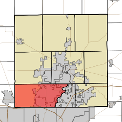 Location in Hamilton County | |
| Coordinates: 39°57′48″N 86°08′54″W | |
| Country | United States |
| State | Indiana |
| County | Hamilton |
| Settled | 1802 |
| Township organized | 1833 |
| Government | |
| • Type | Indiana township |
| Area | |
| • Total | 50.18 sq mi (130.0 km2) |
| • Land | 49.09 sq mi (127.1 km2) |
| • Water | 1.09 sq mi (2.8 km2) 2.17% |
| Elevation | 843 ft (257 m) |
| Population (2019) | |
| • Total | 101,068 |
| • Density | 2,014.1/sq mi (777.6/km2) |
| ZIP codes | 46032, 46033, 46074, 46077, 46082, 46260, 46280, 46290 |
| Area code(s) | 317, 463 |
| GNIS feature ID | 0453209 |
History
Clay Township was organized in 1833.[3]
Micah Newby House was listed on the National Register of Historic Places in 1986.[4]
Geography
According to the 2010 census, the township has a total area of 50.18 square miles (130.0 km2), of which 49.09 square miles (127.1 km2) (or 97.83%) is land and 1.09 square miles (2.8 km2) (or 2.17%) is water.[1] The streams of Almond Ditch, Ams Run, Blue Woods Creek, Boone Creek, Center Creek, Clay Creek, Cool Creek, Elliot Creek, Lily Vestal Drain, Henley Creek, Highway Run, Hot Lick Creek, Kirkendall Creek, Lion Creek, Little Cool Creek, Long Branch, Mitchener Ditch, Spring Mill Run, Well Run, Will Creek, and Witt Creek run through this township.
Cities and towns
Adjacent townships
- Washington Township (north)
- Noblesville Township (northeast)
- Delaware Township (east)
- Washington Township, Marion County (south)
- Pike Township, Marion County (southwest)
- Eagle Township, Boone County (west)
- Union Township, Boone County (northwest)
Cemeteries
The township contains six cemeteries: Calvary, Carmel, Farley, Pleasant Grove, Poplar Ridge, and White Chapel.
Major highways
- Interstate 465
- U.S. Route 31
- U.S. Route 421
- State Road 234
- State Road 431
References
- "Clay Township, Hamilton County, Indiana". Geographic Names Information System. United States Geological Survey, United States Department of the Interior. Retrieved 2009-09-24.
- United States Census Bureau cartographic boundary files
- "Population, Housing Units, Area, and Density: 2010 - County -- County Subdivision and Place -- 2010 Census Summary File 1". United States Census. Archived from the original on 2020-02-12. Retrieved 2013-05-10.
- "Home Place annexation begins today • Current Publishing". March 2018.
- Haines, John F. (1915). History of Hamilton County, Indiana: Her People, Industries And Institutions, Volume 1. B.F. Bowen & Co. p. 153.
- "National Register Information System". National Register of Historic Places. National Park Service. July 9, 2010.
External links
Municipalities and communities of Hamilton County, Indiana, United States | ||
|---|---|---|
County seat: Noblesville | ||
| Cities |  | |
| Towns | ||
| Townships | ||
| Unincorporated communities |
| |
| Footnotes | ‡This populated place also has portions in an adjacent county or counties | |
| ||
Authority control | |
|---|---|
| General |
|
| National libraries | |
This Hamilton County, Indiana location article is a stub. You can help Wikipedia by expanding it. |
Другой контент может иметь иную лицензию. Перед использованием материалов сайта WikiSort.org внимательно изучите правила лицензирования конкретных элементов наполнения сайта.
WikiSort.org - проект по пересортировке и дополнению контента Википедии