world.wikisort.org - USA
Chews Landing (or Chews) is an unincorporated community within Gloucester Township, in Camden County, New Jersey, United States.[2][3]
Chews Landing, New Jersey | |
|---|---|
Unincorporated community | |
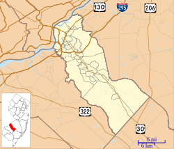
 Chews Landing Location in Camden County (Inset: Camden County in New Jersey)  Chews Landing Chews Landing (New Jersey)  Chews Landing Chews Landing (the United States) | |
| Coordinates: 39°50′00″N 75°03′47″W | |
| Country | |
| State | |
| County | Camden |
| Township | Gloucester |
| Named for | Jeremiah Chew |
| Elevation | 12 m (39 ft) |
| Time zone | UTC-5 (Eastern (EST)) |
| • Summer (DST) | UTC-4 (EDT) |
| Area code(s) | 856 |
| GNIS feature ID | 882408[1] |
Located near the Big Timber Creek, Chews Landing is named after Jeremiah Chew, a revolutionary officer.[4] It is also home to St. John's Episcopal Church and Burying Ground; a historic church that was built in 1880 and added to the National Register of Historic Places in 1980.
References
- U.S. Geological Survey Geographic Names Information System: Chews Landing, New Jersey
- Locality Search, State of New Jersey. Accessed June 9, 2016.
- Gordon, Thomas Francis (1834). "A Gazetteer of the State of New Jersey: Comprehending a General View of Its Physical and Moral Condition, Together with a Topographical and Statistical Account of Its Counties, Towns, Villages, Canals, Rail Roads, &c., Accompanied by a Map".
- Federal Writers' Project (2007). New Jersey, a Guide to Its Present and Past. US History Publishers. ISBN 978-1-60354-029-2. Retrieved June 26, 2011.
Wikimedia Commons has media related to Chews Landing, New Jersey.
Текст в блоке "Читать" взят с сайта "Википедия" и доступен по лицензии Creative Commons Attribution-ShareAlike; в отдельных случаях могут действовать дополнительные условия.
Другой контент может иметь иную лицензию. Перед использованием материалов сайта WikiSort.org внимательно изучите правила лицензирования конкретных элементов наполнения сайта.
Другой контент может иметь иную лицензию. Перед использованием материалов сайта WikiSort.org внимательно изучите правила лицензирования конкретных элементов наполнения сайта.
2019-2025
WikiSort.org - проект по пересортировке и дополнению контента Википедии
WikiSort.org - проект по пересортировке и дополнению контента Википедии
