world.wikisort.org - USA
Cherry Creek is an unincorporated community and a census-designated place (CDP) located in and governed by Arapahoe County, Colorado, United States. The CDP is a part of the Denver–Aurora–Lakewood, CO Metropolitan Statistical Area. The population of the Cherry Creek CDP was 11,120 at the United States Census 2010.[4] The ZIP code 80111 serves the area.[3]
Cherry Creek, Colorado | |
|---|---|
Census Designated Place | |
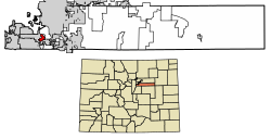 Location of the Cherry Creek CDP in Arapahoe County, Colorado. | |
 Cherry Creek Location of the Cherry Creek CDP in the United States. | |
| Coordinates: 39°36′34″N 104°51′52″W[1] | |
| Country | |
| State | |
| County | Arapahoe County |
| Government | |
| • Type | unincorporated community |
| Area | |
| • Total | 1.669 sq mi (4.322 km2) |
| • Land | 1.669 sq mi (4.322 km2) |
| • Water | 0.000 sq mi (0.000 km2) |
| Elevation | 5,745 ft (1,751 m) |
| Population (2010) | |
| • Total | 11,120 |
| • Density | 6,663/sq mi (2,573/km2) |
| Time zone | UTC-7 (MST) |
| • Summer (DST) | UTC-6 (MDT) |
| ZIP Code[3] | 80111 |
| Area codes | 303 & 720 |
| GNIS feature[2] | Cherry Creek CDP |
Geography
The Cherry Creek CDP has an area of 1,068 acres (4.322 km2), all land.[1]
Demographics
The United States Census Bureau initially defined the Cherry Creek CDP for the United States Census 2010.
| Year | Pop. | ±% |
|---|---|---|
| 2010 | 11,120 | — |
| 2020 | — | |
| Source: United States Census Bureau | ||
See also
- Outline of Colorado
- Index of Colorado-related articles
- State of Colorado
- Colorado cities and towns
- Colorado census designated places
- Colorado counties
- Arapahoe County, Colorado
- Colorado metropolitan areas
- Front Range Urban Corridor
- North Central Colorado Urban Area
- Denver-Aurora-Boulder, CO Combined Statistical Area
- Denver-Aurora-Broomfield, CO Metropolitan Statistical Area
- Colorado cities and towns
References
- "State of Colorado Census Designated Places - BAS20 - Data as of January 1, 2020". United States Census Bureau. Retrieved December 12, 2020.
- "U.S. Board on Geographic Names: Domestic Names". United States Geological Survey. Retrieved December 12, 2020.
- "Zip Code 80111 Map and Profile". zipdatamaps.com. 2020. Retrieved December 20, 2020.
- "2010: DEC Summary File 1". United States Census Bureau. Retrieved December 20, 2020.
External links
Cherry Creek, Coloradoat Wikipedia's sister projects
 Definitions from Wiktionary
 Media from Commons
 News from Wikinews
 Quotations from Wikiquote
 Texts from Wikisource
 Textbooks from Wikibooks
 Resources from Wikiversity
Municipalities and communities of Arapahoe County, Colorado, United States | ||
|---|---|---|
County seat: Littleton | ||
| Cities |
|  |
| Towns |
| |
| CDPs |
| |
| Footnotes | ‡This populated place also has portions in an adjacent county or counties | |
| ||
Текст в блоке "Читать" взят с сайта "Википедия" и доступен по лицензии Creative Commons Attribution-ShareAlike; в отдельных случаях могут действовать дополнительные условия.
Другой контент может иметь иную лицензию. Перед использованием материалов сайта WikiSort.org внимательно изучите правила лицензирования конкретных элементов наполнения сайта.
Другой контент может иметь иную лицензию. Перед использованием материалов сайта WikiSort.org внимательно изучите правила лицензирования конкретных элементов наполнения сайта.
2019-2026
WikiSort.org - проект по пересортировке и дополнению контента Википедии
WikiSort.org - проект по пересортировке и дополнению контента Википедии