world.wikisort.org - USA
Chenango Bridge is a hamlet in the southern part of the Town of Chenango in Broome County, New York, United States. It lies where State Route 12A (Chenango Bridge Road) crosses the Chenango River. The population was 2,883 at the 2010 census, which lists the community as a census-designated place.[6]
Chenango Bridge | |
|---|---|
Hamlet and census-designated place | |
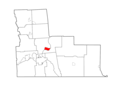 Map highlighting Chenango Bridge's location within Broome County. | |
 Chenango Bridge Location within the state of New York | |
| Coordinates: 42°10′00″N 075°51′45″W[1] | |
| Country | |
| State | |
| County | Broome County |
| Town | Chenango |
| Area | |
| • Total | 2.59 sq mi (6.71 km2) |
| • Land | 2.45 sq mi (6.34 km2) |
| • Water | 0.14 sq mi (0.37 km2) |
| Elevation | 896 ft (273 m) |
| Population (2020) | |
| • Total | 2,884 |
| • Density | 1,177.62/sq mi (454.68/km2) |
| Time zone | UTC-5 (Eastern (EST)) |
| • Summer (DST) | UTC-4 (EDT) |
| ZIP code[3] | 13745 |
| Area code | 607 |
| FIPS code[4][5] | 36-15121 |
| GNIS feature ID[5] | 946480 |
Geography
Chenango Bridge is located at 42°10′00″N 075°51′45″W (42.1667426, -75.8624167) and its elevation is 896 feet (273 m).[1]
According to the 2010 United States Census, Chenango Bridge has a total area of 2.592 square miles (6.71 km2), of which 2.448 square miles (6.34 km2) is land and 0.144 square miles (0.37 km2) is water.[4]
Demographics
| Historical population | |||
|---|---|---|---|
| Census | Pop. | %± | |
| 2020 | 2,884 | — | |
| U.S. Decennial Census[7] | |||
References
- "Chenango Bridge". Geographic Names Information System. United States Geological Survey, United States Department of the Interior. Retrieved January 13, 2013.
- "ArcGIS REST Services Directory". United States Census Bureau. Retrieved September 20, 2022.
- "Post Offices By County: Broome County, New York". United States Postal Service. Retrieved January 13, 2013.
- "Places: New York". 2010 Census Gazetteer Files. United States Census Bureau. Archived from the original on February 17, 2013. Retrieved January 13, 2013.
- "FIPS55 Data: New York". FIPS55 Data. United States Geological Survey. February 23, 2006. Archived from the original on October 19, 2006.
- "Profile of General Population and Housing Characteristics: 2010 Demographic Profile Data: Chenango Bridge CDP, New York". United States Census Bureau. Archived from the original on February 12, 2020. Retrieved January 12, 2013.
- "Census of Population and Housing". Census.gov. Retrieved June 4, 2016.
Municipalities and communities of Broome County, New York, United States | ||
|---|---|---|
County seat: Binghamton | ||
| City |  | |
| Towns | ||
| Villages | ||
| CDPs | ||
| Other hamlets | ||
| Footnotes | ‡This populated place also has portions in an adjacent county or counties | |
| ||
Authority control | |
|---|---|
| General | |
| National libraries | |
This article about a location in Broome County, New York is a stub. You can help Wikipedia by expanding it. |
Текст в блоке "Читать" взят с сайта "Википедия" и доступен по лицензии Creative Commons Attribution-ShareAlike; в отдельных случаях могут действовать дополнительные условия.
Другой контент может иметь иную лицензию. Перед использованием материалов сайта WikiSort.org внимательно изучите правила лицензирования конкретных элементов наполнения сайта.
Другой контент может иметь иную лицензию. Перед использованием материалов сайта WikiSort.org внимательно изучите правила лицензирования конкретных элементов наполнения сайта.
2019-2026
WikiSort.org - проект по пересортировке и дополнению контента Википедии
WikiSort.org - проект по пересортировке и дополнению контента Википедии