world.wikisort.org - USA
Charlos Heights or Charlo's Heights (Salish: nkʷalíʔps [3]) is a census-designated place (CDP) in Ravalli County, Montana, United States. The population was 120 at the 2010 census.[4]
Charlos Heights, Montana | |
|---|---|
Census-designated place | |
 Charlos Heights | |
| Coordinates: 46°7′34″N 114°10′40″W | |
| Country | United States |
| State | Montana |
| County | Ravalli |
| Area | |
| • Total | 1.21 sq mi (3.13 km2) |
| • Land | 1.18 sq mi (3.07 km2) |
| • Water | 0.02 sq mi (0.06 km2) |
| Elevation | 3,740 ft (1,140 m) |
| Population (2020) | |
| • Total | 135 |
| • Density | 114.02/sq mi (44.01/km2) |
| Time zone | UTC-7 (Mountain (MST)) |
| • Summer (DST) | UTC-6 (MDT) |
| ZIP code | 59840 |
| Area code | 406 |
| FIPS code | 30-13975 |
| GNIS feature ID | 2583797[2] |
Geography
Charlos Heights is located at 46°07′35″N 114°10′40″W, along U.S. Route 93 in the valley of the Bitterroot River. It is 9 miles (14 km) south of Hamilton and 8 miles (13 km) north of Darby.
According to the United States Census Bureau, the CDP has a total area of 1.2 square miles (3.0 km2), all land.[4]
The area south of Charlos Heights is called ɫmq̓ʷcn̓é in Salish.[3]
Demographics
| Historical population | |||
|---|---|---|---|
| Census | Pop. | %± | |
| 2020 | 135 | — | |
| U.S. Decennial Census[5] | |||
References
- "ArcGIS REST Services Directory". United States Census Bureau. Retrieved September 5, 2022.
- U.S. Geological Survey Geographic Names Information System: Charlos Heights, Montana
- Tachini, Pete; Louie Adams, Sophie Mays, Mary Lucy Parker, Johnny Arlee, Frances Vanderburg, Lucy Vanderburg, Diana Christopher-Cote (1998). nyoʻnuntn q̓éymin, Flathead Nation Salish dictionary. Pablo, Montana: Bilingual Education Department, Salish Kootenai College. p. 28.
{{cite book}}: CS1 maint: multiple names: authors list (link) - "Geographic Identifiers: 2010 Demographic Profile Data (DP-1): Charlos Heights CDP, Montana". U.S. Census Bureau, American Factfinder. Archived from the original on February 10, 2020. Retrieved March 22, 2013.
- "Census of Population and Housing". Census.gov. Retrieved June 4, 2016.
Municipalities and communities of Ravalli County, Montana, United States | ||
|---|---|---|
County seat: Hamilton | ||
| City | 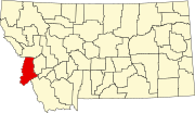 | |
| Towns | ||
| CDPs | ||
| Other communities |
| |
| ||
Текст в блоке "Читать" взят с сайта "Википедия" и доступен по лицензии Creative Commons Attribution-ShareAlike; в отдельных случаях могут действовать дополнительные условия.
Другой контент может иметь иную лицензию. Перед использованием материалов сайта WikiSort.org внимательно изучите правила лицензирования конкретных элементов наполнения сайта.
Другой контент может иметь иную лицензию. Перед использованием материалов сайта WikiSort.org внимательно изучите правила лицензирования конкретных элементов наполнения сайта.
2019-2025
WikiSort.org - проект по пересортировке и дополнению контента Википедии
WikiSort.org - проект по пересортировке и дополнению контента Википедии