world.wikisort.org - USA
Chappells (also Chappell, Chappells Bridge) is an unincorporated community, in Newberry and Saluda Counties, South Carolina, United States.[1]
Chappells, South Carolina | |
|---|---|
Unincorporated community | |
 Chappells, South Carolina  Chappells, South Carolina | |
| Coordinates: 34°10′47″N 81°52′00″W | |
| Country | United States |
| State | South Carolina |
| Counties | Newberry, Saluda |
| Elevation | 436 ft (133 m) |
| Time zone | UTC-5 (Eastern (EST)) |
| • Summer (DST) | UTC-4 (EDT) |
| ZIP code | 29037 |
| Area code(s) | 803, 839 |
| GNIS feature ID | 1247255[1] |
The community was named after the local Chappell family of pioneer citizens.[2] The Moon-Dominick House and Webb-Coleman House are listed on the National Register of Historic Places.[3]
This poor little town has been forgotten due to a tornado in the late-1800s, a flood in 1928, and re-routed roads. The downtown contained a bank, jail, and some other business.
Notes
- U.S. Geological Survey Geographic Names Information System: Chappells, South Carolina
- Federal Writers' Project (1941). Palmetto Place Names. Sloane Printing Co. p. 33.
- "National Register Information System". National Register of Historic Places. National Park Service. July 9, 2010.
Municipalities and communities of Newberry County, South Carolina, United States | ||
|---|---|---|
County seat: Newberry | ||
| City | 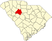 | |
| Towns | ||
| CDP |
| |
| Other communities |
| |
| Footnotes | ‡This populated place also has portions in an adjacent county or counties | |
| ||
Municipalities and communities of Saluda County, South Carolina, United States | ||
|---|---|---|
County seat: Saluda | ||
| Towns |
|  |
| Unincorporated communities |
| |
| Ghost towns | ||
| Footnotes | ‡This populated place also has portions in an adjacent county or counties | |
| ||
This South Carolina state location article is a stub. You can help Wikipedia by expanding it. |
Текст в блоке "Читать" взят с сайта "Википедия" и доступен по лицензии Creative Commons Attribution-ShareAlike; в отдельных случаях могут действовать дополнительные условия.
Другой контент может иметь иную лицензию. Перед использованием материалов сайта WikiSort.org внимательно изучите правила лицензирования конкретных элементов наполнения сайта.
Другой контент может иметь иную лицензию. Перед использованием материалов сайта WikiSort.org внимательно изучите правила лицензирования конкретных элементов наполнения сайта.
2019-2026
WikiSort.org - проект по пересортировке и дополнению контента Википедии
WikiSort.org - проект по пересортировке и дополнению контента Википедии