world.wikisort.org - USA
Cerulean is a census-designated place and unincorporated community in Trigg County, Kentucky, United States. At one time, it was a city, incorporated as Cerulean Springs. It lies along Kentucky Routes 124 and 126 northeast of the city of Cadiz, the county seat of Trigg County.[3] Its elevation is 512 feet (156 m), and it is located at 36°57′34″N 87°42′36″W (36.9594919, -87.7100107).[2] It has a post office with the ZIP code 42215.[4]
Cerulean | |
|---|---|
Census-designated place | |
 Cerulean Location within the state of Kentucky  Cerulean Cerulean (the United States) | |
| Coordinates: 36°57′34″N 87°42′36″W | |
| Country | United States |
| State | Kentucky |
| County | Trigg |
| Area | |
| • Total | 2.56 sq mi (6.64 km2) |
| • Land | 2.55 sq mi (6.62 km2) |
| • Water | 0.01 sq mi (0.02 km2) |
| Elevation | 512 ft (156 m) |
| Population (2020) | |
| • Total | 303 |
| • Density | 118.64/sq mi (45.80/km2) |
| Time zone | UTC-6 (Central (CST)) |
| • Summer (DST) | UTC-5 (CST) |
| ZIP codes | 42215 |
| FIPS code | 21-14068 |
| GNIS feature ID | [2] |
The community is part of the Clarksville, TN–KY Metropolitan Statistical Area.
Geography
The majority of Cerulean is located in Trigg County with a small portion in Christian County.
Demographics
| Historical population | |||
|---|---|---|---|
| Census | Pop. | %± | |
| 2020 | 303 | — | |
| U.S. Decennial Census[5] | |||
History
The local 19th-century health resort Cerulean Springs earned a reputation throughout the Upper South. According to legend, the spring's color was changed to cerulean by the New Madrid earthquake of 1811.[6] The point of greatest eclipse for the solar eclipse of August 21, 2017, was at Orchardale, a farm located near Cerulean.[7]
Schools
Most students in Cerulean attend Trigg County Public Schools in Cadiz. Those who live within the Christian County Borders attend Christian County Public Schools in Hopkinsville, Kentucky.
References
- "2020 U.S. Gazetteer Files". United States Census Bureau. Retrieved March 18, 2022.
- Geographic Names Information System Feature Detail Report, Geographic Names Information System, 1979-09-20. Accessed 2007-12-30.
- Rand McNally. The Road Atlas '06. Chicago: Rand McNally, 2006, p. 42.
- "Free ZIP Code Lookup with area code, county, geocode, MSA/PMSA, population". www.zipinfo.com. Archived from the original on May 17, 2011.
- "Census of Population and Housing". Census.gov. Retrieved June 4, 2016.
- Rennick, Robert M. (1987). Kentucky Place Names. University Press of Kentucky. p. 55. ISBN 0813126312. Retrieved 2013-04-28.
- Highland, Deborah (August 21, 2017). "International crowd gathers for eclipse at Christian County farm". Bowling Green Daily News.
External links
Municipalities and communities of Trigg County, Kentucky, United States | ||
|---|---|---|
County seat: Cadiz | ||
| City | 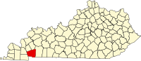 | |
| CDP | ||
| Other unincorporated community |
| |
| Ghost town |
| |
| Footnotes | ‡This populated place also has portions in an adjacent county or counties | |
| ||
Authority control | |
|---|---|
| General |
|
| National libraries | |
This Trigg County, Kentucky state location article is a stub. You can help Wikipedia by expanding it. |
Другой контент может иметь иную лицензию. Перед использованием материалов сайта WikiSort.org внимательно изучите правила лицензирования конкретных элементов наполнения сайта.
WikiSort.org - проект по пересортировке и дополнению контента Википедии