world.wikisort.org - USA
Cedar Township is one of twenty-one current townships in Carroll County, Arkansas, USA.[1] As of the 2010 census, its total population was 3,575.
Cedar Township | |
|---|---|
Township | |
 Cedar Township Location in Arkansas | |
| Coordinates: 36°24′15.08″N 93°47′3.94″W | |
| Country | |
| State | |
| County | Carroll |
| Area | |
| • Total | 35.742 sq mi (92.57 km2) |
| • Land | 35.734 sq mi (92.55 km2) |
| • Water | 0.008 sq mi (0.02 km2) |
| Population (2010) | |
| • Total | 3,575 |
| • Density | 78.90/sq mi (30.46/km2) |
| Time zone | UTC-6 (CST) |
| • Summer (DST) | UTC-5 (CDT) |
| Zip Code | 72631-72632 (Eureka Springs) |
| Area code(s) | 479 |
Geography
According to the United States Census Bureau, Cedar Township covers an area of 35.742 square miles (92.57 km2); 35.734 square miles (92.55 km2) of land and 0.008 square miles (0.021 km2) of water.
Cities, towns, and villages
- Eureka Springs (part)
References
- United States Census Bureau 2008 TIGER/Line Shapefiles
- United States Board on Geographic Names (GNIS)
- United States National Atlas
- "Cedar Township, Carroll County, Arkansas." U.S. Census Bureau. Breakdown. Retrieved June 4, 2012.
External links
Municipalities and communities of Carroll County, Arkansas, United States | ||
|---|---|---|
| Cities | 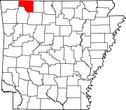 | |
| Towns | ||
| Census-designated places |
| |
| Townships |
| |
| Unincorporated communities |
| |
| Ghost towns |
| |
| Footnotes | ‡This populated place also has portions in an adjacent county or counties | |
| ||
Текст в блоке "Читать" взят с сайта "Википедия" и доступен по лицензии Creative Commons Attribution-ShareAlike; в отдельных случаях могут действовать дополнительные условия.
Другой контент может иметь иную лицензию. Перед использованием материалов сайта WikiSort.org внимательно изучите правила лицензирования конкретных элементов наполнения сайта.
Другой контент может иметь иную лицензию. Перед использованием материалов сайта WikiSort.org внимательно изучите правила лицензирования конкретных элементов наполнения сайта.
2019-2026
WikiSort.org - проект по пересортировке и дополнению контента Википедии
WikiSort.org - проект по пересортировке и дополнению контента Википедии