world.wikisort.org - USA
Carter is an unincorporated area and census-designated place (CDP) in Parker County, Texas, United States. It was first listed as a CDP prior to the 2020 census.[2]
Carter, Texas | |
|---|---|
Census-designated place | |
 Carter  Carter | |
| Coordinates: 32°54′22″N 97°44′19″W | |
| Country | United States |
| State | Texas |
| County | Parker |
| Area | |
| • Total | 6.44 sq mi (16.68 km2) |
| • Land | 6.43 sq mi (16.65 km2) |
| • Water | 0.02 sq mi (0.04 km2) |
| Elevation | 1,070 ft (330 m) |
| Time zone | UTC-6 (Central (CST)) |
| • Summer (DST) | UTC-5 (CDT) |
| ZIP Codes | |
| Area code(s) | 817, 682 |
| FIPS code | 48-13075 |
| GNIS feature ID | 2805831[2] |
It is in the northern part of the county, spread over several low ridges and valleys draining south to the Clear Fork of the Trinity River and north to Walnut Creek, a tributary of the West Fork of the Trinity River. Texas State Highway 51 passes through the east side of the CDP, leading northeast 5 miles (8 km) to Springtown and southwest 10 miles (16 km) to Weatherford, the Parker county seat. Fort Worth is 29 miles (47 km) to the southeast.
References
- "2020 U.S. Gazetteer Files – Texas". United States Census Bureau. Retrieved September 30, 2021.
- "Carter Census Designated Place". Geographic Names Information System. United States Geological Survey, United States Department of the Interior.
Municipalities and communities of Parker County, Texas, United States | ||
|---|---|---|
County seat: Weatherford | ||
| Cities | 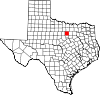 | |
| Towns | ||
| CDPs | ||
| Other communities | ||
| Footnotes | ‡This populated place also has portions in an adjacent county or counties | |
| ||
| This article about a location in Parker County, Texas is a stub. You can help Wikipedia by expanding it. |
Текст в блоке "Читать" взят с сайта "Википедия" и доступен по лицензии Creative Commons Attribution-ShareAlike; в отдельных случаях могут действовать дополнительные условия.
Другой контент может иметь иную лицензию. Перед использованием материалов сайта WikiSort.org внимательно изучите правила лицензирования конкретных элементов наполнения сайта.
Другой контент может иметь иную лицензию. Перед использованием материалов сайта WikiSort.org внимательно изучите правила лицензирования конкретных элементов наполнения сайта.
2019-2026
WikiSort.org - проект по пересортировке и дополнению контента Википедии
WikiSort.org - проект по пересортировке и дополнению контента Википедии