world.wikisort.org - USA
Carl Township is one of twelve townships in Adams County, Iowa, United States. At the 2010 census, its population was 149.[3]
Carl Township, Adams County | |
|---|---|
Township | |
 | |
| Coordinates: 41°06′32″N 094°38′21″W | |
| Country | |
| State | |
| County | Adams |
| Area | |
| • Total | 35.79 sq mi (92.7 km2) |
| • Land | 35.61 sq mi (92.23 km2) |
| • Water | 0.18 sq mi (0.47 km2) |
| Elevation | 1,257 ft (383 m) |
| Population (2010) | |
| • Total | 149 |
| • Density | 4.2/sq mi (1.6/km2) |
| Time zone | UTC-6 (CST) |
| • Summer (DST) | UTC-5 (CDT) |
| FIPS code | 19-90471[2] |
| GNIS feature ID | 0467530 |
Geography
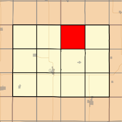
Carl Township covers an area of 35.79 square miles (92.7 km2) and contains no incorporated settlements. According to the USGS, it contains two cemeteries: Carl and Mount Zion.
References
- "US Board on Geographic Names". United States Geological Survey. 2007-10-25. Retrieved 2008-01-31.
- "U.S. Census website". United States Census Bureau. Retrieved 2008-01-31.
- "IA - Carl township". United States Census Bureau. Archived from the original on April 9, 2013. Retrieved March 17, 2013.
External links
Municipalities and communities of Adams County, Iowa, United States | ||
|---|---|---|
County seat: Corning | ||
| Cities |  | |
| Townships | ||
| Unincorporated communities | ||
| Ghost town |
| |
| Footnotes | ‡This populated place also has portions in an adjacent county or counties | |
| ||
This article about the geography of Adams County, Iowa is a stub. You can help Wikipedia by expanding it. |
Текст в блоке "Читать" взят с сайта "Википедия" и доступен по лицензии Creative Commons Attribution-ShareAlike; в отдельных случаях могут действовать дополнительные условия.
Другой контент может иметь иную лицензию. Перед использованием материалов сайта WikiSort.org внимательно изучите правила лицензирования конкретных элементов наполнения сайта.
Другой контент может иметь иную лицензию. Перед использованием материалов сайта WikiSort.org внимательно изучите правила лицензирования конкретных элементов наполнения сайта.
2019-2025
WikiSort.org - проект по пересортировке и дополнению контента Википедии
WikiSort.org - проект по пересортировке и дополнению контента Википедии