world.wikisort.org - USA
Canal Fulton is a city in Stark County, Ohio. The population was 5,325 at the time of the 2020 census. It is part of the Canton-Massillon, OH Metropolitan Statistical Area.
Canal Fulton, Ohio | |
|---|---|
City | |
 Along the Ohio and Erie Canal | |
 Location of Canal Fulton, Ohio | |
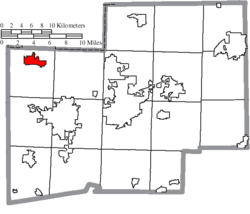 Location of Canal Fulton in Stark County | |
| Coordinates: 40°53′23″N 81°35′43″W | |
| Country | United States |
| State | Ohio |
| County | Stark |
| Area | |
| • Total | 3.48 sq mi (9.00 km2) |
| • Land | 3.41 sq mi (8.84 km2) |
| • Water | 0.06 sq mi (0.16 km2) |
| Elevation | 951 ft (290 m) |
| Population (2020) | |
| • Total | 5,325 |
| • Density | 1,561.13/sq mi (602.70/km2) |
| Time zone | UTC-05:00 (Eastern (EST)) |
| • Summer (DST) | UTC-04:00 (EDT) |
| ZIP code | 44614 |
| Area code | 330 |
| FIPS code | 39-11304[3] |
| GNIS feature ID | 1060923[2] |
| Website | www |
Geography
Canal Fulton is located at 40°53′23″N 81°35′43″W (40.889806, -81.595339),[4] along the Tuscarawas River.[5]
According to the United States Census Bureau, the city has a total area of 3.32 square miles (8.60 km2), of which 3.26 square miles (8.44 km2) is land and 0.06 square miles (0.16 km2) is water.[6]
History
Canal Fulton traces its history to three villages that developed along the Tuscarawas River. Milan was platted on March 23, 1814, by Matthew Rowland who arrived by ox team. It was the first settlement west of the Tuscarawas River in Stark County. Fulton was platted on May 16, 1826, changed its name to Canal Fulton in 1832, and later incorporated as a village. The present name is an amalgamation of the Ohio Canal and the name of a local pioneer, Ben Fulton.[7] In 1843 President John Quincy Adams visits.[8] In 1845, Sts. Philip and James Church organizes.[9] In 1850 the first permanent community school begins operation; railroad operations begin.[10] 1853, Canal Fulton absorbed both Milan and West Fulton.[11] 1855, Union School building is completed and has two rooms accommodating 100 students.[12] In 1869, the construction of railroad on west side of river.[13] 1870 Addition built at Union School.[14] In 1873, The warehouse converted to Opera House.[15] In 1874, Canal Fulton approves organization of a fire department, although one was in existence in the early 1800s. Fire department gets first modern steam-operated pumper.[16] In 1875, Sts. Philip and James School founded.[15]
In 1876, German immigrants came to area as strikebreakers for coal industry.[17] In 1886, new school built to accommodate 12 grades.[18]
Demographics
| Historical population | |||
|---|---|---|---|
| Census | Pop. | %± | |
| 1870 | 1,048 | — | |
| 1880 | 1,196 | 14.1% | |
| 1890 | 1,173 | −1.9% | |
| 1900 | 1,172 | −0.1% | |
| 1910 | 978 | −16.6% | |
| 1920 | 1,057 | 8.1% | |
| 1930 | 1,160 | 9.7% | |
| 1940 | 1,115 | −3.9% | |
| 1950 | 1,258 | 12.8% | |
| 1960 | 1,555 | 23.6% | |
| 1970 | 2,367 | 52.2% | |
| 1980 | 3,481 | 47.1% | |
| 1990 | 4,157 | 19.4% | |
| 2000 | 5,061 | 21.7% | |
| 2010 | 5,479 | 8.3% | |
| 2020 | 5,325 | −2.8% | |
| Sources:[19][20][21][22][23][24][3] | |||
2010 census
As of the census[25] of 2010, there were 5,479 people, 2,186 households, and 1,488 families residing in the city. The population density was 1,680.7 inhabitants per square mile (648.9/km2). There were 2,362 housing units at an average density of 724.5 per square mile (279.7/km2). The racial makeup of the city was 97.0% White, 0.6% African American, 0.1% Native American, 0.4% Asian, 0.2% from other races, and 1.7% from two or more races. Hispanic or Latino of any race were 1.5% of the population.
There were 2,186 households, of which 32.3% had children under the age of 18 living with them, 52.4% were married couples living together, 12.1% had a female householder with no husband present, 3.5% had a male householder with no wife present, and 31.9% were non-families. 27.8% of all households were made up of individuals, and 12.9% had someone living alone who was 65 years of age or older. The average household size was 2.43 and the average family size was 2.95.
The median age in the city was 40.3 years. 23.1% of residents were under the age of 18; 8% were between the ages of 18 and 24; 25.4% were from 25 to 44; 25.9% were from 45 to 64; and 17.6% were 65 years of age or older. The gender makeup of the city was 47.2% male and 52.8% female.
2000 census


As of the census[3] of 2000, there were 5,061 people, 1,823 households, and 1,349 families residing in the city. The population density was 2,090.8 people per square mile (807.5/km2). There were 1,925 housing units at an average density of 795.3 per square mile (307.1/km2). The racial makeup of the city was 97.27% White, 0.91% African American, 0.16% Native American, 0.41% Asian, 0.18% from other races, and 1.07% from two or more races. Hispanic or Latino of any race were 0.67% of the population.
There were 1,823 households, out of which 39.9% had children under the age of 18 living with them, 59.0% were married couples living together, 11.6% had a female householder with no husband present, and 26.0% were non-families. 22.1% of all households were made up of individuals, and 7.5% had someone living alone who was 65 years of age or older. The average household size was 2.65 and the average family size was 3.11.
In the city the population was spread out, with 27.6% under the age of 18, 8.4% from 18 to 24, 32.0% from 25 to 44, 20.7% from 45 to 64, and 11.3% who were 65 years of age or older. The median age was 34 years. For every 100 females, there were 88.7 males. For every 100 females age 18 and over, there were 84.5 males.
The median income for a household in the city was $45,359, and the median income for a family was $51,914. Males had a median income of $42,331 versus $23,540 for females. The per capita income for the city was $21,266. About 3.2% of families and 4.4% of the population were below the poverty line, including 4.8% of those under age 18 and none of those age 65 or over.
References
- "ArcGIS REST Services Directory". United States Census Bureau. Retrieved September 20, 2022.
- "US Board on Geographic Names". United States Geological Survey. 2007-10-25. Retrieved 2008-01-31.
- "U.S. Census website". United States Census Bureau. Retrieved 2008-01-31.
- "US Gazetteer files: 2010, 2000, and 1990". United States Census Bureau. 2011-02-12. Retrieved 2011-04-23.
- DeLorme (1991). Ohio Atlas & Gazetteer. Yarmouth, Maine: DeLorme. ISBN 0-89933-233-1.
- "US Gazetteer files 2010". United States Census Bureau. Archived from the original on 2012-07-02. Retrieved 2013-01-06.
- Overman, William Daniel (1958). Ohio Town Names. Akron, OH: Atlantic Press. p. 22.
- Butzer, Heath (Jul 27, 2014). "Canal Fulton timeline, 1814-2014". The Repository. Retrieved 2018-07-20.
- "Canal Fulton timeline, 1814-2014". The Repository. Retrieved 2018-07-20.
- Butzer (July 27, 2014). "Canal Fulton timeline, 181xfr@3+×4-014". The Repository. Retrieved 2018-07-20.
- "History". City of Canal Fulton. Archived from the original on September 6, 2013. Retrieved September 16, 2013.
- Butzer, Heath (July 27, 2014). "Canal Fulton timeline, 1814-2014". The Repository. Retrieved 2018-07-20.
- "Canal Fulton timeline, 1814-2014". The Repository. Retrieved 2018-07-20.
- Pauletbh, G.; Roncin, G.; Vidal, E.; Toulouse, P.; Dassonville, J. (November 1975). "Fluorocarbons and general metabolism in the rat, rabbit, and dog". Toxicology and Applied Pharmacology. 34 (2): 197–203. doi:10.1016/0041-008x(75)90024-1. ISSN 0041-008X. PMID 1870.
- Cariello, L.; D'Aniello, A. (November 1975). "Isolation and characterization of four toxic protein fractions from the sea anemone Anemonia sulcata". Toxicon. 13 (5): 353–357. doi:10.1016/0041-0101(75)90195-6. ISSN 0041-0101. PMID 1875.
- Viljoen, C. C.; Botes, D. P.; Schabort, J. C. (November 1975). "Spectral properties of Bitis gabonica venom phospholipase A2 in the presence of divalent metal ion, substrate and hydrolysis products". Toxicon. 13 (5): 343–351. doi:10.1016/0041-0101(75)90194-4. ISSN 0041-0101. PMID 1874.
- Béress, L.; Béress, R. (November 1975). "Purification of three polypeptides with neuro- and cardiotoxic activity from the sea anemone Anemonia sulcata". Toxicon. 13 (5): 359–367. doi:10.1016/0041-0101(75)90196-8. ISSN 0041-0101. PMID 1876.
- "Canal Fulton timeline, 1814-2014". The Repository. Retrieved 2018-07-20.
- "Population of Civil Divisions Less than Counties" (PDF). Statistics of the Population of the United States at the Ninth Census. U.S. Census Bureau. 1870. Retrieved 24 April 2020.
- "Population of Civil Divisions Less than Counties" (PDF). Statistics of the Population of the United States at the Tenth Census. U.S. Census Bureau. 1880. Retrieved 28 November 2013.
- "Population: Ohio" (PDF). 1910 U.S. Census. U.S. Census Bureau. Retrieved 28 November 2013.
- "Population: Ohio" (PDF). 1930 US Census. U.S. Census Bureau. Retrieved 28 November 2013.
- "Number of Inhabitants: Ohio" (PDF). 18th Census of the United States. U.S. Census Bureau. 1960. Retrieved 24 April 2020.
- "Ohio: Population and Housing Unit Counts" (PDF). U.S. Census Bureau. Retrieved 22 November 2013.
- "U.S. Census website". United States Census Bureau. Retrieved 2013-01-06.
External links
Municipalities and communities of Stark County, Ohio, United States | ||
|---|---|---|
County seat: Canton | ||
| Cities |  | |
| Villages | ||
| Townships | ||
| CDPs | ||
| Unincorporated communities | ||
| Footnotes | ‡This populated place also has portions in an adjacent county or counties | |
| ||
Authority control | |
|---|---|
| General | |
| National libraries | |
Другой контент может иметь иную лицензию. Перед использованием материалов сайта WikiSort.org внимательно изучите правила лицензирования конкретных элементов наполнения сайта.
WikiSort.org - проект по пересортировке и дополнению контента Википедии