world.wikisort.org - USA
Caledonia County is a county located in the northeastern part of the U.S. state of Vermont. As of the 2020 census, the population was 30,233.[1] Its shire town (county seat) is the town of St. Johnsbury.[2] The county was created in 1792 and organized in 1796.[3] It was given the Latin name for Scotland, in honor of the many settlers who claimed ancestry there.[4]
This article uses bare URLs, which are uninformative and vulnerable to link rot. (August 2022) |
Caledonia County | |
|---|---|
U.S. county | |
 Caledonia Superior Court in St. Johnsbury | |
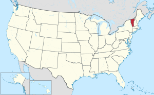
 Location within the U.S. state of Vermont | |
 Vermont's location within the U.S. | |
| Coordinates: 44.46°N 72.10°W | |
| Country | |
| State | |
| Founded | 1796 |
| Named for | Latin name for Scotland |
| Shire Town | St. Johnsbury |
| Largest town | St. Johnsbury |
| Government | |
| • State's Attorney • Assistant Judges • Probate Judge • Sheriff • High Bailiff | Lisa A. Warren (R/D) John S. Hall (D) Roy C. Vance (R/D) William W. Cobb (D) Dean Shatney (D/R) Stephen Bunnell (R) |
| Area | |
| • Total | 658 sq mi (1,700 km2) |
| • Land | 649 sq mi (1,680 km2) |
| • Water | 8.7 sq mi (23 km2) 1.3%% |
| Population (2020) | |
| • Total | 30,233 |
| • Density | 46/sq mi (18/km2) |
| Demonym | Caledonian |
| Time zone | UTC−5 (Eastern) |
| • Summer (DST) | UTC−4 (EDT) |
| Congressional district | At-large |
History
The county shares the same pre-Columbian history with the Northeast Kingdom.
Rogers' Rangers were forced to retreat through the county following their attack on Saint-Francis, Quebec in 1759. To confound their avenging pursuers, they had split up. One group came south over the summit into the Passumpsic River Valley.[5]
Vermont was divided into two counties in March 1778. In 1781 the legislature divided the northernmost county, Cumberland, into three counties: Windham and Windsor, located about where they are now. The northern remainder was called Orange county. This latter tract nearly corresponded with the old New York county of Gloucester, organized by that province March 16, 1770, with Newbury as the shire town.[6]
On November 5, 1792, the legislature divided Chittenden and Orange counties into six separate counties, as follows: Chittenden, Orange, Franklin, Caledonia, Essex, and Orleans.[6] There is a supposition that the county was called Caledonia, to commemorate the large number of Scottish settlers.[7]
Caledonians joined the Union Army in response to a call for volunteers. In September 1861, they joined the Vermont 6th Vermont Infantry, and helped fill out Companies B, D and E. The regiment ultimately became part of the First Vermont Brigade.[8]
In 2008, the county was declared a federal disaster area as the result of storms and flooding which occurred on July 18.[9]
Geography
According to the U.S. Census Bureau, the county has a total area of 658 square miles (1,700 km2), of which 649 square miles (1,680 km2) is land and 8.7 square miles (23 km2) (1.3%) is water.[10]
Caledonia is the most populated county of the three in the Northeast Kingdom. However, it is the smallest in area of the three.
The county has a number of brooks and rivers. The Connecticut River runs along the southeast and forms one of the eastern boundaries of the county. The northern towns are drained by the head branches of the Passumpsic River, which is the largest in the county. It flows south and empties into the Connecticut River in Barnet. There are the Wells, Stevens and Joe's Rivers in the south. In the west the head waters of the Winooski and Lamoille Rivers. There are about twenty lakes and ponds in the county. The largest are Harvey's Lake, in Barnet; Wells River and Lund's Ponds, in Groton; Cole's Pond, in Walden; Clark's and Center Ponds, in Newark; and Stile's Pond, in Waterford. There are falls at different places on the Connecticut, Passumpsic, Wells and Joe's Rivers. Stevens River, near its mouth, falls 80 feet (24 m) in a distance of 20 rods (330 ft; 100 m). Some of the water power has been harnessed for electricity.[11]
There are sulphur springs in Wheelock, Haynesville, in Hardwick; and in St. Johnsbury, near the Moose River.[11]
Geology
Calciferous mica schist underlies much of the county. There is argillaceous slate running through Waterford and Kirby, which narrows in Burke.[11]
Waterford had a lot of talc. This belongs to the gold bearing formations. Specimens of gold were found in town, and iron and copper pyrites in veins. But none in commercial quality. In Waterford there was an outcrop of slate that was quarried for roofing. Kirby Mountain, in Kirby, was largely granite of commercial quality.[11]
Ryegate had 300 acres (120 ha) granite on the south and west sides of Blue Mountain. The granite was created by volcanic action. This was a medium colored granite of commercial grain and texture. It was quarried in the 19th century. It lay in sheets 3 inches (76 mm) to 10 feet (3.0 m) or 15 feet (4.6 m).[11]
Perhaps the most widely known monument locally using this granite was the soldiers monument at Peacham, Vermont. Monuments from this granite exist all over the country. This was one of the best quality quarries in the country in the 19th century.[11]
The presence of Kame terraces in the country are of interest in connection with the drift that gave the Northeast Kingdom its soil, and its surface stones and boulders. These terraces have beds of sand and clay from which bricks were once manufactured.[11]
Based on research by Edward Hitchcock two or three basins can be identified based on a larger number of interconnected terraces in the Passumpsic River Valley.[11]
The first extends from the mouth of the Passumpsic River in Barnet, to the northwest corner of the town of Waterford, on the railroad. It is about 4 miles (6.4 km) long. The river runs through a narrow valley in Barnet, a gorge with no terraces. Narrow terraces in the Town of Passumpsic expand and form a basin. The fourth terrace on the west side of the river is part of the next basin, which is in St. Johnsbury and Lyndon. St. Johnsbury Village is on this high terrace which is called "St. Johnsbury Plain". The base of the terraces at St. Johnsbury is composed of clay. The same terrace occurs on both sides of the river valley beyond Lyndon. There are lower terraces at intervals.[11]
Lyndonville has a high terrace. This may have once extended across the valley to form the end of a basin. Its lower strata are clayey, and are folded and curved. West of this terrace the level is lower. There is the course of a former river bed which ran towards the east. At the upper village of Lyndon the first terrace is about 1 mile (1.6 km) wide. There is a lot of sand and fine gravel adjoining.[11]
Every stream from either side of the valley has its large terraces to correspond with those of the Passumpsic River. It is a characteristic of these terraces that they are large while their quantity is small. The count never exceeds five which is unusual.[11]
The third basin includes the east branch of the Passumpsic River which runs through the Town of Burke. In East Burke there are several terraces. Near the village there are four on the west side, and two on the east side. Above East Burke the valley rises so that its bottom appears like a terrace. Its steep slope crosses the valley at right angles. There are indistinct terraces on its sides. Since the valley seems to be too wide to correspond with the size of the river, the valley may have been formed by water from unknown sources in prehistoric times.[11]
Caledonia has more muck deposits than any other county in the state. This was once thought to be profitable for farmers.[11]
Adjacent counties
- Orleans County - north
- Essex County - northeast
- Grafton County, New Hampshire - southeast
- Washington County - southwest
- Orange County - south
- Lamoille County - west
Demographics
| Historical population | |||
|---|---|---|---|
| Census | Pop. | %± | |
| 1800 | 9,377 | — | |
| 1810 | 18,740 | 99.9% | |
| 1820 | 16,669 | −11.1% | |
| 1830 | 20,967 | 25.8% | |
| 1840 | 21,891 | 4.4% | |
| 1850 | 23,595 | 7.8% | |
| 1860 | 21,708 | −8.0% | |
| 1870 | 22,235 | 2.4% | |
| 1880 | 23,607 | 6.2% | |
| 1890 | 23,436 | −0.7% | |
| 1900 | 24,381 | 4.0% | |
| 1910 | 26,031 | 6.8% | |
| 1920 | 25,762 | −1.0% | |
| 1930 | 27,253 | 5.8% | |
| 1940 | 24,320 | −10.8% | |
| 1950 | 24,049 | −1.1% | |
| 1960 | 22,786 | −5.3% | |
| 1970 | 22,789 | 0.0% | |
| 1980 | 25,808 | 13.2% | |
| 1990 | 27,846 | 7.9% | |
| 2000 | 29,702 | 6.7% | |
| 2010 | 31,227 | 5.1% | |
| 2020 | 30,233 | −3.2% | |
| U.S. Decennial Census[12] 1790–1960[13] 1900–1990[14] 1990–2000[15] 2010–2018[1] | |||
2010 census
As of the 2010 United States Census, there were 31,227 people, 12,553 households, and 8,153 families residing in the county.[16] The population density was 48.1 inhabitants per square mile (18.6/km2). There were 15,942 housing units at an average density of 24.6 per square mile (9.5/km2).[17] Of the 12,553 households, 29.4% had children under the age of 18 living with them, 49.7% were married couples living together, 10.1% had a female householder with no husband present, 35.1% were non-families, and 27.5% of all households were made up of individuals. The average household size was 2.38 and the average family size was 2.86. The median age was 42.1 years.[16]
The median income for a household in the county was $42,706 and the median income for a family was $51,503. Males had a median income of $40,223 versus $30,707 for females. The per capita income for the county was $22,504. About 9.6% of families and 13.5% of the population were below the poverty line, including 15.6% of those under age 18 and 13.0% of those age 65 or over.[18]
Government
As in all Vermont counties, there is a small executive function which is mostly consolidated at the state level. Remaining county government is judicial. There are no "county taxes."
In 2007, median property taxes in the county were $2,278, placing it 265 out of 1,817 counties in the nation with populations over 20,000.[19]
The elected officials of the county as of the 2018 elections are as follows:
| Position[20] | Name | Party | First elected |
|---|---|---|---|
| State Senator | Joe Benning | Republican | 2010 |
| M. Jane Kitchel | Dem/Rep | 2004 | |
| State Rep District 1 | Marcia R. Martel | Republican | 2014 |
| State Rep District 2 | Chip Troiano | Democratic | 2014 |
| State Rep District 3 | Scott Beck | Republican | 2014 |
| Scott Campbell | Dem/Prog | 2018 | |
| State Rep District 4 | Martha Feltus | Republican | 2012 |
| Patrick Seymour | Rep/Dem | 2018 | |
| State Rep District Cal-Wash | Catherine Beattie Toll | Democratic | 2008 |
| State's Attorney | Lisa A. Warren | Rep/Dem | 2010 |
| Assistant Judge | John S. Hall | Democratic | 2014 |
| Roy C. Vance | Dem/Rep | 2006 | |
| Probate Judge | William W. Cobb | Democratic | 2018 |
| Sheriff | Dean Shatney | Dem/Rep | 2014 |
| High Bailiff | Stephen Bunnell | Rep/Dem | 2018 |
| Justices of the Peace: |

| Town | Name | Party | First elected |
|---|---|---|---|
| Barnet 7 | Steven Adler | Democratic | 2014 |
| Susan Coppenrath | Democratic | 2012 | |
| William Graves | Independent | 2002 | |
| Susan Jensen | Republican | 2008 | |
| Dennis Mclam | Republican | 2010 | |
| Stanley Robinson | Independent | 2004 | |
| Shellie Samuels | Democratic | 2014 | |
| Burke 7 | Susan Carr | Republican | 2014 |
| Cathleen Feeley | Independent | 2004 | |
| Joel Gilbert | Democratic | 2012 | |
| William David Hammond | Independent | 2018 | |
| Joan Harlowe | Democratic | 2008 | |
| Christian Bradley Hubbs | Progressive | 2018 | |
| John Kascenska | Republican | 2018 | |
| Danville 10 | Eric Bach | Democratic | 2016 |
| Ted Houle | Independent | 2012 | |
| Virginia Incerpi | Republican | 2008 | |
| Jane Larrabee | Republican | 2004 | |
| Julie Larrabee | Republican | 2006 | |
| Justin Lavely | Democratic | 2014 | |
| Kenneth Linsley | Republican | 2016 | |
| Bruce Melendy | Republican | 2012 | |
| Lindsey Mitchell | Democratic | 2014 | |
| Phyllis Kehley Sweeney | Democratic | 2010 | |
| Groton 7 | Timothy Daily Sr | Democratic | 2008 |
| Tirone Dyer | Democratic | 2016 | |
| Deborah Jurist | Democratic | 2010 | |
| Dorothy Knott | Republican | 2014 | |
| Linda Nunn | Democratic | 2012 | |
| Carrie Peters | Democratic | 2014 | |
| Brent Smith | Republican | 2012 | |
| Hardwick 10 | Donna Casavant | Democratic | 2012 |
| James Casavant | Democratic | 2008 | |
| Bradley Ferland | Independent | 2010 | |
| Jean Hackett | Democratic | 2012 | |
| Bill Hill | Republican | 2004 | |
| Robin Leslie | Democratic | 2018 | |
| Tracy Martin | Republican | 2016 | |
| Allan Michaud | Democratic | 2012 | |
| Lenore Renaud | Democratic | 2006 | |
| George Whitney | Republican | 2010 | |
| Kirby 5 | David Emery | Democratic | 2012 |
| Anne Mclaughry | Democratic | 2008 | |
| Karen Moore | Republican | 2014 | |
| Timothy Peters | Democratic | 2016 | |
| Vacant | n/a | ||
| Lyndon 15 | Joe Benning | Republican | 2008 |
| Catherine M. Boykin | Democratic | 2010 | |
| Edith Bell Brown | Democratic | 1996 | |
| Kevin Calkins | Republican | 2004 | |
| Michael Codding | Republican | 2012 | |
| Dan Daley | Democratic | 2016 | |
| Libre E. Drouin | Democratic | 2016 | |
| Reed Garfield | Republican | 2018 | |
| Kathy M. Gray | Democratic | 2012 | |
| Oralie Lefaivre | Republican | 2014 | |
| Ken Mason | Republican | 2014 | |
| Sean R. Mcfeeley | Democratic | 2016 | |
| Brenda J. Mitchell | Republican | 2010 | |
| Beth Quimby | Republican | 2002 | |
| Sara J. Simpson | Democratic | 2012 | |
| Newark 5 | John Findlay | Independent | 2008 |
| Elizabeth Grout | Republican | 2010 | |
| Sarah Newell | Independent | 2016 | |
| Mary Ann Riggie | Republican | 2012 | |
| Laura Rodger | Independent | 2010 | |
| Peacham 5 | Jean Dedam | Democratic | 2014 |
| Cynthia Greene | Democratic | 2010 | |
| Eric Kaufman | Democratic | 2014 | |
| Samuel Kempton | Democratic | 2006 | |
| Diana Senturia | Democratic | 2012 | |
| Ryegate 7 | Todd Colby | Republican | 2014 |
| Katherine Davie | Democratic | 2016 | |
| Michael Murray | Republican | 2018 | |
| Darcy Nelson | Republican | 2008 | |
| Jennifer R. Nelson | Democratic | 2010 | |
| Nancy Perkins | Democratic | 2006 | |
| Robert Rowden | Republican | 2018 | |
| Sheffield 5 | Barbara Bristol | Independent | 2012 |
| Gay Ellis | Republican | 2010 | |
| Leslie Ham | Democratic | 2016 | |
| Dorothy Scofield | Democratic | 2008 | |
| Sally Woodsimons | Republican | 2018 | |
| St. Johnsbury 15 | Pierre Berube | Republican | 2006 |
| Mark Bickford | Independent | 2000 | |
| David Brown | Republican | 2012 | |
| Stephanie Churchill | Democratic | 2014 | |
| Anne Cosgrove | Democratic | 2010 | |
| Albert Dunn | Republican | 2012 | |
| Conrad Doyon | Democratic | 2014 | |
| Durward Ellis | Republican | 1998 | |
| John Goodrich | Republican | 2008 | |
| Gretchen Hammer | Republican | 2006 | |
| Diane Holmes | Republican | 2016 | |
| Kevin Oddy | Democratic | 2012 | |
| Abby Pollender | Democratic | 2018 | |
| Lisa Rivers | Democratic | 2008 | |
| Milton Rivers | Democratic | 2004 | |
| Stannard 5 | Christine Foster | Independent | 2006 |
| Joseph Gresser | Independent | 2012 | |
| John Reynolds | Independent | 1988 | |
| Evelyn Rich | Democratic | 2016 | |
| Chip Troiano | Democratic | 2010 | |
| Sutton 5 | Marlin Devenger | Independent | 2012 |
| Danielle Fortin | Republican | 2012 | |
| Celeste Girrell | Democratic | 2008 | |
| Alan Seymour | Republican | 2014 | |
| Patrick Seymour | Independent | 2016 | |
| Walden 5 | Diane Cochran | Republican | 2014 |
| Michael Coffey | Democratic | 2016 | |
| Annette Foster | Independent | 2010 | |
| Roger Fox | Republican | 2014 | |
| P. Ann Gaillard | Republican | 2012 | |
| Waterford 7 | Brent Beck | Republican | 2010 |
| Kevin Gillander | Republican | 2018 | |
| Charles Lawrence | Republican | 2008 | |
| David E. Morrison | Republican | 2018 | |
| William Piper | Independent | 2006 | |
| Marcia R. Martel | Republican | 2010 | |
| Bernard Willey | Republican | 2014 | |
| Wheelock 5 | Stephen Amos | Democratic | 2002 |
| Eileen Boland | Democratic | 2012 | |
| Kimberly Cradysmith | Republican | 2010 | |
| Peter Miller | Republican | 2018 | |
| Carol Rossi | Democratic | 2014 |
Elections
In 1828, Caledonia County voted for National Republican Party candidate John Quincy Adams.
In 1832, the county was won by Anti-Masonic Party candidate William Wirt.
From William Henry Harrison in 1836 to Winfield Scott in 1852, the county would vote the Whig Party candidates.
From John C. Frémont in 1856 to Richard Nixon in 1960 (barring 1912, where the county was won by Progressive Party candidate and former president Theodore Roosevelt), the Republican Party would have a 104-year winning streak in the county.
In 1964, the county was won by Democratic Party incumbent President Lyndon B. Johnson, who became not only the first Democratic presidential candidate to win the county, but to win the state of Vermont entirely.
Following the Democrats victory in 1964, the county went back to voting for Republican candidates for another 20 year winning streak starting with Richard Nixon in 1968 and ending with George H. W. Bush in 1988.
The county would be won by Bill Clinton in both the 1992 and 1996 presidential elections.
George W. Bush would win the county in 2000 and would be the last time a Republican presidential candidate would carry the county.
John Kerry won the county in 2004 and it has been won by Democratic candidates ever since.
| Year | Republican | Democratic | Third party | |||
|---|---|---|---|---|---|---|
| No. | % | No. | % | No. | % | |
| 2020 | 6,551 | 40.52% | 9,011 | 55.73% | 607 | 3.75% |
| 2016 | 5,534 | 39.32% | 6,445 | 45.79% | 2,095 | 14.89% |
| 2012 | 5,088 | 37.24% | 8,192 | 59.97% | 381 | 2.79% |
| 2008 | 5,472 | 37.15% | 8,900 | 60.43% | 356 | 2.42% |
| 2004 | 6,765 | 47.60% | 7,106 | 50.00% | 340 | 2.39% |
| 2000 | 6,746 | 49.45% | 5,859 | 42.95% | 1,036 | 7.59% |
| 1996 | 4,089 | 34.66% | 5,593 | 47.40% | 2,117 | 17.94% |
| 1992 | 4,571 | 34.99% | 4,948 | 37.88% | 3,543 | 27.12% |
| 1988 | 6,915 | 61.13% | 4,251 | 37.58% | 146 | 1.29% |
| 1984 | 7,249 | 68.32% | 3,223 | 30.38% | 138 | 1.30% |
| 1980 | 5,986 | 56.88% | 3,284 | 31.21% | 1,253 | 11.91% |
| 1976 | 5,488 | 59.63% | 3,511 | 38.15% | 204 | 2.22% |
| 1972 | 6,762 | 68.04% | 3,094 | 31.13% | 83 | 0.84% |
| 1968 | 4,996 | 58.88% | 3,201 | 37.73% | 288 | 3.39% |
| 1964 | 3,258 | 36.24% | 5,732 | 63.76% | 0 | 0.00% |
| 1960 | 6,688 | 69.69% | 2,909 | 30.31% | 0 | 0.00% |
| 1956 | 7,560 | 81.26% | 1,744 | 18.74% | 0 | 0.00% |
| 1952 | 7,595 | 80.60% | 1,807 | 19.18% | 21 | 0.22% |
| 1948 | 5,873 | 68.75% | 2,585 | 30.26% | 84 | 0.98% |
| 1944 | 5,086 | 64.46% | 2,804 | 35.54% | 0 | 0.00% |
| 1940 | 5,793 | 62.56% | 3,444 | 37.19% | 23 | 0.25% |
| 1936 | 6,054 | 64.25% | 3,342 | 35.47% | 27 | 0.29% |
| 1932 | 6,066 | 62.27% | 3,621 | 37.17% | 54 | 0.55% |
| 1928 | 6,616 | 78.07% | 1,832 | 21.62% | 26 | 0.31% |
| 1924 | 6,205 | 83.60% | 929 | 12.52% | 288 | 3.88% |
| 1920 | 5,537 | 75.85% | 1,694 | 23.21% | 69 | 0.95% |
| 1916 | 3,024 | 60.44% | 1,887 | 37.72% | 92 | 1.84% |
| 1912 | 1,583 | 32.86% | 1,065 | 22.11% | 2,169 | 45.03% |
| 1908 | 2,700 | 74.63% | 764 | 21.12% | 154 | 4.26% |
| 1904 | 2,944 | 81.53% | 580 | 16.06% | 87 | 2.41% |
| 1900 | 2,957 | 76.79% | 817 | 21.22% | 77 | 2.00% |
| 1896 | 3,474 | 78.65% | 729 | 16.50% | 214 | 4.84% |
| 1892 | 2,646 | 65.24% | 1,222 | 30.13% | 188 | 4.64% |
| 1888 | 3,083 | 65.82% | 1,249 | 26.67% | 352 | 7.51% |
| 1884 | 2,639 | 61.99% | 1,314 | 30.87% | 304 | 7.14% |
| 1880 | 3,134 | 69.11% | 1,372 | 30.25% | 29 | 0.64% |
Transportation
Airport
The Caledonia County Airport is located in Lyndon, Vermont.[23]
Major highways
 Interstate 91
 Interstate 93
 U.S. Route 2
 U.S. Route 5
 U.S. Route 302
Communities
Towns
Villages
Incorporated villages are census divisions and provide additional services. They remain part of the towns they are in. Cities are formed when villages become large enough to warrant greater governmental organization, and become separate from the surrounding town.
- Burke Hollow - unincorporated village of Burke
- East Hardwick - unincorporated village of Hardwick
- East Lyndon - unincorporated village of Lyndon
- East Ryegate - unincorporated village of Ryegate
- East St. Johnsbury - unincorporated village of
- Lower Waterford - unincorporated village of Waterford
- Lyndon Corner - unincorporated village of Lyndon; corresponds to the Lyndon census-designated place
- Lyndonville - incorporated village of Lyndon
- Mackville - unincorporated village of Hardwick
- McIndoe Falls - unincorporated village of Barnet
- Passumpsic - unincorporated village of Barnet
- Ryegate Corner - unincorporated village of Ryegate
- South Kirby - unincorporated village of Kirby
- South Ryegate - unincorporated village of Ryegate
- St. Johnsbury Center - unincorporated village of St. Johnsbury
- Upper Waterford - unincorporated village of Waterford
- West Burke - incorporated village of Burke
Census-designated places
Notable people
- Anne Morrow Lindbergh died in Passumpsic in 2001.[24]
See also
- Historical U.S. Census totals for Caledonia County, Vermont
- National Register of Historic Places listings in Caledonia County, Vermont
References
- "State & County QuickFacts". United States Census Bureau. Retrieved October 28, 2021.
- "Find a County". National Association of Counties. Archived from the original on May 31, 2011. Retrieved June 7, 2011.
- "Vermont: Individual County Chronologies". Vermont Atlas of Historical County Boundaries. The Newberry Library. 2008. Retrieved June 30, 2015.
- "AT&T user page". Caledonia County, Vermont Local History and Genealogy. Archived from the original on January 6, 2010. Retrieved December 29, 2006.
- Darrell Hoyt (1985). Sketches of Orleans, Vermont. Mempremagog Press. ISBN 0-9610860-2-5., page 1
- Child, Hamilton. (May 1887). Gazetteer of Lamoille and Orleans Counties, VT.; 1883-1884. Hamilton Child.
- Orleans County, Vermont: History and Information Archived September 28, 2011, at the Wayback Machine. E-referencedesk.com. Retrieved on April 12, 2014.
- Hueguenin, Joan (November 2011). Northeast Kingdom Civil War Roundtable: 4, 5.
{{cite journal}}: Missing or empty|title=(help) - Sutkowski, Matt (August 18, 2008). Part of Vt. declared a disaster area. Burlington Free Press.
- "2010 Census Gazetteer Files". United States Census Bureau. August 22, 2012. Retrieved June 28, 2015.
- Child, Hamilton. (May 1887). Gazetteer of Lamoille and Orleans Counties, VT.; 1883-1884. Hamilton Child.
- "U.S. Decennial Census". United States Census Bureau. Retrieved June 28, 2015.
- "Historical Census Browser". University of Virginia Library. Retrieved June 28, 2015.
- Forstall, Richard L., ed. (March 27, 1995). "Population of Counties by Decennial Census: 1900 to 1990". United States Census Bureau. Retrieved June 28, 2015.
- "Census 2000 PHC-T-4. Ranking Tables for Counties: 1990 and 2000" (PDF). United States Census Bureau. April 2, 2001. Archived (PDF) from the original on October 9, 2022. Retrieved June 28, 2015.
- "DP-1 Profile of General Population and Housing Characteristics: 2010 Demographic Profile Data". United States Census Bureau. Archived from the original on February 13, 2020. Retrieved January 20, 2016.
- "Population, Housing Units, Area, and Density: 2010 - County". United States Census Bureau. Archived from the original on February 13, 2020. Retrieved January 20, 2016.
- "DP03 SELECTED ECONOMIC CHARACTERISTICS – 2006-2010 American Community Survey 5-Year Estimates". United States Census Bureau. Archived from the original on February 13, 2020. Retrieved January 20, 2016.
- McLean, Dan (December 17, 2008). Property tax bills among highest. Burlington Free Press.
- http://vtelectionarchive.sec.state.vt.us/
- "Town Meeting & Local Elections | Elections | Vermont Secretary of State". Archived from the original on July 7, 2019. Retrieved July 7, 2019.
- Leip, David. "Dave Leip's Atlas of U.S. Presidential Elections". uselectionatlas.org. Retrieved June 8, 2018.
- "Caledonia County Airport. Vermont Agency of Transportation. Retrieved 18 June 2012". Archived from the original on May 18, 2012. Retrieved June 18, 2012.
- Wheeler, Scott (June 2010). "Search for /Charles Lindbergh's Kidnapped Son comes to Vermont". Vermont's Northland Journal. 9 (3): 14–15.
External links
Places adjacent to Caledonia County, Vermont | ||||||||||||||||
|---|---|---|---|---|---|---|---|---|---|---|---|---|---|---|---|---|
| ||||||||||||||||
Municipalities and communities of Caledonia County, Vermont, United States | ||
|---|---|---|
Shire town: St. Johnsbury | ||
| Towns |  | |
| Incorporated villages | ||
| CDPs | ||
| Unincorporated communities | ||
| ||
State of Vermont | |
|---|---|
Montpelier (capital) | |
| Regions |
|
| Counties | |
| Cities |
|
| Towns (pop. >5000) | |
| Festivals |
|
| Topics |
|
| Society |
|
Authority control | |
|---|---|
| General | |
| Other |
|
На других языках
[de] Caledonia County
Caledonia County[1] ist ein County im Bundesstaat Vermont der Vereinigten Staaten. Der Sitz der Countyverwaltung (County Seat) befindet sich in St. Johnsbury.- [en] Caledonia County, Vermont
[ru] Каледония (округ)
Каледония (англ. Caledonia County) — округ в штате Вермонт, США. Официально образован в 1796 году. По состоянию на 2010 год, численность населения составляла 31 227 человек.Другой контент может иметь иную лицензию. Перед использованием материалов сайта WikiSort.org внимательно изучите правила лицензирования конкретных элементов наполнения сайта.
WikiSort.org - проект по пересортировке и дополнению контента Википедии