world.wikisort.org - USA
Butlerville is an unincorporated community and census-designated place (CDP) in central Campbell Township, Jennings County, Indiana, United States. As of the 2010 census it had a population of 282.[3]
Butlerville, Indiana | |
|---|---|
Census-designated place | |
 | |
 Location of Butlerville in Jennings County, Indiana | |
 Butlerville  Butlerville | |
| Coordinates: 39°2′4″N 85°30′46″W | |
| Country | United States |
| State | Indiana |
| County | Jennings |
| Township | Campbell |
| Area | |
| • Total | 0.37 sq mi (0.97 km2) |
| • Land | 0.37 sq mi (0.97 km2) |
| • Water | 0.00 sq mi (0.00 km2) |
| Elevation | 807 ft (246 m) |
| Population (2020) | |
| • Total | 300 |
| • Density | 804.29/sq mi (310.76/km2) |
| ZIP code | 47223 |
| GNIS feature ID | 431906[2] |
| FIPS code | 18-09622 |
History
The Butlerville post office was established in 1851.[4] An early settler being a former resident of Butlerville, Ohio, caused the name to be selected.[5] Butlerville was legally platted in 1853.[6]
Hannah Milhous Nixon, mother of President Richard Nixon, was born near Butlerville.
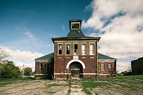
The community was home to Butlerville High School, home of the Bulldogs; which graduated classes from ~1910 thru 1950. Today, the community is serviced by Jennings County High School.
Geography
Butlerville lies along U.S. Route 50, 7 miles (11 km) east-northeast of the town of Vernon, the county seat of Jennings County.[7]
Its elevation is 807 feet (246 m), and it is located at 39°2′4″N 85°30′46″W (39.0344983, -85.5127432).[8] Although Butlerville is unincorporated, it has a post office, with the ZIP code of 47223.[9]
The community is bordered to the west by Southeast Purdue Agricultural Center.
Demographics
| Historical population | |||
|---|---|---|---|
| Census | Pop. | %± | |
| 2020 | 300 | — | |
| U.S. Decennial Census[10] | |||
References
- "2020 U.S. Gazetteer Files". United States Census Bureau. Retrieved March 16, 2022.
- "Butlerville, Indiana". Geographic Names Information System. United States Geological Survey. Retrieved 2009-10-10.
- "Geographic Identifiers: 2010 Census Summary File 1 (G001): Butlerville CDP, Indiana". American Factfinder. U.S. Census Bureau. Archived from the original on February 13, 2020. Retrieved May 18, 2018.
- "Jennings County". Jim Forte Postal History. Retrieved 9 November 2014.
- Jennings Co. Historical Society (1999). Jennings Co., Indiana - Pictorial. Turner Publishing Company. p. 37. ISBN 9781563115219.
- Baker, Ronald L. (October 1995). From Needmore to Prosperity: Hoosier Place Names in Folklore and History. Indiana University Press. p. 84. ISBN 978-0-253-32866-3.
...was platted on July 27, 1853.
- DeLorme. Indiana Atlas & Gazetteer. 3rd ed. Yarmouth: DeLorme, 2004, p. 52. ISBN 0-89933-319-2.
- Geographic Names Information System Feature Detail Report, Geographic Names Information System, 1979-02-14. Accessed 2008-06-01.
- Zip Code Lookup
- "Census of Population and Housing". Census.gov. Retrieved June 4, 2016.
External links
Другой контент может иметь иную лицензию. Перед использованием материалов сайта WikiSort.org внимательно изучите правила лицензирования конкретных элементов наполнения сайта.
WikiSort.org - проект по пересортировке и дополнению контента Википедии
