world.wikisort.org - USA
Burntwood is a ghost town in Rawlins County, Kansas, United States.
Burntwood, Kansas | |
|---|---|
Ghost town | |
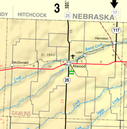 KDOT map of Rawlins County (legend) | |
 Burntwood  Burntwood | |
| Coordinates: 39°58′37″N 101°18′00″W | |
| Country | United States |
| State | Kansas |
| County | Rawlins |
| Elevation | 3,261 ft (994 m) |
| Population | |
| • Total | 0 |
| Time zone | UTC-6 (CST) |
| • Summer (DST) | UTC-5 (CDT) |
| Area code | 785 |
| GNIS ID | 482481[1] |
History
Burntwood was issued a post office in 1886. The post office was discontinued in 1899, reissued in 1903, then permanently discontinued in 1907.[2]
References
- "US Board on Geographic Names". United States Geological Survey. 1984-07-01. Retrieved 2017-12-30.
- "Kansas Post Offices, 1828-1961". Kansas Historical Society. Retrieved 2018-01-05.[permanent dead link]
Further reading
External links
Municipalities and communities of Rawlins County, Kansas, United States | ||
|---|---|---|
County seat: Atwood | ||
| Cities |  | |
| Unincorporated communities |
| |
| Ghost town |
| |
| Footnotes | †This community is designated a Census-Designated Place (CDP) by the United States Census Bureau. | |
| ||
Текст в блоке "Читать" взят с сайта "Википедия" и доступен по лицензии Creative Commons Attribution-ShareAlike; в отдельных случаях могут действовать дополнительные условия.
Другой контент может иметь иную лицензию. Перед использованием материалов сайта WikiSort.org внимательно изучите правила лицензирования конкретных элементов наполнения сайта.
Другой контент может иметь иную лицензию. Перед использованием материалов сайта WikiSort.org внимательно изучите правила лицензирования конкретных элементов наполнения сайта.
2019-2025
WikiSort.org - проект по пересортировке и дополнению контента Википедии
WikiSort.org - проект по пересортировке и дополнению контента Википедии