world.wikisort.org - USA
The Brownsville–Harlingen Metropolitan Statistical Area, as defined by the United States Census Bureau, is an area consisting of one county–Cameron–in the Rio Grande Valley region of South Texas, anchored by the cities of Brownsville and Harlingen. The 2012 U.S. Census Bureau estimate places its metropolitan area population at 415,557, ranking as the eighth most populous metropolitan area in the state of Texas. It is also a component of the Brownsville–Harlingen–Raymondville combined statistical area, which covers two counties (Cameron and Willacy) and had an estimated population of 416,766 as of July 1, 2009.[1]
Brownsville–Harlingen metropolitan area | |
|---|---|
Metropolitan statistical area | |
| Brownsville–Harlingen Metropolitan Statistical Area | |
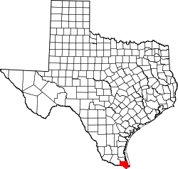 Map of Texas highlighting the Brownsville–Harlingen MSA covering Cameron County | |
| Country | United States |
| State(s) | Texas |
| Largest city | Brownsville |
| Area | |
| • Total | 1,602.2 sq mi (4,150 km2) |
| Population (2012 including Cameron County) | |
| • Total | 415,557 |
| • Rank | 126th in the U.S. |
Brownsville is frequently cited as having one of the highest poverty rates in the United States, with more than 35% of area residents living under the federal poverty line. The typical Brownsville-Harlingen, Texas household earns $32,093 a year, or $21,564 less than the typical American household. 64.6% of Brownsville area adults have at least a high school diploma, 22.3 percentage points fewer than the national average. About 29% of area households rely on food stamps, the third highest percentage of any metro area in the country.[2]
Counties
- Cameron
Communities
Incorporated places
- Town of Bayview
- City of Brownsville (Principal city)
- Town of Combes
- City of Harlingen (Principal city)
- Town of Indian Lake
- Town of Laguna Vista
- City of Los Fresnos
- Town of Los Indios
- City of Palm Valley
- City of Port Isabel
- Town of Primera
- Town of Rancho Viejo
- Village of Rangerville
- City of Rio Hondo
- City of San Benito
- Town of Santa Rosa
- Town of South Padre Island
Census-designated places (unincorporated)
|
|
|
See also
- Texas census statistical areas
References
- "Table 2. Annual Estimates of the Population of Combined Statistical Areas: April 1, 2000 to July 1, 2009 (CBSA-EST2009-02)". 2009 Population Estimates. United States Census Bureau, Population Division. 2010-03-23. Archived from the original (CSV) on 2010-04-20. Retrieved 2010-03-24.
- "Table 1. Annual Estimates of the Population of Metropolitan and Micropolitan Statistical Areas: April 1, 2000 to July 1, 2009 (CBSA-EST2009-01)". 2009 Population Estimates. United States Census Bureau, Population Division. 2010-03-23. Archived from the original (CSV) on 2010-06-15. Retrieved 2010-03-24.
Austin (capital) | ||
| Topics |
|  Seal of Texas |
| Society |
| |
| Regions |
| |
| Metropolitan areas |
| |
| Counties | See: List of counties in Texas | |
This article about a location in Cameron County, Texas is a stub. You can help Wikipedia by expanding it. |
Другой контент может иметь иную лицензию. Перед использованием материалов сайта WikiSort.org внимательно изучите правила лицензирования конкретных элементов наполнения сайта.
WikiSort.org - проект по пересортировке и дополнению контента Википедии