world.wikisort.org - USA
Brierfield is an unincorporated community in Bibb County, Alabama, United States.[1] It was established in the mid 19th century and was the site of a major ironworks operation during and following the American Civil War. It is thought by scholars to be named in honor of Jefferson Davis' Brierfield Plantation, which supplied the first ironworks with machinery.[2] It has two sites listed on the National Register of Historic Places, the Brierfield Furnace and Montebrier.[3]
Brierfield, Alabama | |
|---|---|
Unincorporated community | |
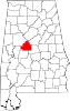
 Brierfield, Alabama Location within the state of Alabama  Brierfield, Alabama Brierfield, Alabama (the United States) | |
| Coordinates: 33°2′21″N 86°54′31″W | |
| Country | United States |
| State | Alabama |
| County | Bibb |
| Elevation | 377 ft (115 m) |
| Time zone | UTC-6 (Central (CST)) |
| • Summer (DST) | UTC-5 (CDT) |
| ZIP code | 35035 |
| Area code(s) | 205, 659 |
Geography
Brierfield is located at 33.03900°N 86.90887°W and has an elevation of 377 feet (115 m).[1]
References
- U.S. Geological Survey Geographic Names Information System: Brierfield, Alabama
- "Brierfield Furnace, State Highway 25, Brierfield Ironworks Park, Brierfield, Bibb County, AL". Historic American Engineering Record. National Park Service. Retrieved 2010-01-25.
- "National Register Information System". National Register of Historic Places. National Park Service. March 13, 2009.
Municipalities and communities of Bibb County, Alabama, United States | ||
|---|---|---|
County seat: Centreville | ||
| Cities |
|  |
| Towns | ||
| Unincorporated communities | ||
| Ghost town | ||
| Footnotes | ‡This populated place also has portions in an adjacent county or counties | |
| ||
This Bibb County, Alabama state location article is a stub. You can help Wikipedia by expanding it. |
Текст в блоке "Читать" взят с сайта "Википедия" и доступен по лицензии Creative Commons Attribution-ShareAlike; в отдельных случаях могут действовать дополнительные условия.
Другой контент может иметь иную лицензию. Перед использованием материалов сайта WikiSort.org внимательно изучите правила лицензирования конкретных элементов наполнения сайта.
Другой контент может иметь иную лицензию. Перед использованием материалов сайта WikiSort.org внимательно изучите правила лицензирования конкретных элементов наполнения сайта.
2019-2026
WikiSort.org - проект по пересортировке и дополнению контента Википедии
WikiSort.org - проект по пересортировке и дополнению контента Википедии