world.wikisort.org - USA
Briarwood is a city in Cass County, North Dakota, United States. The population was 57 at the 2020 census.[3] Briarwood was founded in 1973. It is a suburb directly adjacent to the city of Fargo.
Briarwood, North Dakota | |
|---|---|
City | |
 Sign in Briarwood | |
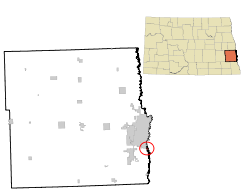 Location of Briarwood, North Dakota | |
| Coordinates: 46°47′11″N 96°47′40″W | |
| Country | United States |
| State | North Dakota |
| County | Cass |
| Government | |
| • Mayor | John Adams |
| Area | |
| • Total | 0.14 sq mi (0.37 km2) |
| • Land | 0.14 sq mi (0.37 km2) |
| • Water | 0.00 sq mi (0.00 km2) |
| Elevation | 906 ft (276 m) |
| Population (2020) | |
| • Total | 57 |
| • Density | 398.60/sq mi (154.35/km2) |
| Time zone | UTC-6 (CST) |
| • Summer (DST) | UTC-5 (CDT) |
| ZIP code | 58104 |
| Area code | 701 |
| FIPS code | 38-09320 |
| GNIS feature ID | 1037277[2] |
Geography
Briarwood is located at 46°47′11″N 96°47′40″W (46.786481, -96.794404).[4]
According to the United States Census Bureau, the city has a total area of 0.15 square miles (0.39 km2), all land.[5]
Demographics
| Historical population | |||
|---|---|---|---|
| Census | Pop. | %± | |
| 1980 | 47 | — | |
| 1990 | 88 | 87.2% | |
| 2000 | 78 | −11.4% | |
| 2010 | 73 | −6.4% | |
| 2020 | 57 | −21.9% | |
| 2021 (est.) | 54 | [6] | −5.3% |
| U.S. Decennial Census[7] 2020 Census[3] | |||
2010 census
As of the census[8] of 2010, there were 73 people, 25 households, and 21 families living in the city. The population density was 486.7 inhabitants per square mile (187.9/km2). There were 28 housing units at an average density of 186.7 per square mile (72.1/km2). The racial makeup of the city was 95.9% White and 4.1% Asian.
There were 25 households, of which 44.0% had children under the age of 18 living with them, 80.0% were married couples living together, 4.0% had a female householder with no husband present, and 16.0% were non-families. 12.0% of all households were made up of individuals, and 4% had someone living alone who was 65 years of age or older. The average household size was 2.92 and the average family size was 3.24.
The median age in the city was 44.8 years. 31.5% of residents were under the age of 18; 1.3% were between the ages of 18 and 24; 17.8% were from 25 to 44; 39.7% were from 45 to 64; and 9.6% were 65 years of age or older. The gender makeup of the city was 54.8% male and 45.2% female.
2000 census
As of the census of 2000, there were 78 people, 25 households, and 21 families living in the city. The population density was 353.8 people per square mile (136.9/km2). There were 26 housing units at an average density of 117.9 per square mile (45.6/km2). The racial makeup of the city was 98.72% White, and 1.28% from two or more races. Hispanic or Latino of any race were 3.85% of the population.
There were 25 households, out of which 56.0% had children under the age of 18 living with them, 76.0% were married couples living together, and 16.0% were non-families. 12.0% of all households were made up of individuals, and 4.0% had someone living alone who was 65 years of age or older. The average household size was 3.12 and the average family size was 3.48.
In the city, the population was spread out, with 38.5% under the age of 18, 1.3% from 18 to 24, 24.4% from 25 to 44, 29.5% from 45 to 64, and 6.4% who were 65 years of age or older. The median age was 38 years. For every 100 females, there were 116.7 males. For every 100 females age 18 and over, there were 128.6 males.
The median income for a household in the city was $180,508, and the median income for a family was $183,640. Males had a median income of $100,000 versus $76,250 for females. The per capita income for the city was $57,751. None of the population and none of the families were below the poverty line.
References
- "ArcGIS REST Services Directory". United States Census Bureau. Retrieved September 20, 2022.
- "US Board on Geographic Names". United States Geological Survey. October 25, 2007. Retrieved January 31, 2008.
- "Explore Census Data". Explore Census Data. United States Census Bureau. Retrieved May 18, 2022.
- "US Gazetteer files: 2010, 2000, and 1990". United States Census Bureau. February 12, 2011. Retrieved April 23, 2011.
- "US Gazetteer files 2010". United States Census Bureau. Archived from the original on February 20, 2011. Retrieved June 14, 2012.
- "City and Town Population Totals: 2020-2021". United States Census Bureau. June 16, 2022. Retrieved June 18, 2022.
- United States Census Bureau. "Census of Population and Housing". Retrieved July 21, 2013.
- "U.S. Census website". United States Census Bureau. Retrieved June 14, 2012.
Municipalities and communities of Cass County, North Dakota, United States | ||
|---|---|---|
County seat: Fargo | ||
| Cities |
|  |
| Townships |
| |
| CDPs | ||
| Unincorporated communities | ||
| Footnotes | ‡This populated place also has portions in an adjacent county or counties | |
| ||
| Counties |
|   |
|---|---|---|
| Main cities | ||
| Surrounding areas |
| |
‡ - county seat | ||
Другой контент может иметь иную лицензию. Перед использованием материалов сайта WikiSort.org внимательно изучите правила лицензирования конкретных элементов наполнения сайта.
WikiSort.org - проект по пересортировке и дополнению контента Википедии