world.wikisort.org - USA
Brandywine Township is one of nine townships in Hancock County, Indiana, United States. As of the 2010 census, its population was 2,392 and it contained 892 housing units.[1]
Brandywine Township | |
|---|---|
Township | |
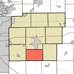 Location in Hancock County | |
| Coordinates: 39°43′34″N 85°46′30″W | |
| Country | United States |
| State | Indiana |
| County | Hancock |
| Government | |
| • Type | Indiana township |
| Area | |
| • Total | 24.24 sq mi (62.8 km2) |
| • Land | 24.23 sq mi (62.8 km2) |
| • Water | 0.01 sq mi (0.03 km2) 0.04% |
| Elevation | 860 ft (262 m) |
| Population (2010) | |
| • Total | 2,392 |
| • Density | 98.7/sq mi (38.1/km2) |
| GNIS feature ID | 0453133 |
History
Brandywine Township was organized in 1828.[2] It was named from the Brandywine Creek.[3]
Geography
According to the 2010 census, the township has a total area of 24.24 square miles (62.8 km2), of which 24.23 square miles (62.8 km2) (or 99.96%) is land and 0.01 square miles (0.026 km2) (or 0.04%) is water.[1] The streams of Maxwell Ditch and Wilson Ditch run through this township.
Cities and towns
- Greenfield (south edge)
Unincorporated towns
- Carrollton
- Reedville Station
(This list is based on USGS data and may include former settlements.)
Adjacent townships
- Center Township (north)
- Blue River Township (east)
- Hanover Township, Shelby County (southeast)
- Van Buren Township, Shelby County (south)
- Sugar Creek Township (west)
Cemeteries
The township contains one cemetery, Little Sugar Creek.
Major highways
 U.S. Route 52
 Indiana State Road 9
Airports and landing strips
- Osgood Field
References
- "Brandywine Township, Hancock County, Indiana". Geographic Names Information System. United States Geological Survey. Retrieved 2009-09-24.
- United States Census Bureau cartographic boundary files
- "Population, Housing Units, Area, and Density: 2010 - County -- County Subdivision and Place -- 2010 Census Summary File 1". United States Census. Archived from the original on 2020-02-12. Retrieved 2013-05-10.
- Richman, George J. (1916). History of Hancock County, Indiana: Its People, Industries and Institutions. Wm. Mitchell Printing Company. pp. 513.
- Binford, John H. (1882). History of Hancock County, Indiana: From Its Earliest Settlement by the "pale Face," in 1818, Down to 1882. King & Binford. pp. 77.
External links
Municipalities and communities of Hancock County, Indiana, United States | ||
|---|---|---|
County seat: Greenfield | ||
| City |
|  |
| Towns |
| |
| Townships | ||
| Unincorporated communities |
| |
| Footnotes | ‡This populated place also has portions in an adjacent county or counties | |
| ||
This Hancock County, Indiana location article is a stub. You can help Wikipedia by expanding it. |
Другой контент может иметь иную лицензию. Перед использованием материалов сайта WikiSort.org внимательно изучите правила лицензирования конкретных элементов наполнения сайта.
WikiSort.org - проект по пересортировке и дополнению контента Википедии