world.wikisort.org - USA
Bonneville is an unincorporated community in Multnomah County, Oregon, United States, on Interstate 84 and the Columbia River. Bonneville is best known as the site of Bonneville Dam. North Bonneville, Washington is across the river.
Bonneville | |
|---|---|
Unincorporated community | |
 Historic incubation building at the Bonneville Hatchery | |
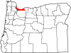
 Bonneville Location within the state of Oregon  Bonneville Bonneville (the United States) | |
| Coordinates: 45°38′10″N 121°57′3″W | |
| Country | United States |
| State | Oregon |
| County | Multnomah |
| Time zone | UTC-8 (Pacific (PST)) |
| • Summer (DST) | UTC-7 (PDT) |
| ZIP code | 97014 |
| Area codes | 458 and 541 |
For decades before the dam was built, Bonneville was popular as a picnic spot for people living along the Columbia River between Portland and The Dalles, and the railroad company maintained an "eating house" for travelers there.[1] Bonneville railroad station was named for explorer Benjamin Bonneville.[1] The name "Bonneville" did not appear on maps until the late 1880s.[2] Bonneville post office was established in 1900.[1]
Climate
Bonneville has a warm-summer Mediterranean climate (Köppen Csb).
| Climate data for Bonneville Dam (1991–2020 normals, extremes 1937–present) | |||||||||||||
|---|---|---|---|---|---|---|---|---|---|---|---|---|---|
| Month | Jan | Feb | Mar | Apr | May | Jun | Jul | Aug | Sep | Oct | Nov | Dec | Year |
| Record high °F (°C) | 64 (18) |
68 (20) |
75 (24) |
88 (31) |
98 (37) |
111 (44) |
107 (42) |
107 (42) |
100 (38) |
86 (30) |
71 (22) |
65 (18) |
107 (42) |
| Mean maximum °F (°C) | 56.6 (13.7) |
57.9 (14.4) |
67.5 (19.7) |
77.2 (25.1) |
85.8 (29.9) |
90.8 (32.7) |
96.5 (35.8) |
96.2 (35.7) |
90.8 (32.7) |
77.0 (25.0) |
62.8 (17.1) |
56.7 (13.7) |
100.2 (37.9) |
| Average high °F (°C) | 42.7 (5.9) |
47.2 (8.4) |
53.3 (11.8) |
59.4 (15.2) |
66.5 (19.2) |
71.6 (22.0) |
79.0 (26.1) |
79.7 (26.5) |
74.2 (23.4) |
62.4 (16.9) |
50.1 (10.1) |
42.4 (5.8) |
60.7 (15.9) |
| Daily mean °F (°C) | 38.5 (3.6) |
41.3 (5.2) |
45.6 (7.6) |
50.8 (10.4) |
57.0 (13.9) |
61.9 (16.6) |
68.1 (20.1) |
68.6 (20.3) |
63.6 (17.6) |
54.5 (12.5) |
45.0 (7.2) |
38.5 (3.6) |
52.8 (11.6) |
| Average low °F (°C) | 34.3 (1.3) |
35.5 (1.9) |
38.0 (3.3) |
42.2 (5.7) |
47.6 (8.7) |
52.3 (11.3) |
57.1 (13.9) |
57.5 (14.2) |
53.1 (11.7) |
46.6 (8.1) |
39.8 (4.3) |
34.7 (1.5) |
44.9 (7.2) |
| Mean minimum °F (°C) | 24.6 (−4.1) |
26.8 (−2.9) |
30.7 (−0.7) |
35.0 (1.7) |
39.2 (4.0) |
45.4 (7.4) |
49.9 (9.9) |
50.5 (10.3) |
45.7 (7.6) |
38.1 (3.4) |
30.7 (−0.7) |
25.5 (−3.6) |
20.3 (−6.5) |
| Record low °F (°C) | 2 (−17) |
7 (−14) |
20 (−7) |
28 (−2) |
31 (−1) |
37 (3) |
43 (6) |
42 (6) |
34 (1) |
29 (−2) |
9 (−13) |
0 (−18) |
0 (−18) |
| Average precipitation inches (mm) | 11.31 (287) |
8.67 (220) |
9.13 (232) |
6.47 (164) |
4.08 (104) |
3.21 (82) |
0.60 (15) |
0.90 (23) |
2.62 (67) |
7.30 (185) |
12.48 (317) |
13.45 (342) |
80.22 (2,038) |
| Average snowfall inches (cm) | 3.5 (8.9) |
3.4 (8.6) |
0.3 (0.76) |
0 (0) |
0 (0) |
0 (0) |
0 (0) |
0 (0) |
0 (0) |
0 (0) |
0.2 (0.51) |
2.9 (7.4) |
10.3 (26) |
| Average precipitation days (≥ 0.01 in) | 21.3 | 18.0 | 20.2 | 18.8 | 14.2 | 11.2 | 4.2 | 3.7 | 7.8 | 15.3 | 21.1 | 22.0 | 177.8 |
| Average snowy days (≥ 0.1 in) | 1.4 | 1.1 | 0.2 | 0 | 0 | 0 | 0 | 0 | 0 | 0 | 0.1 | 1.6 | 4.4 |
| Source: NOAA[3] | |||||||||||||
References
- McArthur, Lewis A.; McArthur, Lewis L. (2003) [1928]. Oregon Geographic Names (7th ed.). Portland, Oregon: Oregon Historical Society Press. p. 98. ISBN 978-0875952772.
- "Lewis & Clark's Columbia River—200 Years Later: Bonneville, Oregon". Archived from the original on 2007-09-27. Retrieved 2007-08-28.
- "NOWData – NOAA Online Weather Data". National Oceanic and Atmospheric Administration. Retrieved 2022-08-17.
Municipalities and communities of Multnomah County, Oregon, United States | ||
|---|---|---|
County seat: Portland | ||
| Cities |
|  |
| CDPs | ||
| Other communities |
| |
| Footnotes | ‡This populated place also has portions in an adjacent county or counties | |
| ||
Authority control | |
|---|---|
| General | |
| National libraries | |
This Multnomah County, Oregon state location article is a stub. You can help Wikipedia by expanding it. |
Другой контент может иметь иную лицензию. Перед использованием материалов сайта WikiSort.org внимательно изучите правила лицензирования конкретных элементов наполнения сайта.
WikiSort.org - проект по пересортировке и дополнению контента Википедии