world.wikisort.org - USA
Bonanza Mountain Estates is an unincorporated community and a census-designated place (CDP) located in and governed by Boulder County, Colorado, United States. The CDP is a part of the Boulder, CO Metropolitan Statistical Area. The population of the Bonanza Mountain Estates CDP was 128 at the United States Census 2010.[4] The Nederland post office (Zip Code 80466) serves the area.[3]
Bonanza Mountain Estates, Colorado | |
|---|---|
Census Designated Place | |
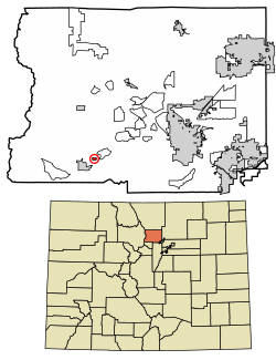 Location of the Bonanza Mountain Estates CDP in Boulder County, Colorado. | |
 Bonanza Mountain Estates Location of the Bonanza Mountain Estates CDP in the United States. | |
| Coordinates: 39°58′37″N 105°28′46″W[1] | |
| Country | |
| State | |
| County | Boulder County |
| Government | |
| • Type | unincorporated community |
| Area | |
| • Total | 0.168 sq mi (0.436 km2) |
| • Land | 0.168 sq mi (0.436 km2) |
| • Water | 0.000 sq mi (0.000 km2) |
| Elevation | 8,448 ft (2,575 m) |
| Population (2010) | |
| • Total | 128 |
| • Density | 762/sq mi (294/km2) |
| Time zone | UTC-7 (MST) |
| • Summer (DST) | UTC-6 (MDT) |
| ZIP Code[3] | Nederland 80466 |
| Area codes | 303 & 720 |
| GNIS feature[2] | Bonanza Mountain Estates CDP |
Geography
The CDP is a residential community located in southern Boulder County in the Front Range of the Colorado Rocky Mountains, just east of the town of Nederland. It is situated on a ridge between Middle Boulder Creek and North Boulder Creek. Ridge Road is the main street through the community, leading west to Nederland and east to St. Ann Highlands.
The Bonanza Mountain Estates CDP has an area of 108 acres (0.436 km2), all land.[5]
Demographics
The United States Census Bureau initially defined the Bonanza Mountain Estates CDP for the United States Census 2010.
| Year | Pop. | ±% |
|---|---|---|
| 2010 | 128 | — |
| 2020 | — | |
| Source: United States Census Bureau | ||
See also
- Outline of Colorado
- Index of Colorado-related articles
- State of Colorado
- Colorado cities and towns
- Colorado census designated places
- Colorado counties
- Boulder County, Colorado
- Colorado metropolitan areas
- Front Range Urban Corridor
- North Central Colorado Urban Area
- Denver-Aurora-Boulder, CO Combined Statistical Area
- Boulder, CO Metropolitan Statistical Area
- Colorado cities and towns
References
- "State of Colorado Census Designated Places - BAS20 - Data as of January 1, 2020". United States Census Bureau. Retrieved December 16, 2020.
- "U.S. Board on Geographic Names: Domestic Names". United States Geological Survey. Retrieved December 16, 2020.
- "Zip Code 80466 Map and Profile". zipdatamaps.com. 2020. Retrieved December 20, 2020.
- "2010: DEC Summary File 1". United States Census Bureau. Retrieved December 20, 2020.
- "State of Colorado Census Designated Places - BAS20 - Data as of January 1, 2020". United States Census Bureau. Retrieved November 23, 2020.
External links
 Definitions from Wiktionary
 Media from Commons
 News from Wikinews
 Quotations from Wikiquote
 Texts from Wikisource
 Textbooks from Wikibooks
 Resources from Wikiversity
Municipalities and communities of Boulder County, Colorado, United States | ||
|---|---|---|
County seat: Boulder | ||
| Cities |
|  |
| Towns | ||
| CDPs |
| |
| Unincorporated communities |
| |
| Ghost town |
| |
| Footnotes | ‡This populated place also has portions in an adjacent county or counties | |
| ||
Другой контент может иметь иную лицензию. Перед использованием материалов сайта WikiSort.org внимательно изучите правила лицензирования конкретных элементов наполнения сайта.
WikiSort.org - проект по пересортировке и дополнению контента Википедии