world.wikisort.org - USA
Bennsville[2] (spelled Bensville by the United States Census Bureau[3]) is a census-designated place (CDP) in Charles County, Maryland, United States. Per the 2020 census, the population was 15,288.[4] The area is not an official postal designation, but is part of the Waldorf or Pomfret postal area. The Bennsville area is growing with new residential development, encouraged by the extension in the 1990s of Maryland Route 228 which provides quick access to Maryland Route 210. Bennsville has experienced the 2006 opening of North Point High School and the straightening of Middletown Road in 2008.
Bennsville (Bensville), Maryland | |
|---|---|
Census-designated place | |
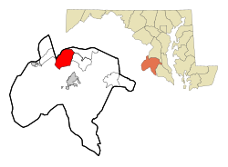 Location of Bennsville, Maryland | |
| Coordinates: 38°37′24″N 77°0′23″W | |
| Country | United States |
| State | Maryland |
| County | Charles |
| Area | |
| • Total | 16.91 sq mi (43.78 km2) |
| • Land | 16.90 sq mi (43.78 km2) |
| • Water | 0.00 sq mi (0.00 km2) |
| Elevation | 184 ft (56 m) |
| Population (2020) | |
| • Total | 15,288 |
| • Density | 904.40/sq mi (349.19/km2) |
| Time zone | UTC−5 (Eastern (EST)) |
| • Summer (DST) | UTC−4 (EDT) |
| FIPS code | 24-06615 |
| GNIS feature ID | 0589738 |
Geography
Bennsville is located at 38°37′24″N 77°0′23″W (38.623302, −77.006265).[5]
According to the United States Census Bureau, the CDP has a total area of 16.9 square miles (43.8 km2), all land.[3]
Demographics
| Historical population | |||
|---|---|---|---|
| Census | Pop. | %± | |
| 2010 | 11,923 | — | |
| 2020 | 15,288 | 28.2% | |
| U.S. Decennial Census[6] 2010[7] 2020[8] | |||
2020 census
| Race / Ethnicity | Pop 2010[7] | Pop 2020[8] | % 2010 | % 2020 |
|---|---|---|---|---|
| White alone (NH) | 5,131 | 3,957 | 43.03% | 25.88% |
| Black or African American alone (NH) | 5,238 | 8,521 | 43.93% | 55.74% |
| Native American or Alaska Native alone (NH) | 59 | 51 | 0.49% | 0.33% |
| Asian alone (NH) | 496 | 731 | 4.16% | 4.78% |
| Pacific Islander alone (NH) | 10 | 7 | 0.08% | 0.05% |
| Some Other Race alone (NH) | 33 | 90 | 0.28% | 0.59% |
| Mixed Race/Multi-Racial (NH) | 437 | 988 | 3.67% | 6.46% |
| Hispanic or Latino (any race) | 519 | 943 | 4.35% | 6.17% |
| Total | 11,923 | 15,288 | 100.00% | 100.00% |
Note: the US Census treats Hispanic/Latino as an ethnic category. This table excludes Latinos from the racial categories and assigns them to a separate category. Hispanics/Latinos can be of any race.
2000 Census
As of the census[9] of 2000, there were 7,325 people, 2,429 households, and 2,071 families residing in the CDP. The population density was 431.6 inhabitants per square mile (166.6/km2). There were 2,493 housing units at an average density of 146.9 per square mile (56.7/km2). The racial makeup of the CDP was 76.46% White, 18.02% African American, 0.41% Native American, 2.32% Asian, 0.10% Pacific Islander, 0.55% from other races, and 2.14% from two or more races. Hispanic or Latino of any race were 2.20% of the population.
There were 2,429 households, out of which 43.4% had children under the age of 18 living with them, 74.9% were married couples living together, 7.5% had a female householder with no husband present, and 14.7% were non-families. 10.5% of all households were made up of individuals, and 2.1% had someone living alone who was 65 years of age or older. The average household size was 3.01 and the average family size was 3.25.
In the CDP, the population was spread out, with 28.1% under the age of 18, 6.8% from 18 to 24, 32.5% from 25 to 44, 27.4% from 45 to 64, and 5.3% who were 65 years of age or older. The median age was 36 years. For every 100 females, there were 97.5 males. For every 100 females age 18 and over, there were 97.3 males.
The median income for a household in the CDP was $83,388, and the median income for a family was $85,988. Males had a median income of $51,770 versus $39,797 for females. The per capita income for the CDP was $29,677. About 0.4% of families and 1.5% of the population were below the poverty line, including none of those under age 18 and 5.5% of those age 65 or over.
References
- "2020 U.S. Gazetteer Files". United States Census Bureau. Retrieved April 26, 2022.
- U.S. Geological Survey Geographic Names Information System: Bennsville, Maryland
- "Geographic Identifiers: 2010 Demographic Profile Data (DP-1): Bensville CDP, Maryland". United States Census Bureau. Retrieved August 3, 2012.
- "Bensville CDP, Maryland". United States Census Bureau. Retrieved April 15, 2022.
- "US Gazetteer files: 2010, 2000, and 1990". United States Census Bureau. 2011-02-12. Retrieved 2011-04-23.
- "Decennial Census of Population and Housing by Decades". US Census Bureau.
- "P2 HISPANIC OR LATINO, AND NOT HISPANIC OR LATINO BY RACE – 2010: DEC Redistricting Data (PL 94-171) – Bensville CDP, Maryland". United States Census Bureau.
- "P2 HISPANIC OR LATINO, AND NOT HISPANIC OR LATINO BY RACE – 2020: DEC Redistricting Data (PL 94-171) – Bensville CDP, Maryland". United States Census Bureau.
- "U.S. Census website". United States Census Bureau. Retrieved 2008-01-31.
Municipalities and communities of Charles County, Maryland, United States | ||
|---|---|---|
County seat: La Plata | ||
| Towns |  | |
| CDPs | ||
| Other communities | ||
| ||
На других языках
- [en] Bennsville, Maryland
[ru] Беннсвилл
Беннсвилл (англ. Bennsville) — статистически обособленная местность в округе Чарльз, штат Мэриленд, США. На площади 43,8 км² (43,8 км² — суша, водоёмов нет), согласно переписи 2010 года, проживают 11 923 человек. Плотность населения составляет 270 чел/км².Другой контент может иметь иную лицензию. Перед использованием материалов сайта WikiSort.org внимательно изучите правила лицензирования конкретных элементов наполнения сайта.
WikiSort.org - проект по пересортировке и дополнению контента Википедии