world.wikisort.org - USA
Belvoir is a small, unincorporated community in Fauquier County, Virginia. It is situated between the towns of Marshall and The Plains. It is off US Route 17, at the crossroads of the John Marshall Highway (State Route 55), Zulla Road (State Route 709), and Belvoir Road (State Route 709). Because of the development of Marshall and The Plains, Belvoir as a hamlet has lost local relevance. The area is usually referred to as The Plains because it shares its ZIP Code of 20189.
Municipalities and communities of Fauquier County, Virginia, United States | ||
|---|---|---|
County seat: Warrenton | ||
| Towns | 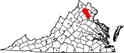 | |
| CDPs |
| |
| Other communities |
| |
| Footnotes | ‡This populated place also has portions in an adjacent county or counties | |
| ||
Belvoir, Virginia | |
|---|---|
Unincorporated community | |
 Belvoir Location within the state of Virginia  Belvoir Belvoir (Virginia)  Belvoir Belvoir (the United States) | |
| Coordinates: 38°39′27″N 77°43′01″W | |
| Country | United States |
| State | Virginia |
| County | Fauquier |
| Time zone | UTC−5 (Eastern (EST)) |
| • Summer (DST) | UTC−4 (EDT) |
| ZIP codes | 20189 |
This Fauquier County, Virginia state location article is a stub. You can help Wikipedia by expanding it. |
Текст в блоке "Читать" взят с сайта "Википедия" и доступен по лицензии Creative Commons Attribution-ShareAlike; в отдельных случаях могут действовать дополнительные условия.
Другой контент может иметь иную лицензию. Перед использованием материалов сайта WikiSort.org внимательно изучите правила лицензирования конкретных элементов наполнения сайта.
Другой контент может иметь иную лицензию. Перед использованием материалов сайта WikiSort.org внимательно изучите правила лицензирования конкретных элементов наполнения сайта.
2019-2026
WikiSort.org - проект по пересортировке и дополнению контента Википедии
WikiSort.org - проект по пересортировке и дополнению контента Википедии