world.wikisort.org - USA
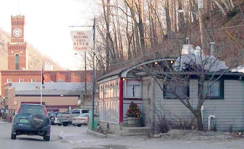
Bellows Falls is an incorporated village located in the town of Rockingham in Windham County, Vermont, United States. The population was 2,747 at the 2020 census.[4] Bellows Falls is home to the Green Mountain Railroad, a heritage railroad; the annual Roots on the River Festival;[5] and the No Film Film Festival.[6]
This article contains too many pictures, charts or diagrams for its overall length. (April 2022) |
Bellows Falls, Vermont | |
|---|---|
Village | |
 Bellows Falls in the early spring, viewed from Fall Mountain in New Hampshire | |
 Bellows Falls, Vermont Location within the state of Vermont | |
| Coordinates: 43°8′0″N 72°26′38″W | |
| Country | United States |
| State | Vermont |
| County | Windham |
| Incorporated | 1909 |
| Area | |
| • Total | 1.39 sq mi (3.59 km2) |
| • Land | 1.37 sq mi (3.55 km2) |
| • Water | 0.02 sq mi (0.05 km2) |
| Elevation | 312 ft (95 m) |
| Population (2020) | |
| • Total | 2,747 |
| • Density | 2,005.1/sq mi (774.2/km2) |
| Time zone | UTC-5 (Eastern (EST)) |
| • Summer (DST) | UTC-4 (EDT) |
| ZIP code | 05101 |
| Area code | 802 |
| FIPS code | 50-04225[2] |
| GNIS feature ID | 1456381[3] |
| Website | Official website |
History

The community was settled in 1753 by colonists of English descent, who called it Great Falls.[7] Later the settlers renamed the town for Colonel Benjamin Bellows, a landowner,[8][9] but kept the name Great Falls for the waterfall, a translation of their Abenaki name, "Kitchee pontegu."[7] In 1785, Colonel Enoch Hale built at the falls the first bridge over the Connecticut River. It was the only bridge across the river until 1796, when another was built at Springfield, Massachusetts.[10] The bridge was later replaced. Two bridges currently link Bellows Falls to New Hampshire: the New Arch Bridge (also called the Church Street Bridge), which replaced the Arch Bridge in 1982, and the Vilas Bridge.[11]
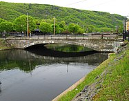
The Bellows Falls Canal, one of the first canals built in the United States, was dug by a British-owned company from 1791 to 1802. The original canal was 22 feet wide and four feet deep, and had 9 locks, each 75 feet long and 20 feet wide, which allowed shipping to go around Great Falls by being lifted 52 feet (16 m) around the gorge. River traffic declined after railroads were built to the Connecticut Valley in 1849, and by 1858 the canal had become used exclusively for water power to run the paper mills which became established there. In 1874 the canal was enlarged to 75 feet wide and 17 feet deep. By 1908 it was delivering 15,000 horsepower to the mills. When the mills replaced water power with electrical power, the canal was widened again in 1927–28 to 100 feet, and the water was used to power turbines to generate electricity. The canal's bottom was lined with concrete, and the sides secured with rip-rap set in concrete. A fish ladder allows salmon to continue upstream at times when the bulk of the river's flow is diverted to the canal. The canal is now part of the Bellows Falls Downtown Historic District.[12][13][14]
In 1802, entrepreneurs built the first paper mill in Windham County. Two railroads converged in 1849 at Bellows Falls, helping it develop into a major mill town. By 1859, a woolen textile mill was operating, in addition to factories that produced furniture, marble, sashes and blinds, iron castings, carriages, cabinetware, rifles, harness, shoe pegs and organs.[15]
The years of industry created wealth in the town, and substantial Victorian houses and mercantile buildings were constructed. Bellows Falls today attracts visitors through heritage tourism based on its historic Victorian architecture. The commercial town center, along with the canal, the bridges spanning it, and several neighborhoods of houses, were listed as historic districts on the National Register of Historic Places, as were individual landmarks such as the historic railroad station and the Adams Gristmill Warehouse.[16][17]
Geography
The village is located within the town of Rockingham. According to the United States Census Bureau, the village has a total area of 1.4 square miles (3.6 km2), all land. Bellows Falls is bounded on the east by the Connecticut River.
| Historical population | |||
|---|---|---|---|
| Census | Pop. | %± | |
| 1870 | 697 | — | |
| 1880 | 2,229 | 219.8% | |
| 1890 | 3,092 | 38.7% | |
| 1900 | 4,337 | 40.3% | |
| 1910 | 4,883 | 12.6% | |
| 1920 | 4,860 | −0.5% | |
| 1930 | 3,930 | −19.1% | |
| 1940 | 4,236 | 7.8% | |
| 1950 | 3,881 | −8.4% | |
| 1960 | 3,831 | −1.3% | |
| 1970 | 3,505 | −8.5% | |
| 1980 | 3,456 | −1.4% | |
| 1990 | 3,313 | −4.1% | |
| 2000 | 3,165 | −4.5% | |
| 2010 | 3,148 | −0.5% | |
| 2020 | 2,747 | −12.7% | |
| U.S. Decennial Census[18] | |||
Demographics
As of the census[2] of 2000, there were 3,165 people, 1,329 households, and 782 families residing in the village. The population density was 2,286.1 people per square mile (885.5/km2). There were 1,443 housing units at an average density of 1,042.3/sq mi (403.7/km2). The racial makeup of the village was 97.28% White, 0.35% African American, 0.16% Native American, 0.51% Asian, 0.03% Pacific Islander, 0.22% from other races, and 1.45% from two or more races. Hispanic or Latino of any race were 1.14% of the population.
There were 1,329 households, out of which 32.2% had children under the age of 18 living with them, 40.0% were couples living together and joined in either marriage or civil union, 14.1% had a female householder with no husband present, and 41.1% were non-families. 34.5% of all households were made up of individuals, and 16.7% had someone living alone who was 65 years of age or older. The average household size was 2.35 and the average family size was 3.01.
In the village, the population was spread out, with 26.1% under the age of 18, 7.8% from 18 to 24, 28.3% from 25 to 44, 21.5% from 45 to 64, and 16.2% who were 65 years of age or older. The median age was 37 years. For every 100 females, there were 94.1 males. For every 100 females age 18 and over, there were 88.6 males.
The median income for a household in the village was $29,608, and the median income for a family was $45,688. Males had a median income of $29,137 versus $22,340 for females. The per capita income for the village was $15,276. About 5.6% of families and 12.6% of the population were below the poverty line, including 14.3% of those under age 18 and 15.9% of those age 65 or over.
Arts and culture
Tourism
Bellows Falls has cultural attractions including:
- Just downstream of the bridge are petroglyphs on large boulders at the Bellows Falls Petroglyph Site.[19]

Transportation
Gallery
 Bellows Falls (Great Falls) at high flow
(ndg) Island House Hotel
(c. 1850s) Robertson Paper Company Complex, built c. 1890-c. 1960
(2013) Arch bridge to North Walpole, New Hampshire
(1905) Westminster High Bridge over Saxton's River
(1906) Paper mills
(1907)](//upload.wikimedia.org/wikipedia/commons/thumb/1/19/The_Square%2C_Bellows_Falls%2C_VT.jpg/187px-The_Square%2C_Bellows_Falls%2C_VT.jpg) The Square has been the commercial center of Bellows Falls practically since the first residents settled there.[20]
The Square has been the commercial center of Bellows Falls practically since the first residents settled there.[20]
(c. 1908) The Gas Station at Bridge and Island Streets was built c.1935 in the Colonial Revival style and was added to the NRHP in 1990
(2017) A house on Westminster Terrace, part of the Westminster Terrace Historic District, designated in 2010
(2013)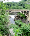 The falls under the Vilas Bridge at medium flow in 2014; taken looking north


](http://upload.wikimedia.org/wikipedia/commons/1/19/The_Square%2C_Bellows_Falls%2C_VT.jpg)


- Bellows Falls Downtown Historic District
 The Depot Street Bridge over the Bellows Falls Canal
(2016)](//upload.wikimedia.org/wikipedia/commons/thumb/d/d1/Frank_Adams_Grist_Mill%2C_Bellows_Falls%2C_Vermont.jpg/187px-Frank_Adams_Grist_Mill%2C_Bellows_Falls%2C_Vermont.jpg) The Frank Adams Grist Mill was founded in 1831 and ran continuously until the early 1960s[12]
The Frank Adams Grist Mill was founded in 1831 and ran continuously until the early 1960s[12]
(2017)](//upload.wikimedia.org/wikipedia/commons/thumb/2/2c/Brown_Block%2C_1-5_Canal_Street%2C_Bellows_Falls%2C_Vermont.jpg/99px-Brown_Block%2C_1-5_Canal_Street%2C_Bellows_Falls%2C_Vermont.jpg) The Brown Block at 1-5 Canal Street, built in 1890 in the Queen Anne style[12]
The Brown Block at 1-5 Canal Street, built in 1890 in the Queen Anne style[12]
(2017) Looking south down Canal Street towards The Square; the Brown Block can be seen in the background
(2016)](//upload.wikimedia.org/wikipedia/commons/thumb/3/3d/Edward_Arms_Block%2C_Westminster_Street%2C_Bellows_Falls%2C_Vermont.jpg/121px-Edward_Arms_Block%2C_Westminster_Street%2C_Bellows_Falls%2C_Vermont.jpg) The Edward Arms Block was built in 1890 and had an additional floor added in 1910[12]
The Edward Arms Block was built in 1890 and had an additional floor added in 1910[12]
(2017)![The Bellows Falls Railroad Tunnel under Bridge Street and The Square dates from the 1840s. The bottom was excavated in the 1970s and in 2007, to allow taller trains to pass through[12][21](2017)](//upload.wikimedia.org/wikipedia/commons/thumb/5/58/Bellows_Falls_Railroad_Tunnel.jpg/187px-Bellows_Falls_Railroad_Tunnel.jpg)
](//upload.wikimedia.org/wikipedia/commons/thumb/b/b8/Centennial_Block%2C_Bellows_Falls.jpg/187px-Centennial_Block%2C_Bellows_Falls.jpg) The Centennial Block, built by the National Bank of Bellows Falls in 1875[22]
The Centennial Block, built by the National Bank of Bellows Falls in 1875[22]
(2016)](//upload.wikimedia.org/wikipedia/commons/thumb/e/ea/Commercial_Block%2C_Bellows_Falls%2C_Vermont.jpg/171px-Commercial_Block%2C_Bellows_Falls%2C_Vermont.jpg) The commercial block at 20 Square was built in 1912[12]
The commercial block at 20 Square was built in 1912[12]
(2017)](//upload.wikimedia.org/wikipedia/commons/thumb/5/5b/USPO_Bellows_Falls%2C_Vermont.jpg/187px-USPO_Bellows_Falls%2C_Vermont.jpg) United States Post Office, built in 1930 in the Georgian Revival style with Spanish Colonial Revival style elements[12]
United States Post Office, built in 1930 in the Georgian Revival style with Spanish Colonial Revival style elements[12]
(2017)![The Windham Hotel, built in 1932.[12] From the mid-1970s to the mid-1980s it housed one of Vermont's only gay bars, Andrews Inn[23](2017)](//upload.wikimedia.org/wikipedia/commons/thumb/e/e2/Windham_Hotel%2C_Bellows_Falls%2C_Vermont.jpg/187px-Windham_Hotel%2C_Bellows_Falls%2C_Vermont.jpg)

](http://upload.wikimedia.org/wikipedia/commons/d/d1/Frank_Adams_Grist_Mill%2C_Bellows_Falls%2C_Vermont.jpg)
](http://upload.wikimedia.org/wikipedia/commons/2/2c/Brown_Block%2C_1-5_Canal_Street%2C_Bellows_Falls%2C_Vermont.jpg)

](http://upload.wikimedia.org/wikipedia/commons/3/3d/Edward_Arms_Block%2C_Westminster_Street%2C_Bellows_Falls%2C_Vermont.jpg)
![The Bellows Falls Railroad Tunnel under Bridge Street and The Square dates from the 1840s. The bottom was excavated in the 1970s and in 2007, to allow taller trains to pass through[12][21](2017)](http://upload.wikimedia.org/wikipedia/commons/5/58/Bellows_Falls_Railroad_Tunnel.jpg)
](http://upload.wikimedia.org/wikipedia/commons/b/b8/Centennial_Block%2C_Bellows_Falls.jpg)
](http://upload.wikimedia.org/wikipedia/commons/e/ea/Commercial_Block%2C_Bellows_Falls%2C_Vermont.jpg)
](http://upload.wikimedia.org/wikipedia/commons/5/5b/USPO_Bellows_Falls%2C_Vermont.jpg)
![The Windham Hotel, built in 1932.[12] From the mid-1970s to the mid-1980s it housed one of Vermont's only gay bars, Andrews Inn[23](2017)](http://upload.wikimedia.org/wikipedia/commons/e/e2/Windham_Hotel%2C_Bellows_Falls%2C_Vermont.jpg)
- Bellows Falls Neighborhood Historic District
](//upload.wikimedia.org/wikipedia/commons/thumb/a/ac/Masonic_Temple%2C_Bellows_Falls_Vermont.jpg/187px-Masonic_Temple%2C_Bellows_Falls_Vermont.jpg) The Bellows Falls Masonic Temple, formerly the Wyman & Almira Flint House, was built c.1870 in the Second Empire style[24]
The Bellows Falls Masonic Temple, formerly the Wyman & Almira Flint House, was built c.1870 in the Second Empire style[24]
(2017)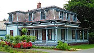 A Victorian house at 6 Temple Street
(2017)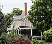 The William A. Hall House was built in 1890–92 in the Colonial Revival stye. It is now the Readmore Inn.
(2013)](//upload.wikimedia.org/wikipedia/commons/thumb/8/89/Rockingham_Public_Library%2C_Bellows_Falls%2C_Vermont.jpg/187px-Rockingham_Public_Library%2C_Bellows_Falls%2C_Vermont.jpg) The Rockingham Free Public Library, built in 1909, is a Carnegie library[24]
The Rockingham Free Public Library, built in 1909, is a Carnegie library[24]
(2017)](//upload.wikimedia.org/wikipedia/commons/thumb/9/95/Former_Armory%2C_Company_E_First_Infantry_Vemont_National_Guard%2C_Bellows_Falls%2C_Vermont.jpg/187px-Former_Armory%2C_Company_E_First_Infantry_Vemont_National_Guard%2C_Bellows_Falls%2C_Vermont.jpg) The former armory of Company E of the First Infantry of the Vermont National Guard was built in 1915. It is now low-income housing.[24]
The former armory of Company E of the First Infantry of the Vermont National Guard was built in 1915. It is now low-income housing.[24]
(2017)
](http://upload.wikimedia.org/wikipedia/commons/a/ac/Masonic_Temple%2C_Bellows_Falls_Vermont.jpg)


](http://upload.wikimedia.org/wikipedia/commons/8/89/Rockingham_Public_Library%2C_Bellows_Falls%2C_Vermont.jpg)
](http://upload.wikimedia.org/wikipedia/commons/9/95/Former_Armory%2C_Company_E_First_Infantry_Vemont_National_Guard%2C_Bellows_Falls%2C_Vermont.jpg)
Notable people
- Warner A. Graham – American judge[25]
See also
- Arch Bridge (Bellows Falls)
- National Register of Historic Places listings in Windham County, Vermont
- Steamtown, U.S.A. – Former museum in Vermont, United States
References
- "2019 U.S. Gazetteer Files". United States Census Bureau. Retrieved August 7, 2020.
- "U.S. Census website". United States Census Bureau. Retrieved 2008-01-31.
- U.S. Geological Survey Geographic Names Information System: Bellows Falls
- "Census - Geography Profile: Bellows Falls village, Vermont". Retrieved December 26, 2021.
- "Roots on the River" Vermont Festivals
- No Film Film Festival Facebook[unreliable source?]
- GNIS page for Great Falls
- Coolidge, Austin J.; Mansfield, John B. (1859). A History and Description of New England. Boston, Massachusetts. pp. 886–888.
- Geographic Names Information System, Bellows Falls,VT.
- The First Toll Bridge at Bellows Falls
- Collins, Anne L.; Lisai, Virginia; and Luring Louise (2002) Around Bellows Falls: Rockingham, Westminster, and Saxtons River Arcadia Publishing. ISBN 978-0-7385-1033-0
- "Bellows Falls Downtown Historic District"
- Historic marker on site at Bridge Street, Bellows Falls[unreliable source?]
- "Bellows Falls Canal"
- Coolidge, A. J. and Mansfield, J. B. (1859) A. J. Coolidge & J. B. Mansfield, A History and Description of New England Boston, Massachusetts
- "National Register Information System". National Register of Historic Places. National Park Service. July 9, 2010.
- "NRHP nomination for Bellows Falls Downtown Historic District". National Park Service. Retrieved 2015-10-31.
- "Census of Population and Housing". Census.gov. Retrieved June 4, 2015.
- "Face Value: The Bellows Falls Petroglyphs". 9 August 2015.[unreliable source?]
- Historical marker on the Windham Hotel
- "Windham Hotel History"
- "Centennial Block"
- "Andrews Inn Oral History Project" Green Mountain Crossroads
- "Bellows Falls Neighborhood Historic District Self-Guided Walking Tour" (PDF). Archived from the original (PDF) on 2016-10-20. Retrieved 2017-06-20.
- Cutler, William Richard (1914). New England Families, Genealogical and Memorial. Vol. 3. New York, NY: Lewis Historical Publishing Company. p. 1468.
External links
Municipalities and communities of Windham County, Vermont, United States | ||
|---|---|---|
Shire town: Newfane | ||
| Towns |
|  |
| Villages | ||
| CDPs | ||
| Other communities |
| |
| Footnotes | § Disincorporated ‡ This populated place also has portions in an adjacent county or counties | |
| ||
Authority control | |
|---|---|
| General | |
| National libraries | |
На других языках
[de] Bellows Falls
Bellows Falls[1] ist ein Village in der Town Rockingham im Windham County des Bundesstaates Vermont in den Vereinigten Staaten mit 2747 Einwohnern (laut Volkszählung von 2020). Bellows Falls liegt im Südosten der Town Rockingham, am westlichen Ufer des Connecticut Rivers.- [en] Bellows Falls, Vermont
Другой контент может иметь иную лицензию. Перед использованием материалов сайта WikiSort.org внимательно изучите правила лицензирования конкретных элементов наполнения сайта.
WikiSort.org - проект по пересортировке и дополнению контента Википедии