world.wikisort.org - USA
Ashland is a census-designated place (CDP) comprising the main village within the town of Ashland in Aroostook County, Maine, United States. The population of the CDP was 709 at the 2010 census,[2] out of a population of 1,309 for the entire town.
Ashland, Maine | |
|---|---|
Census-designated place | |
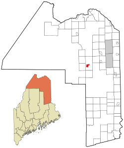 Location of Ashland, Maine | |
| Coordinates: 46°37′36″N 68°24′7″W | |
| Country | United States |
| State | Maine |
| County | Aroostook |
| Town | Ashland |
| Area | |
| • Total | 4.48 sq mi (11.61 km2) |
| • Land | 4.46 sq mi (11.55 km2) |
| • Water | 0.02 sq mi (0.06 km2) |
| Elevation | 712 ft (217 m) |
| Population (2020) | |
| • Total | 639 |
| • Density | 143.31/sq mi (55.33/km2) |
| Time zone | UTC-5 (Eastern (EST)) |
| • Summer (DST) | UTC-4 (EDT) |
| ZIP code | 04732 |
| Area code | 207 |
| FIPS code | 23-01675 |
| GNIS feature ID | 2583553 |
Geography
The Ashland CDP is located along the Aroostook River near the center of the town of Ashland. Maine State Routes 11, 227 and 163 intersect at the center of the CDP.
According to the United States Census Bureau, the CDP has a total area of 4.5 square miles (11.6 km2), of which 4.4 square miles (11.5 km2) is land and 0.039 square miles (0.1 km2), or 0.52%, is water.[2]
Demographics
| Historical population | |||
|---|---|---|---|
| Census | Pop. | %± | |
| 2020 | 639 | — | |
| U.S. Decennial Census[3] | |||
References
- "2020 U.S. Gazetteer Files". United States Census Bureau. Retrieved April 8, 2022.
- "Geographic Identifiers: 2010 Demographic Profile Data (G001): Ashland CDP, Maine". U.S. Census Bureau, American Factfinder. Archived from the original on February 12, 2020. Retrieved May 22, 2013.
- "Census of Population and Housing". Census.gov. Retrieved June 4, 2016.
Municipalities and communities of Aroostook County, Maine, United States | ||
|---|---|---|
County seat: Houlton | ||
| Cities |  | |
| Towns |
| |
| Plantations | ||
| Unorganized territories | ||
| CDPs | ||
| Other communities |
| |
| Indian reservations |
| |
| ||
Authority control | |
|---|---|
| General | |
| National libraries | |
Текст в блоке "Читать" взят с сайта "Википедия" и доступен по лицензии Creative Commons Attribution-ShareAlike; в отдельных случаях могут действовать дополнительные условия.
Другой контент может иметь иную лицензию. Перед использованием материалов сайта WikiSort.org внимательно изучите правила лицензирования конкретных элементов наполнения сайта.
Другой контент может иметь иную лицензию. Перед использованием материалов сайта WikiSort.org внимательно изучите правила лицензирования конкретных элементов наполнения сайта.
2019-2025
WikiSort.org - проект по пересортировке и дополнению контента Википедии
WikiSort.org - проект по пересортировке и дополнению контента Википедии