world.wikisort.org - USA
Ash Flat is a 1st oldest city in Fulton and Sharp counties in the U.S. state of Arkansas. The population was 1,198 at the 2020
This article uses bare URLs, which are uninformative and vulnerable to link rot. (August 2022) |
Ash Flat, Arkansas | |
|---|---|
City | |
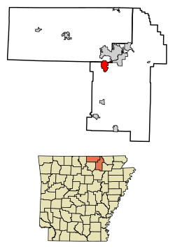 Location of Ash Flat in Fulton County and Sharp County, Arkansas. | |
 Ash Flat Location in Arkansas | |
| Coordinates: 36°13′52″N 91°36′33″W | |
| Country | United States |
| State | Arkansas |
| Counties | Sharp, Fulton |
| Area | |
| • Total | 6.32 sq mi (16.36 km2) |
| • Land | 6.32 sq mi (16.36 km2) |
| • Water | 0.00 sq mi (0.00 km2) |
| Elevation | 663 ft (202 m) |
| Population (2020) | |
| • Total | 1,137 |
| • Density | 180.05/sq mi (69.52/km2) |
| Time zone | UTC-6 (Central (CST)) |
| • Summer (DST) | UTC-5 (CDT) |
| ZIP code | 72513 |
| Area code | 870 |
| FIPS code | 05-02470 |
| GNIS feature ID | 0076202[2] |
| Website | www |
History
Ash Flat was established in 1856. The community was so named for a grove of ash trees near the original town site.[3]
In 1967, the Arkansas General Assembly designated Ash Flat as the single county seat of Sharp County, a title previously held by Hardy and Evening Shade concurrently.
Geography
Ash Flat is located at 36°13′52″N 91°36′33″W (36.231107, -91.609163).[4]
According to the United States Census Bureau, the city has a total area of 6.1 square miles (15.9 km2), all land.[5]
Demographics
| Historical population | |||
|---|---|---|---|
| Census | Pop. | %± | |
| 2020 | 1,137 | — | |
| U.S. Decennial Census[6] | |||
| Historical population | |||
|---|---|---|---|
| Census | Pop. | %± | |
| 1940 | 315 | — | |
| 1950 | 265 | −15.9% | |
| 1960 | 192 | −27.5% | |
| 1970 | 211 | 9.9% | |
| 1980 | 524 | 148.3% | |
| 1990 | 667 | 27.3% | |
| 2000 | 977 | 46.5% | |
| 2010 | 1,082 | 10.7% | |
| 2018 (est.) | 1,094 | [7] | 1.1% |
| U.S. Decennial Census[8] | |||
2020 census
| Race | Number | Percentage |
|---|---|---|
| White (non-Hispanic) | 1,027 | 90.33% |
| Black or African American (non-Hispanic) | 6 | 0.53% |
| Native American | 12 | 1.06% |
| Asian | 8 | 0.7% |
| Other/Mixed | 50 | 4.4% |
| Hispanic or Latino | 34 | 2.99% |
As of the 2020 United States census, there were 1,137 people, 471 households, and 248 families residing in the city.
2010 census
As of the 2010 United States Census, there were 1,082 people living in the city. The racial makeup of the city was 96.8% White, 0.5% Black, 0.5% Native American and 1.5% from two or more races. 0.8% were Hispanic or Latino of any race.
2000 census
As of the census[10] of 2000, there were 977 people, 430 households, and 233 families living in the city. The population density was 175.7 inhabitants per square mile (67.8/km2). There were 485 housing units at an average density of 87.2 per square mile (33.7/km2). The racial makeup of the city was 98.57% White, 0.41% Black or African American, 0.20% Native American, and 0.82% from two or more races. 0.72% of the population were Hispanic or Latino of any race.
There were 430 households, out of which 24.0% had children under the age of 18 living with them, 42.1% were married couples living together, 10.5% had a female householder with no husband present, and 45.8% were non-families. 41.4% of all households were made up of individuals, and 27.7% had someone living alone who was 65 years of age or older. The average household size was 2.09 and the average family size was 2.91.
In the city, the population was spread out, with 21.6% under the age of 18, 5.7% from 18 to 24, 20.5% from 25 to 44, 20.6% from 45 to 64, and 31.6% who were 65 years of age or older. The median age was 47 years. For every 100 females, there were 72.9 males. For every 100 females age 18 and over, there were 70.6 males.
The median income for a household in the city was $16,797, and the median income for a family was $22,019. Males had a median income of $24,815 versus $15,556 for females. The per capita income for the city was $11,506. About 24.5% of families and 31.7% of the population were below the poverty line, including 42.2% of those under age 18 and 22.6% of those age 65 or over.
Notable people
- Preacher Roe, major league baseball player[11]
- Gordon Carpenter, Olympic gold medalist in basketball
Education
Ash Flat is served by the Highland School District, which operates Highland High School. The Highland district was formed from the 1962 consolidation of the Ash Flat School District and the Hardy School District. Due to the previous rivalry between the two districts, some members of the community were unsure whether the vote to consolidate would succeed.[12]
Ozarka College established a site in Ash Flat in the fall of 2001.[13]
References
- "2020 U.S. Gazetteer Files". United States Census Bureau. Retrieved October 29, 2021.
- U.S. Geological Survey Geographic Names Information System: Ash Flat, Arkansas
- Moyer, Armond; Moyer, Winifred (1958). The origins of unusual place-names. Keystone Pub. Associates. p. 9.
- "US Gazetteer files: 2010, 2000, and 1990". United States Census Bureau. 2011-02-12. Retrieved 2011-04-23.
- "Geographic Identifiers: 2010 Demographic Profile Data (G001): Ash Flat city, Arkansas". United States Census Bureau. Retrieved August 10, 2012.
- "Census of Population and Housing". Census.gov. Retrieved June 4, 2016.
- "Population and Housing Unit Estimates". Retrieved February 15, 2020.
- "Census of Population and Housing". Census.gov. Retrieved June 4, 2015.
- "Explore Census Data". data.census.gov. Retrieved 2021-12-30.
- "U.S. Census website". United States Census Bureau. Retrieved 2008-01-31.
- Reichler, Joseph L., ed. (1979) [1969]. The Baseball Encyclopedia (4th ed.). New York: Macmillan Publishing. ISBN 0-02-578970-8.
- "Our History". Highland School District. Archived from the original on 2012-08-04. Retrieved 2012-12-02.
- http://www.ozarka.edu
External links
- City of Ash Flat official website
- Regional information
- Ash Flat at Arkansas.com
- http://www.ashflatfire.org/
Municipalities and communities of Sharp County, Arkansas, United States | ||
|---|---|---|
County seat: Ash Flat | ||
| Cities |  | |
| Towns | ||
| CDP | ||
| Other unincorporated communities | ||
| Footnotes | ‡This populated place also has portions in an adjacent county or counties | |
| ||
Municipalities and communities of Fulton County, Arkansas, United States | ||
|---|---|---|
County seat: Salem | ||
| Cities |  | |
| Town | ||
| Unincorporated communities | ||
| Footnotes | ‡This populated place also has portions in an adjacent county or counties | |
| ||
На других языках
- [en] Ash Flat, Arkansas
[ru] Аш-Флат
Аш-Флат (англ. Ash Flat) — город, расположенный в округах Фултон и Шарп (штат Арканзас, США) с населением в 977 человек по статистическим данным переписи 2000 года. Является административным центром округа Шарп.Другой контент может иметь иную лицензию. Перед использованием материалов сайта WikiSort.org внимательно изучите правила лицензирования конкретных элементов наполнения сайта.
WikiSort.org - проект по пересортировке и дополнению контента Википедии