world.wikisort.org - USA
Arjay is an unincorporated community and coal town in Bell County, Kentucky, United States. Arjay is located on Kentucky Route 66 4 miles (6.4 km) northeast of Pineville.[3] Arjay has a post office with ZIP code 40902, which opened on February 23, 1911.[4][5] The community's name comes from the initials of coal operator R. J. Asher.[6]
Arjay, Kentucky | |
|---|---|
Unincorporated community | |
 Houses along the railroad track in Arjay, 1946. Photo by Russell Lee. | |
 Arjay, Kentucky | |
| Coordinates: 36°48′17″N 83°38′45″W | |
| Country | United States |
| State | Kentucky |
| County | Bell |
| Area | |
| • Total | 0.62 sq mi (1.61 km2) |
| • Land | 0.62 sq mi (1.61 km2) |
| • Water | 0.00 sq mi (0.00 km2) |
| Elevation | 1,066 ft (325 m) |
| Population (2020) | |
| • Total | 183 |
| • Density | 295.16/sq mi (113.97/km2) |
| Time zone | UTC-5 (Eastern (EST)) |
| • Summer (DST) | UTC-4 (EDT) |
| ZIP code | 40902 |
| Area code(s) | 606 |
| GNIS feature ID | 486025[2] |
Demographics
| Historical population | |||
|---|---|---|---|
| Census | Pop. | %± | |
| 2020 | 183 | — | |
| U.S. Decennial Census[7] | |||
References
- "2020 U.S. Gazetteer Files". United States Census Bureau. Retrieved March 18, 2022.
- "Arjay". Geographic Names Information System. United States Geological Survey, United States Department of the Interior.
- State Primary Road System: Bell County (PDF) (Map). Kentucky Transportation Cabinet. 2012. Retrieved February 23, 2013.
- United States Postal Service (2012). "USPS - Look Up a ZIP Code". Retrieved 2012-02-15.
- "Postmaster Finder - Post Offices by ZIP Code". United States Postal Service. Retrieved February 23, 2013.
- Rennick, Robert M. (1987). Kentucky Place Names. University Press of Kentucky. p. 375. ISBN 9780813126319.
- "Census of Population and Housing". Census.gov. Retrieved June 4, 2016.
Municipalities and communities of Bell County, Kentucky, United States | ||
|---|---|---|
County seat: Pineville | ||
| Cities | 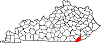 | |
| CDP | ||
| Other unincorporated communities |
| |
| Ghost towns |
| |
| Footnotes | ‡This populated place also has portions in an adjacent county or counties | |
| ||
This Bell County, Kentucky state location article is a stub. You can help Wikipedia by expanding it. |
Текст в блоке "Читать" взят с сайта "Википедия" и доступен по лицензии Creative Commons Attribution-ShareAlike; в отдельных случаях могут действовать дополнительные условия.
Другой контент может иметь иную лицензию. Перед использованием материалов сайта WikiSort.org внимательно изучите правила лицензирования конкретных элементов наполнения сайта.
Другой контент может иметь иную лицензию. Перед использованием материалов сайта WikiSort.org внимательно изучите правила лицензирования конкретных элементов наполнения сайта.
2019-2026
WikiSort.org - проект по пересортировке и дополнению контента Википедии
WikiSort.org - проект по пересортировке и дополнению контента Википедии