world.wikisort.org - USA
Anthoston is an unincorporated community and census-designated place (CDP) in Henderson County, Kentucky, United States. It is 6 miles (10 km) south of Henderson, the county seat, between U.S. Route 41 to the west and Interstate 69, the former Pennyrile Parkway, to the east. There is no direct access to it from I-69.
Anthoston, Kentucky | |
|---|---|
Census-designated place | |
 Anthoston  Anthoston | |
| Coordinates: 37°45′34″N 87°32′18″W | |
| Country | United States |
| State | Kentucky |
| County | Henderson |
| Area | |
| • Total | 0.65 sq mi (1.68 km2) |
| • Land | 0.65 sq mi (1.67 km2) |
| • Water | 0.00 sq mi (0.01 km2) |
| Elevation | 455 ft (139 m) |
| Population (2020) | |
| • Total | 225 |
| • Density | 348.84/sq mi (134.74/km2) |
| Time zone | UTC-6 (Central (CST)) |
| • Summer (DST) | UTC-5 (CST) |
| FIPS code | 21-01720 |
| GNIS feature ID | 485968[2] |
Anthoston Had a radio station that went on the air in 1970 WAUZ At 103.1MHz FM Later became WBIC, WHKC and WGBF-FM. Their tower and transmitter were moved to the present location in 1987.
Anthoston was first listed as a CDP in 2014, so no census population figures are available for it.
Demographics
| Historical population | |||
|---|---|---|---|
| Census | Pop. | %± | |
| 2020 | 225 | — | |
| U.S. Decennial Census[3] | |||
References
- "2020 U.S. Gazetteer Files". United States Census Bureau. Retrieved March 18, 2022.
- U.S. Geological Survey Geographic Names Information System: Anthoston, Kentucky
- "Census of Population and Housing". Census.gov. Retrieved June 4, 2016.
Municipalities and communities of Henderson County, Kentucky, United States | ||
|---|---|---|
County seat: Henderson | ||
| Cities | 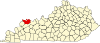 | |
| CDPs |
| |
| Other communities |
| |
| Ghost town |
| |
| Footnotes | ‡This populated place also has portions in an adjacent county or counties | |
| ||
Текст в блоке "Читать" взят с сайта "Википедия" и доступен по лицензии Creative Commons Attribution-ShareAlike; в отдельных случаях могут действовать дополнительные условия.
Другой контент может иметь иную лицензию. Перед использованием материалов сайта WikiSort.org внимательно изучите правила лицензирования конкретных элементов наполнения сайта.
Другой контент может иметь иную лицензию. Перед использованием материалов сайта WikiSort.org внимательно изучите правила лицензирования конкретных элементов наполнения сайта.
2019-2026
WikiSort.org - проект по пересортировке и дополнению контента Википедии
WikiSort.org - проект по пересортировке и дополнению контента Википедии