world.wikisort.org - USA
Alloway Township is a township in Salem County, New Jersey, United States. As of the 2010 United States Census, the township's population was 3,467,[8][9][10] reflecting an increase of 693 (+25.0%) from the 2,774 counted in the 2000 Census, which had in turn declined by 21 (−0.8%) from the 2,795 counted in the 1990 Census.[19] What is now Alloway was formally incorporated as Upper Alloways Creek Township by a Royal charter granted on June 17, 1767, from portions of the now-defunct Alloways Creek Township. The township was formally incorporated by an act of the New Jersey Legislature on February 21, 1798. Quinton Township was formed from portions of the township on February 18, 1873. The name was officially changed to Alloway Township as of February 21, 1884.[20]
Alloway Township, New Jersey | |
|---|---|
Township | |
| Township of Alloway | |
 Dickenson House | |
 Alloway Township highlighted in Salem County. Inset map: Salem County highlighted in the State of New Jersey. | |
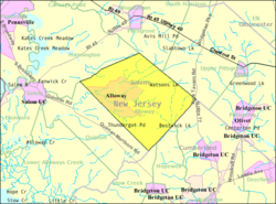 Census Bureau map of Alloway Township, New Jersey | |
 Carneys Point Township Location in Salem County  Carneys Point Township Location in New Jersey  Carneys Point Township Location in the United States | |
| Coordinates: 39.562311°N 75.310603°W[1][2] | |
| Country | |
| State | |
| County | |
| Royal charter | June 17, 1767, as Upper Alloways Creek Township |
| Incorporated | February 21, 1798 |
| Renamed | February 21, 1884, as Alloway Township |
| Named for | Native American Chief Alloway |
| Government | |
| • Type | Township |
| • Body | Township Committee |
| • Mayor | P. Ed McKelvey (R, term ends December 31, 2022)[4][5] |
| • Administrator / Municipal clerk | Charlet Cheeseman[6] |
| Area | |
| • Total | 33.91 sq mi (87.84 km2) |
| • Land | 33.48 sq mi (86.70 km2) |
| • Water | 0.44 sq mi (1.13 km2) 1.29% |
| • Rank | 71st of 565 in state 6th of 15 in county[1] |
| Elevation | 62 ft (19 m) |
| Population | |
| • Total | 3,467 |
| • Estimate (2019)[11] | 3,359 |
| • Rank | 433rd of 566 in state 9th of 15 in county[12] |
| • Density | 103.8/sq mi (40.1/km2) |
| • Rank | 542nd of 566 in state 10th of 15 in county[12] |
| Time zone | UTC−05:00 (Eastern (EST)) |
| • Summer (DST) | UTC−04:00 (Eastern (EDT)) |
| ZIP Code | |
| Area codes | 856 exchanges: 339, 878, 935[15] |
| FIPS code | 3403300880[1][16][17] |
| GNIS feature ID | 00882131[18] |
| Website | www |
The name Alloway is derivative of Allowas, a local Native American chief.[21][22][23]
Geography
According to the United States Census Bureau, the township had a total area of 33.91 square miles (87.84 km2), including 33.48 square miles (86.70 km2) of land and 0.44 square miles (1.13 km2) of water (1.29%).[1][2]
Alloway (with a 2010 Census population of 1,402[24]) is an unincorporated community and census-designated place (CDP) located within Alloway Township.[25][26][27] Other unincorporated communities, localities and place names located partially or completely within the township include Aldine, Alloway Junction, Dilkes Mile, Friesburg, Lake Sycamore, Mower, New Boston, Oakland, Penton, Remsterville, Riddleton and Watsons Mills.[28]
The township borders Mannington Township, Pilesgrove Township, Quinton Township and Upper Pittsgrove Township in Salem County; and Hopewell Township, Stow Creek Township and Upper Deerfield Township in Cumberland County.[29][30]
Demographics
| Historical population | |||
|---|---|---|---|
| Census | Pop. | %± | |
| 1810 | 1,921 | — | |
| 1820 | 2,194 | 14.2% | |
| 1830 | 2,136 | −2.6% | |
| 1840 | 2,235 | 4.6% | |
| 1850 | 2,530 | 13.2% | |
| 1860 | 2,899 | 14.6% | |
| 1870 | 3,062 | 5.6% | |
| 1880 | 1,917 | * | −37.4% |
| 1890 | 1,675 | −12.6% | |
| 1900 | 1,528 | −8.8% | |
| 1910 | 1,533 | 0.3% | |
| 1920 | 1,431 | −6.7% | |
| 1930 | 1,575 | 10.1% | |
| 1940 | 1,705 | 8.3% | |
| 1950 | 1,792 | 5.1% | |
| 1960 | 2,226 | 24.2% | |
| 1970 | 2,550 | 14.6% | |
| 1980 | 2,680 | 5.1% | |
| 1990 | 2,795 | 4.3% | |
| 2000 | 2,774 | −0.8% | |
| 2010 | 3,467 | 25.0% | |
| 2019 (est.) | 3,359 | [11][31] | −3.1% |
| Population sources: 1810–2000[32] 1810–1920[33] 1840[34] 1850–1870[35] 1850[36] 1870[37] 1880–1890[38] 1890–1910[39] 1910–1930[40] 1930–1990[41] 2000[42][43] 2010[8][9][10] * = Lost territory in previous decade.[20] | |||
Census 2010
The 2010 United States census counted 3,467 people, 1,193 households, and 945 families in the township. The population density was 103.8 per square mile (40.1/km2). There were 1,268 housing units at an average density of 38.0 per square mile (14.7/km2). The racial makeup was 91.49% (3,172) White, 5.08% (176) Black or African American, 0.43% (15) Native American, 0.89% (31) Asian, 0.00% (0) Pacific Islander, 0.61% (21) from other races, and 1.50% (52) from two or more races. Hispanic or Latino of any race were 1.96% (68) of the population.[8]
Of the 1,193 households, 34.5% had children under the age of 18; 67.6% were married couples living together; 6.3% had a female householder with no husband present and 20.8% were non-families. Of all households, 17.4% were made up of individuals and 8.0% had someone living alone who was 65 years of age or older. The average household size was 2.84 and the average family size was 3.21.[8]
26.2% of the population were under the age of 18, 7.8% from 18 to 24, 23.2% from 25 to 44, 30.8% from 45 to 64, and 11.9% who were 65 years of age or older. The median age was 40.1 years. For every 100 females, the population had 101.9 males. For every 100 females ages 18 and older there were 102.5 males.[8]
The Census Bureau's 2006–2010 American Community Survey showed that (in 2010 inflation-adjusted dollars) median household income was $86,979 (with a margin of error of +/− $8,158) and the median family income was $91,979 (+/− $8,633). Males had a median income of $61,544 (+/− $11,567) versus $35,528 (+/− $2,497) for females. The per capita income for the borough was $27,649 (+/− $2,963). About 4.6% of families and 5.6% of the population were below the poverty line, including 3.9% of those under age 18 and 19.1% of those age 65 or over.[44]
Census 2000
As of the 2000 United States Census[16] there were 2,774 people, 948 households, and 742 families residing in the township. The population density was 84.5 inhabitants per square mile (32.6/km2). There were 995 housing units at an average density of 30.3 per square mile (11.7/km2). The racial makeup of the township was 90.70% White, 6.89% African American, 0.54% Native American, 0.43% Asian, 0.40% from other races, and 1.05% from two or more races. Hispanic or Latino of any race were 2.38% of the population.[42][43]
There were 948 households, out of which 36.0% had children under the age of 18 living with them, 66.8% were married couples living together, 7.0% had a female householder with no husband present, and 21.7% were non-families. 18.7% of all households were made up of individuals, and 8.2% had someone living alone who was 65 years of age or older. The average household size was 2.80 and the average family size was 3.19.[42][43]
In the township the population was spread out, with 28.1% under the age of 18, 6.8% from 18 to 24, 29.0% from 25 to 44, 23.8% from 45 to 64, and 12.4% who were 65 years of age or older. The median age was 37 years. For every 100 females, there were 103.5 males. For every 100 females age 18 and over, there were 105.0 males.[42][43]
The median income for a household in the township was $56,528, and the median income for a family was $65,132. Males had a median income of $43,839 versus $27,188 for females. The per capita income for the township was $22,935. About 4.5% of families and 8.2% of the population were below the poverty line, including 8.1% of those under age 18 and 4.6% of those age 65 or over.[42][43]
Government
Local government
Alloway is governed under the township form of New Jersey municipal government. The township is one of 141 municipalities (of the 564) statewide that use this form of government.[45] The Township Committee is comprised of three members, who are elected directly by the voters at-large in partisan elections to serve three-year terms of office on a staggered basis, with one seat coming up for election each year as part of the November general election.[3][46] At an annual reorganization meeting, the council selects one of its members to serves as mayor and another as deputy mayor.[citation needed]
As of 2022[update], the Alloway Township Committee consists of Mayor P. Ed McKelvey (R, term on committee ends December 31, 2024; term as mayor ends 2023), Deputy Mayor K. Myrle Patrick (R, term on committee ends 2022; term as deputy mayor ends 2020) and Warren Morgan III (D, 2023).[4][47][48][49][50]
Federal, state and county representation
Alloway Township is located in the 2nd Congressional district[51] and is part of New Jersey's 3rd state legislative district[9][52][53]
For the 117th United States Congress, New Jersey's Second Congressional District is represented by Jeff Van Drew (R, Dennis Township).[54] New Jersey is represented in the United States Senate by Democrats Cory Booker (Newark, term ends 2027)[55] and Bob Menendez (Harrison, term ends 2025).[56][57]
For the 2022–2023 session, the 3rd Legislative District of the New Jersey Legislature is represented in the State Senate by Edward Durr (R, Logan Township) and in the General Assembly by Bethanne McCarthy-Patrick (R, Mannington Township) and Beth Sawyer (R, Woolwich Township).[58]
Salem County is governed by a five-member Board of County Commissioners who are elected at-large to serve three-year terms of office on a staggered basis, with either one or two seats coming up for election each year. At an annual reorganization meeting held in the beginning of January, the board selects a Director and a Deputy Director from among its members.[59] As of 2022[update], Salem County's Commissioners (with party, residence and term-end year listed in parentheses) are Director Benjamin H. Laury (R, Elmer, term as commissioner ends December 31, 2024; term as director ends 2022), Deputy Director Gordon J. "Mickey" Ostrum, Jr. (R, Pilesgrove Township, term as commissioner ends 2024; term as deputy director ends 2022), R. Scott Griscom (R, Mannington Township, 2022), Edward A. Ramsay (R, Pittsgrove Township, 2023) and Lee R. Ware (D, Elsinboro Township, 2022).[59][60] Constitutional officers elected on a countywide basis are County Clerk Dale A. Cross (R, 2024),[61][62] Sheriff Charles M. Miller (R, 2024)[63][64] and Surrogate Nicki A. Burke (D, 2023).[65][66]
Politics
As of March 23, 2011, there were a total of 2,269 registered voters in Alloway Township, of which 509 (22.4% vs. 30.6% countywide) were registered as Democrats, 596 (26.3% vs. 21.0%) were registered as Republicans and 1,163 (51.3% vs. 48.4%) were registered as Unaffiliated. There was one voter registered to another party.[67] Among the township's 2010 Census population, 65.4% (vs. 64.6% in Salem County) were registered to vote, including 88.7% of those ages 18 and over (vs. 84.4% countywide).[67][68]
In the 2012 presidential election, Republican Mitt Romney received 58.5% of the vote (1,019 cast), ahead of Democrat Barack Obama with 39.7% (691 votes), and other candidates with 1.8% (31 votes), among the 1,754 ballots cast by the township's 2,412 registered voters (13 ballots were spoiled), for a turnout of 72.7%.[69][70] In the 2008 presidential election, Republican John McCain received 1,011 votes (56.5% vs. 46.6% countywide), ahead of Democrat Barack Obama with 731 votes (40.8% vs. 50.4%) and other candidates with 32 votes (1.8% vs. 1.6%), among the 1,790 ballots cast by the township's 2,312 registered voters, for a turnout of 77.4% (vs. 71.8% in Salem County).[71] In the 2004 presidential election, Republican George W. Bush received 1,060 votes (62.6% vs. 52.5% countywide), ahead of Democrat John Kerry with 609 votes (36.0% vs. 45.9%) and other candidates with 15 votes (0.9% vs. 1.0%), among the 1,693 ballots cast by the township's 2,172 registered voters, for a turnout of 77.9% (vs. 71.0% in the whole county).[72]
In the 2013 gubernatorial election, Republican Chris Christie received 68.1% of the vote (770 cast), ahead of Democrat Barbara Buono with 27.8% (314 votes), and other candidates with 4.1% (46 votes), among the 1,138 ballots cast by the township's 2,397 registered voters (8 ballots were spoiled), for a turnout of 47.5%.[73][74] In the 2009 gubernatorial election, Republican Chris Christie received 660 votes (55.4% vs. 46.1% countywide), ahead of Democrat Jon Corzine with 368 votes (30.9% vs. 39.9%), Independent Chris Daggett with 137 votes (11.5% vs. 9.7%) and other candidates with 17 votes (1.4% vs. 2.0%), among the 1,192 ballots cast by the township's 2,302 registered voters, yielding a 51.8% turnout (vs. 47.3% in the county).[75]
Education
The Alloway Township School District serves students in public school for pre-kindergarten through eighth grade at Alloway Township School. As of the 2018–2019 school year, the district, comprised of one school, had an enrollment of 365 students and 28.5 classroom teachers (on an FTE basis), for a student–teacher ratio of 12.8:1.[76]
Students in public school for ninth through twelfth grades attend Woodstown High School in Woodstown, which serves students from Pilesgrove Township and Woodstown, along with students from Alloway Township, Oldmans Township and Upper Pittsgrove Township who attend the high school as part of sending/receiving relationships with the Woodstown-Pilesgrove Regional School District.[77] As of the 2018–2019 school year, the high school had an enrollment of 603 students and 48.6 classroom teachers (on an FTE basis), for a student–teacher ratio of 12.4:1.[78]
Transportation

As of May 2010[update], the township had a total of 79.86 miles (128.52 km) of roadways, of which 36.66 miles (59.00 km) were maintained by the municipality and 43.20 miles (69.52 km) by Salem County.[79]
New Jersey Route 77 passes through the far eastern corner of the township. County Route 540 and County Route 581 also traverse the township.
References
- 2019 Census Gazetteer Files: New Jersey Places, United States Census Bureau. Accessed July 1, 2020.
- US Gazetteer files: 2010, 2000, and 1990, United States Census Bureau. Accessed September 4, 2014.
- 2012 New Jersey Legislative District Data Book, Rutgers University Edward J. Bloustein School of Planning and Public Policy, April 2006, p. 19.
- Township Committee, Alloway Township. Accessed May 23, 2022.
- 2022 New Jersey Mayors Directory, New Jersey Department of Community Affairs. Accessed March 1, 2022. As of date accessed, McKelvey's name is misspelled and he is listed with a term-end year of 2024, which is the end of his three-year committee term, not his one-year mayoral term of office.
- Clerk / Registrar, Alloway Creek Township. Accessed May 23, 2022.
- U.S. Geological Survey Geographic Names Information System: Township of Alloway, Geographic Names Information System. Accessed March 4, 2013.
- DP-1 - Profile of General Population and Housing Characteristics: 2010 for Alloway township, Salem County, New Jersey, United States Census Bureau. Accessed January 16, 2013.
- Municipalities Sorted by 2011-2020 Legislative District, New Jersey Department of State. Accessed February 1, 2020.
- Profile of General Demographic Characteristics: 2010 for Alloway township Archived 2018-03-16 at the Wayback Machine, New Jersey Department of Labor and Workforce Development. Accessed January 16, 2013.
- Annual Estimates of the Resident Population for Minor Civil Divisions in New Jersey: April 1, 2010 to July 1, 2019, United States Census Bureau. Accessed May 21, 2020.
- GCT-PH1 Population, Housing Units, Area, and Density: 2010 - State -- County Subdivision from the 2010 Census Summary File 1 for New Jersey, United States Census Bureau. Accessed December 11, 2012.
- Look Up a ZIP Code for Alloway, NJ, United States Postal Service. Accessed January 16, 2013.
- ZIP Codes, State of New Jersey. Accessed August 23, 2013.
- Area Code Lookup - NPA NXX for Alloway, NJ, Area-Codes.com. Accessed September 1, 2013.
- U.S. Census website , United States Census Bureau. Accessed September 4, 2014.
- Geographic Codes Lookup for New Jersey, Missouri Census Data Center. Accessed April 1, 2022.
- US Board on Geographic Names, United States Geological Survey. Accessed September 4, 2014.
- Table 7. Population for the Counties and Municipalities in New Jersey: 1990, 2000 and 2010 Archived August 7, 2017, at the Wayback Machine, New Jersey Department of Labor and Workforce Development, February 2011. Accessed January 16, 2013.
- Snyder, John P. The Story of New Jersey's Civil Boundaries: 1606–1968, Bureau of Geology and Topography; Trenton, New Jersey; 1969. p. 217. Accessed January 17, 2012.
- Pierce, Arthur Dudley. Smugglers' Woods: Jaunts and Journeys in Colonial and Revolutionary New Jersey, p. 87. Rutgers University Press, 1960. ISBN 9780813504445. Accessed August 29, 2015.
- Gannett, Henry. The Origin of Certain Place Names in the United States, p. 21. United States Government Printing Office, 1905. Accessed December 23, 2014.
- Hutchinson, Viola L. The Origin of New Jersey Place Names, New Jersey Public Library Commission, May 1945. Accessed August 26, 2015.
- DP-1 - Profile of General Population and Housing Characteristics: 2010 Demographic Profile Data for Alloway CDP, New Jersey, United States Census Bureau. Accessed January 16, 2013.
- GCT-PH1 - Population, Housing Units, Area, and Density: 2010 - County -- County Subdivision and Place from the 2010 Census Summary File 1 for Salem County, New Jersey, United States Census Bureau. Accessed January 16, 2013.
- 2006-2010 American Community Survey Geography for New Jersey, United States Census Bureau. Accessed January 16, 2013.
- New Jersey: 2010 - Population and Housing Unit Counts - 2010 Census of Population and Housing (CPH-2-32), United States Census Bureau, August 2012. Accessed January 16, 2013.
- Locality Search, State of New Jersey. Accessed March 26, 2015.
- Salem County Map, Coalition for a Healthy NJ. Accessed March 17, 2020.
- New Jersey Municipal Boundaries, New Jersey Department of Transportation. Accessed November 15, 2019.
- Census Estimates for New Jersey April 1, 2010 to July 1, 2019, United States Census Bureau. Accessed May 21, 2020.
- Barnett, Bob. Population Data for Salem County Municipalities, 1810 - 2000, WestJersey.org, January 6, 2011. Accessed January 16, 2013.
- Compendium of censuses 1726-1905: together with the tabulated returns of 1905, New Jersey Department of State, 1906. Accessed August 13, 2013.
- Bowen, Francis. American Almanac and Repository of Useful Knowledge for the Year 1843, p. 231, David H. Williams, 1842. Accessed August 13, 2013.
- Raum, John O. The History of New Jersey: From Its Earliest Settlement to the Present Time, Volume 1, p. 255, J. E. Potter and company, 1877. Accessed January 16, 2013. "Upper Alloway's Creek township contained 2,530 inhabitants in 1850; in 1860, 2,899; in 1870, 3,062."
- Debow, James Dunwoody Brownson. The Seventh Census of the United States: 1850, p. 140. R. Armstrong, 1853. Accessed January 16, 2013.
- Staff. A compendium of the ninth census, 1870, p. 260. United States Census Bureau, 1872. Accessed January 16, 2013.
- Porter, Robert Percival. Preliminary Results as Contained in the Eleventh Census Bulletins: Volume III - 51 to 75, p. 99. United States Census Bureau, 1890. Accessed January 16, 2013.
- Thirteenth Census of the United States, 1910: Population by Counties and Minor Civil Divisions, 1910, 1900, 1890, United States Census Bureau, p. 338. Accessed January 16, 2013.
- Fifteenth Census of the United States : 1930 - Population Volume I, United States Census Bureau, p. 718. Accessed January 16, 2013.
- New Jersey Resident Population by Municipality: 1930 - 1990 Archived May 10, 2015, at the Wayback Machine, Workforce New Jersey Public Information Network. Accessed June 28, 2015.
- Census 2000 Profiles of Demographic / Social / Economic / Housing Characteristics for Alloway township, Salem County, New Jersey[permanent dead link], United States Census Bureau. Accessed January 16, 2013.
- DP-1: Profile of General Demographic Characteristics: 2000 - Census 2000 Summary File 1 (SF 1) 100-Percent Data for Alloway township, Salem County, New Jersey, United States Census Bureau. Accessed January 16, 2013.
- DP03: Selected Economic Characteristics from the 2006-2010 American Community Survey 5-Year Estimates for Alloway township, Salem County, New Jersey, United States Census Bureau. Accessed January 16, 2013.
- Inventory of Municipal Forms of Government in New Jersey, Rutgers University Center for Government Studies, July 1, 2011. Accessed November 18, 2019.
- "Forms of Municipal Government in New Jersey", p. 7. Rutgers University Center for Government Studies. Accessed June 3, 2015.
- 2022 Municipal Data Sheet, Alloway Township. Accessed May 23, 2022.
- Election Summary Report General Election Salem County November 2, 2021 Official Results Report, Salem County, New Jersey, updated November 15, 2021. Accessed January 1, 2022.
- Election Summary Report Salem County NJ General Election November 3, 2020 Official Report, Salem County, New Jersey, updated November 25, 2020. Accessed January 1, 2021.
- November 5, 2019 Summary Report Salem County, NJ Official Results, Salem County, New Jersey Clerk, updated November 18, 2019. Accessed January 1, 2020.
- Plan Components Report, New Jersey Redistricting Commission, December 23, 2011. Accessed February 1, 2020.
- 2019 New Jersey Citizen's Guide to Government, New Jersey League of Women Voters. Accessed October 30, 2019.
- Districts by Number for 2011-2020, New Jersey Legislature. Accessed January 6, 2013.
- Directory of Representatives: New Jersey, United States House of Representatives. Accessed January 3, 2019.
- U.S. Sen. Cory Booker cruises past Republican challenger Rik Mehta in New Jersey, PhillyVoice. Accessed April 30, 2021. "He now owns a home and lives in Newark's Central Ward community."
- Biography of Bob Menendez, United States Senate, January 26, 2015. "Menendez, who started his political career in Union City, moved in September from Paramus to one of Harrison's new apartment buildings near the town's PATH station.."
- Home, sweet home: Bob Menendez back in Hudson County. nj.com. Accessed April 30, 2021. "Booker, Cory A. - (D - NJ) Class II; Menendez, Robert - (D - NJ) Class I"
- Legislative Roster for District 3, New Jersey Legislature. Accessed January 11, 2022.
- County Commissioners, Salem County, New Jersey. Accessed May 1, 2022.
- 2021 County Data Sheet, Salem County, New Jersey. Accessed May 1, 2022.
- About, Salem County Clerk's Office. Accessed May 1, 2022.
- Clerks, Constitutional Officers Association of New Jersey. Accessed June 20, 2022.
- Home Page, Salem County Sheriff's Office. Accessed May 1, 2022.
- Sheriffs, Constitutional Officers Association of New Jersey. Accessed June 20, 2022.
- Surrogate's Court, Salem County, New Jersey. Accessed May 1, 2022.
- Surrogates, Constitutional Officers Association of New Jersey. Accessed June 20, 2022.
- Voter Registration Summary - Salem, New Jersey Department of State Division of Elections, March 23, 2011. Accessed January 16, 2013.
- GCT-P7: Selected Age Groups: 2010 - State -- County Subdivision; 2010 Census Summary File 1 for New Jersey , United States Census Bureau. Accessed January 16, 2013.
- "Presidential General Election Results - November 6, 2012 - Salem County" (PDF). New Jersey Department of Elections. March 15, 2013. Retrieved December 24, 2014.
- "Number of Registered Voters and Ballots Cast - November 6, 2012 - General Election Results - Salem County" (PDF). New Jersey Department of Elections. March 15, 2013. Retrieved December 24, 2014.
- 2008 Presidential General Election Results: Salem County, New Jersey Department of State Division of Elections, December 23, 2008. Accessed January 16, 2013.
- 2004 Presidential Election: Salem County, New Jersey Department of State Division of Elections, December 13, 2004. Accessed January 16, 2013.
- "Governor - Salem County" (PDF). New Jersey Department of Elections. January 29, 2014. Retrieved December 24, 2014.
- "Number of Registered Voters and Ballots Cast - November 5, 2013 - General Election Results - Salem County" (PDF). New Jersey Department of Elections. January 29, 2014. Retrieved December 24, 2014.
- 2009 Governor: Salem County Archived 2012-10-17 at the Wayback Machine, New Jersey Department of State Division of Elections, December 31, 2009. Accessed January 16, 2013.
- District information for Alloway Twp School District, National Center for Education Statistics. Accessed April 1, 2020.
- Woodstown-Pilesgrove Regional School District 2016 Report Card Narrative, New Jersey Department of Education. Accessed August 6, 2017. "This School Report Card provides the school district's constituents with information concerning the district's programs, including test scores, attendance data of students and staff, financial details, and other specifics which together form a comprehensive review of our school district's offerings to the Woodstown-Pilesgrove community as well as the high school sending districts of Alloway, Oldmans, and Upper Pittsgrove."
- School data for Woodstown High School, National Center for Education Statistics. Accessed April 1, 2020.
- Salem County Mileage by Municipality and Jurisdiction, New Jersey Department of Transportation, May 2010. Accessed November 13, 2013.
External links
- Official Alloway Township Website
- Alloway Township page on Salem County website
- Official Website of the Alloway Township Halloween Parade
- Alloway Township School District
- School Performance Report for Alloway Township School, New Jersey Department of Education
- Data for Alloway Township School District, National Center for Education Statistics
- Woodstown High School
- Alloway Township Youth League
Municipalities and communities of Salem County, New Jersey, United States | ||
|---|---|---|
County seat: Salem | ||
| City |  | |
| Boroughs | ||
| Townships | ||
| CDPs | ||
| Other unincorporated communities |
| |
| ||
Другой контент может иметь иную лицензию. Перед использованием материалов сайта WikiSort.org внимательно изучите правила лицензирования конкретных элементов наполнения сайта.
WikiSort.org - проект по пересортировке и дополнению контента Википедии