world.wikisort.org - USA
Ada is an unincorporated community in Ottawa County, Kansas, United States.[1] As of the 2020 census, the population of the community and nearby areas was 86.[2] It is located approximately 12 miles west of Minneapolis.
Ada, Kansas | |
|---|---|
Unincorporated community | |
 KDOT map of Ottawa County (legend) | |
 Ada  Ada | |
| Coordinates: 39°9′5″N 97°53′21″W[1] | |
| Country | United States |
| State | Kansas |
| County | Ottawa |
| Township | Fountain |
| Elevation | 1,299 ft (396 m) |
| Population (2020)[2] | |
| • Total | 86 |
| Time zone | UTC-6 (CST) |
| • Summer (DST) | UTC-5 (CDT) |
| Area code | 785 |
| FIPS code | 20-00225[1] |
| GNIS ID | 476271[1] |
History
Ottawa County was formed in 1860 and organized in 1866.[3] A post office was opened in Ada in 1872, and remained in operation until it was discontinued in 1998.[4]
In 1888, a rail line of the Chicago, Kansas and Western Railroad opened from Manchester, Kansas in the east to Barnard in the west, a 43 mi (69 km) line, with a depot in Ada. The Atchison, Topeka and Santa Fe Railway acquired this railroad in 1901.[5] An application was filed in 1983 to abandon this "Minneapolis District" line.[6]
Demographics
| Historical population | |||
|---|---|---|---|
| Census | Pop. | %± | |
| 2010 | 100 | — | |
| 2020 | 86 | −14.0% | |
| U.S. Decennial Census | |||
For statistical purposes, the United States Census Bureau has defined Ada as a census-designated place starting with the 2010 census.[7]
Education
The community is served by North Ottawa County USD 239 public school district.
Ada High School was closed through school unification in 1965.[8] The Ada High School mascot was Wildcats.[9]
References
- "Ada, Kansas", Geographic Names Information System, United States Geological Survey, United States Department of the Interior
- "Profile of Ada, Kansas (CDP) in 2020". United States Census Bureau. Archived from the original on December 12, 2021. Retrieved December 12, 2021.
- Ottawa County History, Ottawa County Kansas, Retrieved 21 February 2022
- "Kansas Post Offices, 1828-1961". Kansas Historical Society. Archived from the original on October 9, 2013. Retrieved 22 June 2014.
- Gannett, Henry (1898). A Gazetteer of Kansas. Govt. Print. Off. p. 23.
- The Minneapolis District, Abandoned Rails, Retrieved 21 February 2022
- , p. 36 (Ada CDP is listed in 2010 census with population of 100, "X"s are listed for 2000 and 1990 census; the 2000 census does not list an Ada CDP)
- (1 April 2020). At 81, Topekan Dean Larson still a hit on softball field, Salina Journal
- "Wilsey Beats Ada In Finals", The Salina Journal, 5 March 1961, p.17.
Further reading
External links
Municipalities and communities of Ottawa County, Kansas, United States | ||
|---|---|---|
County seat: Minneapolis | ||
| Cities | 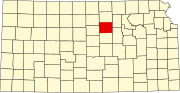 | |
| Unincorporated communities | ||
| Ghost towns |
| |
| Footnotes | †This community is designated a Census-Designated Place (CDP) by the United States Census Bureau. | |
| ||
Другой контент может иметь иную лицензию. Перед использованием материалов сайта WikiSort.org внимательно изучите правила лицензирования конкретных элементов наполнения сайта.
WikiSort.org - проект по пересортировке и дополнению контента Википедии