world.wikisort.org - USA
14th Street is a major crosstown street in the New York City borough of Manhattan, traveling between Eleventh Avenue on Manhattan's West Side and Avenue C on Manhattan's East Side. It forms a boundary between several neighborhoods and is sometimes considered the border between Lower Manhattan and Midtown Manhattan.
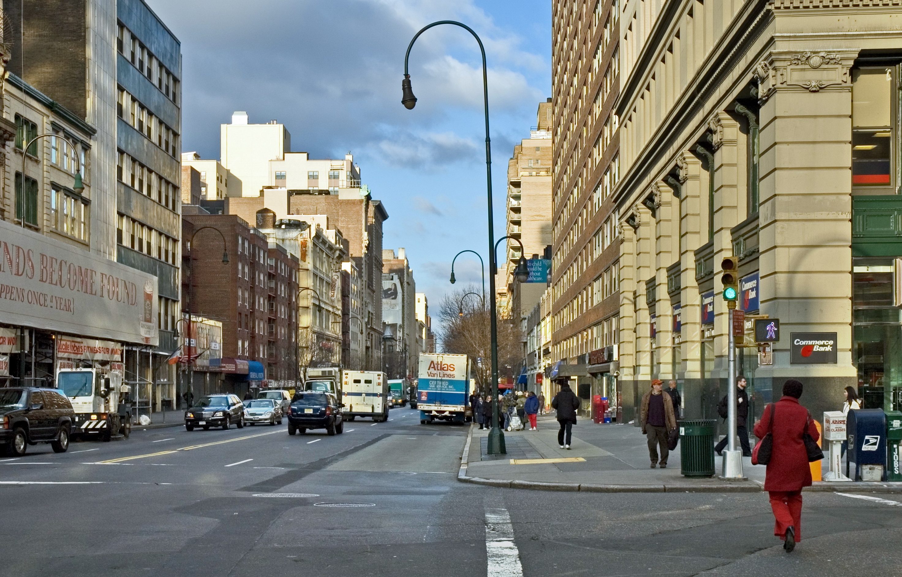 14th Street looking west from Fifth Avenue | |
 | |
| Maintained by | NYCDOT |
|---|---|
| Length | 2.0 mi[1] (3.2 km) |
| Location | Manhattan, New York City |
| Postal code | 10014, 10011, 10003, 10009 |
| Coordinates | 40.7357°N 73.9929°W |
| West end | |
| East end | Avenue C in East Village / Stuyvesant Town |
| North | 15th Street |
| South | 13th Street |
| Construction | |
| Commissioned | March 1811 |
At Broadway, 14th Street forms the southern boundary of Union Square. It is also considered the northern boundary of Greenwich Village, Alphabet City, and the East Village, and the southern boundary of Chelsea, Flatiron/Lower Midtown, and Gramercy. West of Third Avenue, 14th Street marks the southern terminus of western Manhattan's grid system. North of 14th Street, the streets make up a near-perfect grid that runs in numerical order. South of 14th, the grid continues in the East Village almost perfectly, but not so in Greenwich Village, where an older and less uniform grid plan applies.
In the early history of New York City, 14th Street was an upscale location. However, it lost its glamour and status as the city grew northward and today it is primarily zoned as a commercial street.[2] In October 2019, a busway restriction was put in place between Third and Ninth Avenues, prohibiting most types of vehicles during the daytime.
History
The street was designated by the Commissioners' Plan of 1811 as the southernmost of 15 east–west streets that would be 100 feet (30 m) in width (while other streets were designated as 60 feet (18 m) wide).[3]
Description
West 14th Street begins at an interchange with New York State Route 9A northeast of Greenwich Village.[4] At the end of the interchange, it intersects with 10th Avenue. The street continues east, intersecting with Washington Street, Ninth Avenue/Hudson Street, Eighth Avenue, Seventh Avenue, Sixth Avenue, and Fifth Avenue.[4] After Fifth Avenue, West 14th Street becomes East 14th Street and goes on to form the southern border of Union Square between University Place and Fourth Avenue. East of Fourth Avenue, 14th Street forms the southern end of Irving Place, a north–south road that terminates at Gramercy Park. 14th Street then intersects with Third Avenue, which forms the border between the neighborhoods of the East Village to the south and Gramercy to the north. The street goes on to intersect with Second Avenue.[4] At First Avenue, 14th Street widens from a four-lane road to a six-lane divided boulevard with a westbound service road. It then intersects with the main thoroughfares of Alphabet City: Avenue A, Avenue B, and Avenue C, where the street terminates. It formerly terminated at FDR Drive via an on-ramp to the southbound FDR before the September 11 attacks, when the New York Police Department vacated the portion between Avenue C and FDR due to the presence of the nearby ConEdison East River Generating Station along 14th and 15th Streets as a possible terrorist target.[4]
Since October 2019, vehicle restrictions are in place on 14th Street between Third and Ninth Avenues from 6 a.m. to 10 p.m.[5][6] The only vehicles that can use the busway are buses, trucks making deliveries on 14th Street, emergency and Access-A-Ride vehicles, and local traffic traveling for no more than one block.[7]: 63–64
Public transportation

14th Street is well served by the New York City Subway. The BMT Canarsie Line (L train) runs underneath 14th Street from Eighth Avenue to the East River, stopping at Eighth Avenue, Sixth Avenue, Union Square, Third Avenue, and First Avenue. Additionally, every subway route that crosses 14th Street has a stop there, except for the B and D trains:[8]
- 14th Street–Union Square on the BMT Canarsie Line, BMT Broadway Line, and IRT Lexington Avenue Line serving the 4, 5, 6, <6>, L, N, Q, R, and W trains
- 14th Street/Sixth Avenue on the IRT Broadway–Seventh Avenue Line, BMT Canarsie Line, and IND Sixth Avenue Line serving the 1, 2, 3, F and <F>, L, and M trains
- 14th Street–Eighth Avenue on the BMT Canarsie Line and IND Eighth Avenue Line serving the A, C, E, and L trains
A station at Second Avenue and 14th Street is planned as part of Phase 3 of the Second Avenue Subway, which is currently unfunded.[9]
PATH also makes a stop at 14th Street at its intersection with Sixth Avenue.[10]
In the past, every former IRT elevated line had a station at 14th Street:
- 14th Street on the IRT Second Avenue Line
- 14th Street on the IRT Third Avenue Line
- 14th Street on the IRT Sixth Avenue Line
- 14th Street on the IRT Ninth Avenue Line
Two New York City Bus routes serve the entire street, the M14A and M14D.[11]
Bus priority and truck access
Alongside the Canarsie Tunnel closure between 2019 and 2020, the New York City Department of Transportation began planning conversion of 14th Street between Third and Ninth Avenues into a bus-only corridor during rush hours. The department began planning a new Select Bus Service bus rapid transit route to be implemented across 14th Street.[12][13][14] At the time, the M14A/D routes were among the busiest and slowest NYCT bus routes.[15] The M14A/D were converted to Select Bus Service routes on July 1, 2019.[5][6]
The 14th Street busway was inspired by Toronto's successful King Street Pilot Project, which sped up transit times for transit riders on the 504 King streetcar route, the Toronto Transit Commission's busiest surface route.[16] As part of the busway plan, the only motor vehicles that could use the busway, between 5 a.m. to 10 p.m. daily, would be buses, trucks making deliveries on 14th Street, emergency and Access-A-Ride vehicles. Local traffic would be required to turn off 14th Street at the next intersection.[7]: 63–64 Arthur Schwartz, a lawyer who lives on nearby 12th Street, blocked the plan[17][15] by filing several injunctions to halt its implementation.[18][19][17] As a result, the busway was not implemented as scheduled in July 2019;[20][21] pushing its implementation back to August 2019.[16][18] The plan was blocked once again, pending an appeal.[19][17] The August ruling was later overturned by a panel of judges who approved the busway's implementation, which took effect on October 3, 2019.[22][23] The busway was so successful on its first day that M14 buses had to be slowed down in order to keep from running ahead of their posted schedules.[24]
Points of interest
This list is incomplete; you can help by adding missing items. (September 2014) |
From west to east, points of interest include:
- Little Island at Pier 55
- Hudson River Park
- High Line
- New York County National Bank (at Eighth Avenue), a New York City designated landmark[25]
- New York Savings Bank (at Eighth Avenue), a New York City designated landmark[26] and National Register of Historic Places (NRHP) landmark
- Norwood Club (241 West 14th Street), a New York City designated landmark[27]
- 154 West 14th Street, a New York City designated landmark[28]
- 144 West 14th Street, a New York City designated landmark[29]
- The Salvation Army Greater New York Divisional Headquarters (120 West 14th Street), a New York City designated landmark[30]
- Fourteenth Street Theatre (107 West 14th Street),[31] demolished in 1938.[32]
- R. H. Macy & Co. Store, 14th Street Annex (56 West 14th Street), a New York City designated landmark[33]
- Baumann Brothers Furniture and Carpets Store (22-26 East 14th Street), a New York City designated landmark[34]
- Lincoln Building (at Union Square West), a New York City designated landmark[35] and NRHP landmark
- Union Square Park
- Consolidated Edison Building (at Irving Place), a New York City designated landmark[36]
- First German Baptist Church (334 East 14th Street), a New York City designated landmark[37]
- Grace Chapel (406 East 14th Street), a New York City designated landmark[38] and NRHP landmark
- Immaculate Conception Roman Catholic Church/Grace Chapel Hospital (414 East 14th Street), a New York City designated landmark[39]
See also
References
Notes
- Google (August 31, 2015). "14th Street (Manhattan)" (Map). Google Maps. Google. Retrieved August 31, 2015.
- "NYC's Zoning & Land Use Map". ZoLa. Archived from the original on July 26, 2019. Retrieved June 11, 2019.
- Morris, Gouverneur, De Witt, Simeon, and Rutherford, John [sic] (March 1811) "Remarks Of The Commissioners For Laying Out Streets And Roads In The City Of New York, Under The Act Of April 3, 1807" Archived June 22, 2016, at the Wayback Machine, Cornell University Library. Accessed June 27, 2016. "These streets are all sixty feet wide except fifteen, which are one hundred feet wide, viz.: Numbers fourteen, twenty-three, thirty-four, forty-two, fifty-seven, seventy-two, seventy-nine, eighty-six, ninety-six, one hundred and six, one hundred and sixteen, one hundred and twenty-five, one hundred and thirty-five, one hundred and forty-five, and one hundred and fifty-five--the block or space between them being in general about two hundred feet."
- Google (July 20, 2007). "14th Street - New York City" (Map). Google Maps. Google. Retrieved July 20, 2007.
- "Commuter Alert: Most Of 14th Street Will Be Closed To Cars Most Of The Time Starting July 1". CBS New York. June 11, 2019. Archived from the original on June 11, 2019. Retrieved June 11, 2019.
- Spivack, Caroline (June 11, 2019). "Dedicated busway on 14th Street will roll out on July 1". Curbed NY. Archived from the original on June 11, 2019. Retrieved June 11, 2019.
- "MTA New York City Transit Canarsie Tunnel Project Supplemental Environmental Assessment and Section 4(f) Review: Appendices" (PDF). mta.info. New York City Transit Authority. July 2018. Archived (PDF) from the original on July 27, 2018. Retrieved July 27, 2018.
- "Subway Map" (PDF). Metropolitan Transportation Authority. September 2021. Retrieved September 17, 2021.
- Second Avenue Subway Map Archived July 17, 2016, at the Wayback Machine, MTA's website
- "14th Street Station - PATH". The Port Authority of NY & NJ. Archived from the original on August 6, 2018. Retrieved August 6, 2018.
- "Manhattan Bus Map" (PDF). Metropolitan Transportation Authority. July 2019. Retrieved December 1, 2020.
- "L train shutdown to close portion of 14th Street to cars during rush hour: MTA". New York's PIX11 / WPIX-TV. December 13, 2017. Archived from the original on December 15, 2017. Retrieved December 15, 2017.
- Walker, Ameena (December 13, 2017). "Long-awaited L train shutdown plan finally released". Curbed NY. Archived from the original on December 15, 2017. Retrieved December 15, 2017.
- Nir, Sarah Maslin (December 13, 2017). "Rerouting Thousands: City Plans for L Train Closure". The New York Times. ISSN 0362-4331. Archived from the original on December 16, 2017. Retrieved December 16, 2017.
- Kabak, Benjamin (August 20, 2019). "The 14th Street busway fight could determine NYC's transit future". Curbed NY. Archived from the original on August 20, 2019. Retrieved August 21, 2019.
- Hu, Winnie (August 8, 2019). "Major Traffic Experiment in N.Y.C.: Cars All but Banned on Major Street". The New York Times. ISSN 0362-4331. Archived from the original on August 8, 2019. Retrieved August 9, 2019.
- Spivack, Caroline (August 9, 2019). "Judge hits brakes on 14th Street busway—again". Curbed NY. Archived from the original on August 11, 2019. Retrieved August 12, 2019.
- "Court: 14th St. car ban can start". The Villager. August 7, 2019. Archived from the original on August 9, 2019. Retrieved August 9, 2019.
- Lee, Vivian (August 10, 2019). "Ban on Most Cars on 14th Street Delayed Amid Last-Minute Appeal". Spectrum News NY1 | New York City. Archived from the original on August 12, 2019. Retrieved August 12, 2019.
- "14th Street busway supporters slam lawsuit as classist". am New York. Archived from the original on July 3, 2019. Retrieved July 3, 2019.
- Spivack, Caroline (June 28, 2019). "14th Street busway blocked by judge". Curbed NY. Archived from the original on July 1, 2019. Retrieved July 3, 2019.
- "Busway plan banning most cars from 14th Street kicks off Thursday". Crain's New York Business. September 30, 2019. Retrieved October 1, 2019.
- Plitt, Amy (September 27, 2019). "14th Street busway gets the green light from judges". Curbed NY. Retrieved October 1, 2019.
- Berger, Paul (October 3, 2019). "Buses Cruise Through Manhattan Corridor as Traffic Change Takes Effect". Wall Street Journal. Retrieved October 5, 2019.
- "New York County National Bank" (PDF). New York City Landmarks Preservation Commission. June 7, 1988. Retrieved October 10, 2019.
- "New York Savings Bank" (PDF). New York City Landmarks Preservation Commission. June 8, 1988. Retrieved October 10, 2019.
- "Andrew Norwood House" (PDF). New York City Landmarks Preservation Commission. May 9, 1978. Retrieved October 10, 2019.
- "154 West 14th Street Building" (PDF). New York City Landmarks Preservation Commission. June 28, 2011. Retrieved October 10, 2019.
- "144 West 14th Street Building" (PDF). New York City Landmarks Preservation Commission. November 18, 2018. Retrieved October 10, 2019.
- "The Salvation Army National and Territorial Headquarters" (PDF). New York City Landmarks Preservation Commission. October 17, 2017. Retrieved October 10, 2019.
- Berg, J.C. (January 9, 2011). The Fourteenth Street Theater Archived May 26, 2018, at the Wayback Machine, nycvintageimages.com
- Cooper, Lee E. (March 1, 1938). "Old Fourteenth St. Theatre to Pass Into Hands of Wreckers on Monday". The New York Times. Archived from the original on May 26, 2018. Retrieved May 25, 2018.
- "R. H. Macy & Co. Store, 14th Street Annex" (PDF). New York City Landmarks Preservation Commission. December 20, 2011. Retrieved October 10, 2019.
- "Baumann Brothers Furniture and Carpets Store" (PDF). New York City Landmarks Preservation Commission. November 18, 2008. Retrieved October 10, 2019.
- "Lincoln Building" (PDF). New York City Landmarks Preservation Commission. July 12, 1988. Retrieved October 10, 2019.
- "Consolidated Edison Company Building" (PDF). New York City Landmarks Preservation Commission. February 10, 2009. Retrieved October 10, 2019.
- "First German Baptist Church" (PDF). New York City Landmarks Preservation Commission. October 28, 2014. Retrieved October 10, 2019.
- "Grace Chapel" (PDF). New York City Landmarks Preservation Commission. June 7, 1966. Retrieved October 10, 2019.
- "Grace Chapel Hospital" (PDF). New York City Landmarks Preservation Commission. June 7, 1966. Retrieved October 10, 2019.
External links
- New York Songlines: 14th Street, a virtual walking tour
| Authority control: National libraries |
|---|
На других языках
- [en] 14th Street (Manhattan)
[ru] 14-я улица (Манхэттен)
14-я улица (англ. 14th Street) — это улица в Нью-Йорке длиной 3500 метров. По 14-й улице проходит граница Нижнего Манхэттена и Мидтауна.Другой контент может иметь иную лицензию. Перед использованием материалов сайта WikiSort.org внимательно изучите правила лицензирования конкретных элементов наполнения сайта.
WikiSort.org - проект по пересортировке и дополнению контента Википедии