world.wikisort.org - Vereinigte_Staaten
West Columbia ist eine Stadt (City) im Lexington County im Bundesstaat South Carolina in den Vereinigten Staaten. Bei der letzten Volkszählung im Jahr 2010 lebten 14.988 Einwohner in der Stadt. West Columbia ist Teil der Metropolregion um Columbia.
| West Columbia | |||
|---|---|---|---|
 Downtown West Columbia | |||
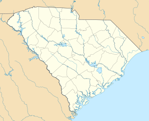
| Lage in South Carolina | |||
| |||
| Basisdaten | |||
| Gründung: | 1894 | ||
| Staat: | Vereinigte Staaten | ||
| Bundesstaat: | South Carolina | ||
| County: | Lexington County | ||
| Koordinaten: | 33° 59′ N, 81° 4′ W | ||
| Zeitzone: | Eastern (UTC−5/−4) | ||
| Einwohner: | 17.416 (Stand: 2020) | ||
| Haushalte: | 8.363 (Stand: 2020) | ||
| Fläche: | 23,73 km² (ca. 9 mi²) davon 23,28 km² (ca. 9 mi²) Land | ||
| Bevölkerungsdichte: | 748 Einwohner je km² | ||
| Höhe: | 87 m | ||
| Vorwahl: | +1 803, 839 | ||
| FIPS: | 45-75850 | ||
| GNIS-ID: | 1251380 | ||
| Website: | www.westcolumbiasc.gov | ||
Geografie
West Columbia grenzt im Osten an Columbia, die Hauptstadt des Bundesstaates, über den Congaree River. Es liegt in der Nähe von Columbias Stadtzentrum oder Downtown District sowie dem South Carolina State House und dem Congaree Vista, der lokal als "the Vista" bekannt ist. Die Stadt grenzt im Süden an ihren Schwestervorort Cayce. Ein kleiner Teil der Stadt grenzt im Osten an die Stadt Lexington.
Geschichte
West Columbia wurde 1894 als Brookland gegründet, aber der U.S. Postal Service nannte die Stadt New Brookland, da es eine andere Stadt namens Brookland gab. Im Jahr 1936 wurde der Name in West Columbia geändert, um die Nähe zu Columbia, der Hauptstadt, zu betonen.
Demografie
Nach einer Schätzung von 2019 leben in West Columbia 17.998 Menschen. Die Bevölkerung teilte sich im selben Jahr auf in 76,2 % Weiße, 18,4 % Afroamerikaner, 0,1 % amerikanische Ureinwohner, 1,7 % Asiaten, 0,3 % Ozeanier und 2,5 % mit zwei oder mehr Ethnizitäten. Hispanics oder Latinos aller Ethnien machten 9,0 % der Bevölkerung aus. Das mittlere Haushaltseinkommen lag bei 46.623 US-Dollar und die Armutsquote bei 15,6 %.[1]
| Jahr | Einwohner¹ |
|---|---|
| 1950 | 1.543 |
| 1960 | 6.410 |
| 1970 | 7.838 |
| 1980 | 10.409 |
| 1990 | 10.588 |
| 2000 | 13.064 |
| 2010 | 14.988 |
| 2020 | 17.416 |
¹ 1950 – 2020: Volkszählungsergebnisse
Sehenswürdigkeiten
Die Gervais Street Bridge, die Mount Hebron Temperance Hall, der New Brookland Historic District und der Saluda Factory Historic District sind im National Register of Historic Places aufgeführt.
Weblinks
- Offizielle Website von West Columbia (englisch)
Einzelnachweise
- U.S. Census Bureau QuickFacts: Easley city, South Carolina. Abgerufen am 27. Januar 2021 (englisch).
На других языках
- [de] West Columbia (South Carolina)
[en] West Columbia, South Carolina
West Columbia is a city and commuter town in the suburban eastern sections of Lexington County, South Carolina, United States. According to the 2010 census, the population was 14,988, and the 2019 population estimate was 17,998.[7] West Columbia is bordered to the east by Columbia, the state capital, across the Congaree River. It is near Columbia's city center or downtown district as well as the South Carolina State House and the Congaree Vista, known locally as "the Vista." The city is bordered to the south by its sister suburb, Cayce. A small portion of the city borders the town of Lexington to the east.[8][9] West Columbia is part of the greater Columbia, SC metropolitan statistical area.Другой контент может иметь иную лицензию. Перед использованием материалов сайта WikiSort.org внимательно изучите правила лицензирования конкретных элементов наполнения сайта.
WikiSort.org - проект по пересортировке и дополнению контента Википедии