world.wikisort.org - Vereinigte_Staaten
Safford ist eine US-amerikanische Stadt in Arizona im Graham County. Sie hat 9232 Einwohner (Stand 2004) auf einer Fläche von 20,6 km². Safford ist Verwaltungssitz (County Seat) des Countys. Die Stadt liegt an den U.S. Highways 70 und 191.
| Safford | |||
|---|---|---|---|
 Safford, Arizona | |||
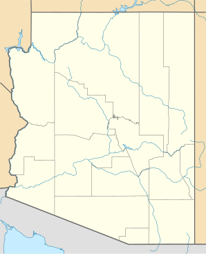
| Lage in Arizona | |||
| |||
| Basisdaten | |||
| Gründung: | 1874 | ||
| Staat: | Vereinigte Staaten | ||
| Bundesstaat: | Arizona | ||
| County: | Graham County | ||
| Koordinaten: | 32° 49′ N, 109° 43′ W | ||
| Zeitzone: | Mountain Standard Time (UTC−7) | ||
| Einwohner: | 10.129 (Stand: 2020) | ||
| Haushalte: | 3.311 (Stand: 2020) | ||
| Fläche: | 20,6 km² (ca. 8 mi²) davon 20,5 km² (ca. 8 mi²) Land | ||
| Bevölkerungsdichte: | 494 Einwohner je km² | ||
| Höhe: | 889 m | ||
| Postleitzahlen: | 85546, 85548 | ||
| Vorwahl: | +1 928 | ||
| FIPS: | 04-62000 | ||
| GNIS-ID: | 0010657 | ||
| Website: | www.cityofsafford.us | ||
| Bürgermeister: | Ronald M. Green | ||
Söhne und Töchter
- Elliot Johnson (* 1984), Profi-Baseballspieler
- Michael Ensign (* 1944), Schauspieler
Weblinks
Commons: Safford – Sammlung von Bildern, Videos und Audiodateien
- cityofsafford.us – offizielle Website (englisch)
Orte im Graham County im US-Bundesstaat Arizona
County Seat: Safford
| Cities | ||
| Towns | ||
| CDPs |
Bryce • Bylas • Cactus Flats • Central • Fort Thomas • Peridot‡ • San Jose • Solomon • Swift Trail Junction | |
| Unincorporated Communities |
Artesia • Ashurst • Bonita • Buena Vista • Calva • Cork • Eden • Emery • Fort Grant • Geronimo • Glenbar • Graham • Hollywood • Indian Hot Springs • Kimball • Klondyke • Lone Star • Natches • Old Columbine • Point of Pines • Sanchez • Tanque • Turkey Flat • Whitlock Cienega | |
| Indianerreservat |
San Carlos‡ | |
| Geisterstädte |
Aravaipa • Camp Goodwin • Spenazuma |

‡ mit einem Teil in angrenzenden Countys
Liste der Städte in Arizona
Liste der Städte in Arizona
На других языках
- [de] Safford (Arizona)
[en] Safford, Arizona
Safford (Western Apache: Ichʼįʼ Nahiłtį́į́)[2] is a city in Graham County, Arizona, United States. According to the 2020 Census, the population of the city is 10,129.[3] The city is the county seat of Graham County.[4]Текст в блоке "Читать" взят с сайта "Википедия" и доступен по лицензии Creative Commons Attribution-ShareAlike; в отдельных случаях могут действовать дополнительные условия.
Другой контент может иметь иную лицензию. Перед использованием материалов сайта WikiSort.org внимательно изучите правила лицензирования конкретных элементов наполнения сайта.
Другой контент может иметь иную лицензию. Перед использованием материалов сайта WikiSort.org внимательно изучите правила лицензирования конкретных элементов наполнения сайта.
2019-2026
WikiSort.org - проект по пересортировке и дополнению контента Википедии
WikiSort.org - проект по пересортировке и дополнению контента Википедии