world.wikisort.org - Vereinigte_Staaten
Rogers ist ein gemeindefreies Gebiet in Montgomery County im US-Bundesstaat Virginia[1], südlich des Verwaltungssitzes (County Seat) von Christiansburg. Es ist Teil der Blacksburg-Christiansburg-Radford Metropolitan Statistical Area, welche das gesamte Montgomery County und die Stadt Radford umfasst.
| Rogers | |||
|---|---|---|---|
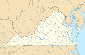
Lage in Virginia | |||
| Basisdaten | |||
| Staat: | Vereinigte Staaten | ||
| Bundesstaat: | Virginia | ||
| County: | Montgomery County | ||
| Koordinaten: | 37° 5′ N, 80° 24′ W | ||
| Zeitzone: | Eastern (UTC−5/−4) | ||
| Höhe: | 556 m | ||
| FIPS: | 51-68608 | ||
| GNIS-ID: | 1473503 | ||
Einzelnachweise
- Rogers (Englisch) In: Geographic Names Information System. United States Geological Survey. Abgerufen am 23. Juni 2017.
Orte im Montgomery County im US-Bundesstaat Virginia
County Seat: Christiansburg
| Towns: |
Blacksburg • Christiansburg |
|
| CDPs: |
Belview • Elliston • Lafayette • Merrimac • Plum Creek • Prices Fork • Riner • Shawsville | |
| Unincorporated Communities: |
Alleghany Springs • Basham • Belmont • Bennetts Mill • Brush Harbor • Cambria • Centerville • Childress • Ellett • Fagg • Graysontown • Ironto • McCoy • McDonalds Mill • Midway Heights • New Ellett • Piedmont • Pilot • Rogers • Sugar Grove • Vicker • Yellow Sulphur |

Liste der Orte in Virginia
На других языках
- [de] Rogers (Virginia)
[en] Rogers, Virginia
Rogers is an unincorporated community in Montgomery County, Virginia,[1] south of the county seat of Christiansburg. It is part of the Blacksburg–Christiansburg Metropolitan Statistical Area, which encompasses all of Montgomery County and the city of Radford.Текст в блоке "Читать" взят с сайта "Википедия" и доступен по лицензии Creative Commons Attribution-ShareAlike; в отдельных случаях могут действовать дополнительные условия.
Другой контент может иметь иную лицензию. Перед использованием материалов сайта WikiSort.org внимательно изучите правила лицензирования конкретных элементов наполнения сайта.
Другой контент может иметь иную лицензию. Перед использованием материалов сайта WikiSort.org внимательно изучите правила лицензирования конкретных элементов наполнения сайта.
2019-2025
WikiSort.org - проект по пересортировке и дополнению контента Википедии
WikiSort.org - проект по пересортировке и дополнению контента Википедии