world.wikisort.org - Vereinigte_Staaten
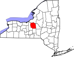
Das Onondaga County[1] ist ein County im Bundesstaat New York der Vereinigten Staaten. Bei der Volkszählung im Jahr 2020 hatte das County 476.516 Einwohner und eine Bevölkerungsdichte von 236 Einwohnern pro Quadratkilometer.[2] Der Verwaltungssitz (County Seat) ist Syracuse.
 Onondaga County Courthouse | |
| Verwaltung | |
|---|---|
| US-Bundesstaat: | New York |
| Verwaltungssitz: | Syracuse |
| Gründung: | 1792 |
| Gebildet aus: | Herkimer County |
| Vorwahl: | 001 315 |
| Demographie | |
| Einwohner: | 476.516 (Stand: 2020) |
| Bevölkerungsdichte: | 235,78 Einwohner/km2 |
| Geographie | |
| Fläche gesamt: | 2087 km² |
| Wasserfläche: | 66 km² |
| Karte | |
 | |
| Website: www.ongov.net | |
Geografie
Das County hat eine Fläche von 2087 Quadratkilometern, wovon 66 Quadratkilometer Wasserfläche sind. Es grenzt an den Oneida Lake und hat Anteil am Skaneateles Lake. Vollständig im Onondaga County liegen der Onondaga Lake sowie der Otisco Lake.
Umliegende Gebiete
| Oswego County | Oswego County | Oswego County |
| Cayuga County |  |
Madison County |
| Cayuga County | Cortland County | Madison |
Geschichte
Das County wurde 1792 gebildet und nach den Onondaga-Indianern benannt.
Ein Ort hat den Status einer National Historic Landmark, der New York State Barge Canal.[3] 145 Bauwerke und Stätten des Countys sind insgesamt im National Register of Historic Places eingetragen (Stand 19. Februar 2018).[4]
 Das Reuel E. Smith House ist eines von 145 Objekten im County, die im National Register of Historic Places eingetragen sind.
 Das Onondaga County Savings Bank Building, auch bekannt als „Gridley Building“ in Syracuse


Bevölkerungsentwicklung
| Jahr | 1800 | 1810 | 1820 | 1830 | 1840 | 1850 | 1860 | 1870 | 1880 | 1890 |
|---|---|---|---|---|---|---|---|---|---|---|
| Einwohner | 7406 | 25.987 | 41.467 | 58.973 | 67.911 | 85.890 | 90.686 | 104.183 | 117.893 | 146.247 |
| Jahr | 1900 | 1910 | 1920 | 1930 | 1940 | 1950 | 1960 | 1970 | 1980 | 1990 |
| Einwohner | 168.735 | 200.298 | 241.465 | 291.606 | 295.108 | 341.719 | 423.028 | 472.746 | 463.920 | 468.973 |
| Jahr | 2000 | 2010 | 2020 | 2030 | 2040 | 2050 | 2060 | 2070 | 2080 | 2090 |
| Einwohner | 458.336 | 467.026 | 476.516 |
Städte und Ortschaften
Zusätzlich zu den unten angeführten selbständigen Gemeinden gibt es im Onondaga County mehrere villages.
| Ortschaft | Status | Einwohner (2010)[6] | Gesamte Fläche [km²][7] | Landfläche [km²]![7] | Bevölkerungsdichte [Einwohner / km²] | Gründung[8] | Besonderheit |
|---|---|---|---|---|---|---|---|
| Camillus | town | 24.167 | 89,2 | 89,2 | 270,9 | 8. März 1799 | |
| Cicero | town | 31.632 | 125,5 | 125,0 | 253,1 | 18. Feb. 1807 | |
| Clay | town | 58.206 | 126,5 | 124,2 | 468,6 | 16. Apr. 1827 | |
| De Witt | town | 25.838 | 87,7 | 87,5 | 295,3 | 12. Apr. 1835 | |
| Elbridge | town | 5.922 | 99,2 | 97,2 | 60,7 | 26. März 1829 | |
| Fabius | town | 1.964 | 121,1 | 120,4 | 14,1 | 9. März 1798 | |
| Geddes | town | 17.118 | 31,8 | 23,7 | 722,3 | 18. März 1848 | |
| LaFayette | town | 4.952 | 102,7 | 101,6 | 48,7 | 15. Apr. 1825 | |
| Lysander | town | 21.759 | 167,3 | 159,8 | 136,2 | 5. März 1794 | |
| Manlius | town | 32.370 | 129,4 | 127,5 | 253,9 | 5. März 1794 | |
| Marcellus | town | 2.623 | 84,4 | 84,0 | 31,2 | 5. März 1794 | |
| Onondaga Nation Reservation | reservation | 468 | 24,1 | 23,9 | 19,6 | ||
| Onondaga | town | 23.101 | 149,8 | 149,5 | 154,5 | 9. März 1798 | |
| Otisco | town | 2.541 | 80,7 | 76,5 | 33,2 | 21. März 1806 | |
| Pompey | town | 7.080 | 172,2 | 171,9 | 41,2 | Jan. 1789 | |
| Salina | town | 33.710 | 39,0 | 35,6 | 946,9 | 27. März 1809 | |
| Skaneateles | town | 7.209 | 126,5 | 110,3 | 65,4 | 26. Feb. 1830 | |
| Spafford | town | 1.686 | 101,6 | 84,7 | 19,9 | 8. Apr. 1811 | |
| Syracuse | city | 145.170 | 66,3 | 64,9 | 2.236,8 | 13. Apr. 1825 | County Seat; city seit 14. Dezember 1847 |
| Tully | town | 2.738 | 68,1 | 66,7 | 41,0 | 4. Apr. 1803 | |
| Van Buren | town | 13.185 | 93,5 | 91,7 | 143,8 | 26. März 1829 |
Literatur
- W. Woodford Clayton: History of Onondaga County, New York. D. Mason & Co, Syracuse NY 1878 (430 S., archive.org).
Weblinks
- Website des Countys (englisch)
Einzelnachweise
- Onondaga County. In: Geographic Names Information System. United States Geological Survey (englisch).
- https://www.census.gov/quickfacts/fact/table/onondagacountynewyork/SBO030212
- New York. (PDF) Listing of National Historic Landmarks by State, National Park Service; abgerufen am 19. Februar 2018.
- Suchmaske Datenbank. National Register Information System, National Park Service; abgerufen 19. Februar 2018.
- Einwohnerzahl 1800–2010 laut Volkszählungsergebnissen
- Einwohnerdaten aus dem US-Census von 2010. In: American Factfinder
- Offizielle Daten. United States Board on Geographic Names
- Franklin Benjamin Hough: Gazetteer of the State of New York. Band 2. A. Boyd, Albany NY 1873, S. 480 ff.
Liste der Countys in New York
Albany |
Allegany |
Bronx |
Broome |
Cattaraugus |
Cayuga |
Chautauqua |
Chemung |
Chenango |
Clinton |
Columbia |
Cortland |
Delaware |
Dutchess |
Erie |
Essex |
Franklin |
Fulton |
Genesee |
Greene |
Hamilton |
Herkimer |
Jefferson |
Kings (Brooklyn) |
Lewis |
Livingston |
Madison |
Monroe |
Montgomery |
Nassau |
New York (Manhattan) |
Niagara |
Oneida |
Onondaga |
Ontario |
Orange |
Orleans |
Oswego |
Otsego |
Putnam |
Queens |
Rensselaer |
Richmond (Staten Island) |
Rockland |
Saratoga |
Schenectady |
Schoharie |
Schuyler |
Seneca |
St. Lawrence |
Steuben |
Suffolk |
Sullivan |
Tioga |
Tompkins |
Ulster |
Warren |
Washington |
Wayne |
Westchester |
Wyoming |
Yates
На других языках
- [de] Onondaga County
[en] Onondaga County, New York
Onondaga County (/ˌɒnənˈdɑːɡə/ ON-ən-DAH-gə) is a county in the U.S. state of New York. As of the 2020 census, the population was 476,516.[1] The county seat is Syracuse.[2][ru] Онондага (округ)
Округ Онондага (англ. Onondaga County) — округ штата Нью-Йорк, США. Население округа на 2000 год составляло 458 336 человек. Административный центр округа — город Сиракьюс.Другой контент может иметь иную лицензию. Перед использованием материалов сайта WikiSort.org внимательно изучите правила лицензирования конкретных элементов наполнения сайта.
WikiSort.org - проект по пересортировке и дополнению контента Википедии