world.wikisort.org - Vereinigte_Staaten
Lafayette ist eine Stadt im Contra Costa County im US-Bundesstaat Kalifornien, Vereinigte Staaten, mit 24.700 Einwohnern (Stand: 2004). Die geographischen Koordinaten sind: 37,89° Nord, 122,12° West. Das Stadtgebiet hat eine Größe von 39,9 km².
| Lafayette | |||
|---|---|---|---|
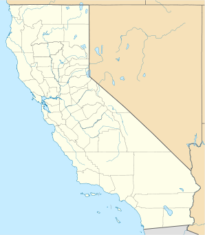
Lage in Kalifornien | |||
| Basisdaten | |||
| Gründung: | 1857 | ||
| Staat: | Vereinigte Staaten | ||
| Bundesstaat: | Kalifornien | ||
| County: | Contra Costa County | ||
| Koordinaten: | 37° 53′ N, 122° 7′ W | ||
| Zeitzone: | Pacific (UTC−8/−7) | ||
| Einwohner: | 25.391 (Stand: 2020) | ||
| Haushalte: | 9.470 (Stand: 2020) | ||
| Fläche: | 39,9 km² (ca. 15 mi²) davon 39,4 km² (ca. 15 mi²) Land | ||
| Bevölkerungsdichte: | 644 Einwohner je km² | ||
| Höhe: | 97,5 m | ||
| Postleitzahlen: | 94549, 94596 | ||
| Vorwahl: | +1 925 | ||
| FIPS: | 06-39122 | ||
| GNIS-ID: | 0277535 | ||
| Website: | www.lovelafayette.org | ||
| Bürgermeister: | Teresa Gerringer | ||
Söhne und Töchter der Stadt
- Charles Tickner (* 1953), Eiskunstläufer
Weblinks
| Cities |
Antioch • Brentwood • Clayton • Concord • El Cerrito • Hercules • Lafayette • Martinez • Oakley • Orinda • Pinole • Pittsburg • Pleasant Hill • Richmond • San Pablo • San Ramon • Walnut Creek |
|
| Towns |
Danville • Moraga | |
| CDPs |
Acalanes Ridge • Alamo • Alhambra Valley • Bay Point • Bayview • Bethel Island • Blackhawk • Byron • Camino Tassajara • Castle Hill • Clyde • Contra Costa Centre • Crockett • Diablo • Discovery Bay • East Richmond Heights • El Sobrante • Kensington • Knightsen • Montalvin Manor • Mountain View • Norris Canyon • North Gate • North Richmond • Pacheco • Port Costa • Reliez Valley • Rodeo • Rollingwood • Saranap • San Miguel • Shell Ridge • Tara Hills • Vine Hill | |
| Unincorporated Communities |
Canyon • Cornwall • Nichols • Oleum • Rheem • Selby • Stege • Tassajara • Tormey • Valona |

На других языках
- [de] Lafayette (Kalifornien)
[en] Lafayette, California
Lafayette (formerly La Fayette)[7] is a city in Contra Costa County, California, United States. As of 2020, the city's population was 25,391. It was named after the Marquis de Lafayette, a French military officer of the American Revolutionary War.Другой контент может иметь иную лицензию. Перед использованием материалов сайта WikiSort.org внимательно изучите правила лицензирования конкретных элементов наполнения сайта.
WikiSort.org - проект по пересортировке и дополнению контента Википедии