world.wikisort.org - Vereinigte_Staaten
Canton ist eine Stadt im Hartford County im US-Bundesstaat Connecticut, Vereinigte Staaten, mit 9932 Einwohnern (Stand: 2005). Das Stadtgebiet hat eine Größe von 64,9 km².
| Canton | |||
|---|---|---|---|
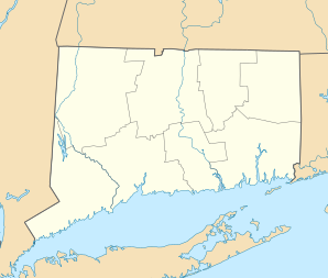
Lage in Connecticut | |||
| Basisdaten | |||
| Gründung: | 1806 | ||
| Staat: | Vereinigte Staaten | ||
| Bundesstaat: | Connecticut | ||
| County: | Hartford County | ||
| Koordinaten: | 41° 52′ N, 72° 55′ W | ||
| Zeitzone: | Eastern (UTC−5/−4) | ||
| Einwohner: | 10.124 (Stand: 2020) | ||
| Haushalte: | 4.238 (Stand: 2020) | ||
| Fläche: | 64,9 km² (ca. 25 mi²) davon 63,6 km² (ca. 25 mi²) Land | ||
| Bevölkerungsdichte: | 159 Einwohner je km² | ||
| Höhe: | 121 m | ||
| Postleitzahlen: | 06019, 06020, 06022, 06059 | ||
| Vorwahl: | +1 860 | ||
| FIPS: | 09-12270 | ||
| GNIS-ID: | 0213404 | ||
| Website: | www.townofcantonct.org | ||
Canton wurde 1737 das erste Mal als Siedlung erwähnt. 1806 wurde sie zur Stadt. Canton hat Anbindung an die US-Routes 44 und 202 und liegt etwa 22 km westlich von Hartford.
Schulen
- Cherry Brook Primary School
- Canton Intermediate School
- Canton Middle School
- Canton High School
Söhne und Töchter der Stadt
- Lucien Barbour (1811–1880), Jurist und Politiker
- Philemon Bliss (1813–1889), Jurist und Politiker
Weblinks
| Cities | ||
| Towns |
Avon • Berlin • Bloomfield • Burlington • Canton • East Granby • East Hartford • East Windsor • Enfield • Farmington • Glastonbury • Granby • Hartland • Manchester • Marlborough • Newington • Plainville • Rocky Hill • Simsbury • South Windsor • Southington • Suffield • West Hartford • Wethersfield • Windsor Locks • Windsor | |
| CDPs |
Blue Hills • Broad Brook • Canton Valley • Collinsville • Glastonbury Center • Hazardville • Kensington • Manchester • North Granby • Plantsville • Salmon Brook • Sherwood Manor • Simsbury Center • Southwood Acres • Suffield Depot • Tariffville • Terramuggus • Thompsonville • Weatogue • West Simsbury | |
| Unincorporated Communities |
Canton Center • East Windsor Hill • Hockanum • Marion • Mayberry Village • Milldale • Newington Junction • South Glastonbury • West Granby |

На других языках
- [de] Canton (Connecticut)
[en] Canton, Connecticut
Canton is a town, incorporated in 1806, located in the Farmington Valley section of Hartford County, Connecticut, United States. The population was 10,124 as of the 2020 census.[1] It is bordered by Granby on the north, Simsbury on the east, Avon and Burlington on the south, New Hartford on the west, and Barkhamsted on the northwest. Running through it is the Farmington River. The town includes the villages of North Canton, Canton Center, Canton (Canton Valley), and Collinsville. In September 2007, Collinsville was ranked in Budget Travel magazine as one of the "Ten Coolest Small Towns In America".[2]Другой контент может иметь иную лицензию. Перед использованием материалов сайта WikiSort.org внимательно изучите правила лицензирования конкретных элементов наполнения сайта.
WikiSort.org - проект по пересортировке и дополнению контента Википедии