world.wikisort.org - Uruguay
Las Piedras (which means "The Stones") is a suburb of Bella Unión in the Artigas Department of northern Uruguay.
Las Piedras | |
|---|---|
Suburb of Bella Unión | |
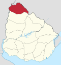
 Las Piedras Location in Uruguay | |
| Coordinates: 30°14′0″S 57°35′0″W | |
| Country | |
| Department | Artigas Department |
| Population (2011) | |
| • Total | 2,771 |
| Time zone | UTC -3 |
| Postal code | 55100 |
| Dial plan | +598 4779 (+4 digits) |
Location
The suburb is located on Route 3 and borders the urban area of the city to the south, suburb Franquia to the north and suburb Cuareim to the west.
Geography
Las Piedras, Franquia and Cuareim are located on a protruding part of land between Uruguay River and the mouth of Río Cuareim, where the international boundaries of Uruguay, Argentina and Brazil meet.
Population
In 2011 it had a population of 2,771.[1]
| Year | Population |
|---|---|
| 1963 | 216 |
| 1975 | 738 |
| 1985 | 1,253 |
| 1996 | 2,099 |
| 2004 | 2,164 |
| 2011 | 2,771 |
Source: Instituto Nacional de Estadística de Uruguay[2]
References
- "Censos 2011 Cuadros Artigas". INE. 2012. Archived from the original on 10 October 2012. Retrieved 25 August 2012.
- "1963–1996 Statistics / L". Instituto Nacional de Estadística de Uruguay. 2004. Archived from the original (DOC) on 29 November 2011. Retrieved 3 July 2011.
External links
Capital: Artigas | ||
| Municipalities |
|  |
| Towns and villages |
| |
| Sights | ||
This article about a place in Artigas Department is a stub. You can help Wikipedia by expanding it. |
На других языках
- [en] Las Piedras, Artigas
[ru] Лас-Пьедрас (Артигас)
Лас-Пьедрас (исп. Las Piedras) — населённый пункт на крайнем севере Уругвая, в департаменте Артигас.Текст в блоке "Читать" взят с сайта "Википедия" и доступен по лицензии Creative Commons Attribution-ShareAlike; в отдельных случаях могут действовать дополнительные условия.
Другой контент может иметь иную лицензию. Перед использованием материалов сайта WikiSort.org внимательно изучите правила лицензирования конкретных элементов наполнения сайта.
Другой контент может иметь иную лицензию. Перед использованием материалов сайта WikiSort.org внимательно изучите правила лицензирования конкретных элементов наполнения сайта.
2019-2025
WikiSort.org - проект по пересортировке и дополнению контента Википедии
WikiSort.org - проект по пересортировке и дополнению контента Википедии