world.wikisort.org - Uruguay
Bella Unión is a city in the north part of Artigas Department of Uruguay.
Bella Unión | |
|---|---|
City | |
 Bella Unión, Uruguay | |
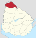
 Bella Unión Location in Uruguay | |
| Coordinates: 30°15′0″S 57°35′0″W | |
| Country | |
| Department | |
| Founded | 1829 |
| Founded by | Fructuoso Rivera |
| Population (2011 Census) | |
| • Total | 12,200 |
| Time zone | UTC -3 |
| Postal code | 55100 |
| Dial plan | +598 4779 (+4 digits) |
Location
It is located at the north end of Route 3, on the banks of the Uruguay River, near the mouth of Río Cuareim. Being situated on a piece of land protruding between Argentina and Brazil, it lies across Monte Caseros, Corrientes of Argentina to the west and across Barra do Quaraí of Brazil, which is only 6 kilometres (3.7 mi) to the northeast, joined by a bridge over Río Cuareim.
History
The original settlement was founded on 13 May 1829 under the name "Santa Rosa". It was started by Fructuoso Rivera, who played a prominent role in the early history of Uruguay. On 20 April 1928, it was renamed to "Bella Unión" by the Act of Ley No. 8.207.[1] On 15 October 1963, its status was raised to "Ciudad" (city) by the Act of Ley No. 13.180.[2]
Population
In 2011, Bella Unión had a population of 12,200.[3] Together with its peripheral populated and rural areas (Coronado, Portones de Hierro y Campodónico, Las Piedras, Franquia & Cuareim) they form a population centre of around 18,000.
| Year | Population |
|---|---|
| 1908 | 5,414 |
| 1963 | 4,955 |
| 1975 | 7,778 |
| 1985 | 12,238 |
| 1996 | 13,537 |
| 2004 | 13,187 |
| 2011 | 12,200 |
Source: Instituto Nacional de Estadística de Uruguay[dead link][1]
Places of worship
- St. Rose of Lima of the Cuareim Parish Church (Roman Catholic)
Notable local person
The writer Jesús Moraes, (1955-), who specializes in short stories in Spanish, is from Bella Unión, and is one of the relatively few contemporary Uruguayan writers strongly identified with the Uruguayan north.
See also
Climate data
| Climate data for Bella Unión (1980–2009) | |||||||||||||
|---|---|---|---|---|---|---|---|---|---|---|---|---|---|
| Month | Jan | Feb | Mar | Apr | May | Jun | Jul | Aug | Sep | Oct | Nov | Dec | Year |
| Average high °C (°F) | 32.0 (89.6) |
30.5 (86.9) |
29.0 (84.2) |
25.0 (77.0) |
21.5 (70.7) |
19.0 (66.2) |
18.6 (65.5) |
21.2 (70.2) |
22.7 (72.9) |
25.5 (77.9) |
27.9 (82.2) |
29.7 (85.5) |
25.2 (77.4) |
| Daily mean °C (°F) | 26.0 (78.8) |
24.9 (76.8) |
23.7 (74.7) |
20.0 (68.0) |
16.5 (61.7) |
14.4 (57.9) |
13.6 (56.5) |
15.4 (59.7) |
17.1 (62.8) |
20.1 (68.2) |
22.0 (71.6) |
24.2 (75.6) |
19.8 (67.6) |
| Average low °C (°F) | 20.1 (68.2) |
19.4 (66.9) |
18.3 (64.9) |
14.9 (58.8) |
11.6 (52.9) |
9.8 (49.6) |
8.7 (47.7) |
9.6 (49.3) |
11.4 (52.5) |
14.8 (58.6) |
16.2 (61.2) |
18.7 (65.7) |
14.5 (58.1) |
| Average precipitation mm (inches) | 141.4 (5.57) |
144.4 (5.69) |
145.9 (5.74) |
175.6 (6.91) |
109.1 (4.30) |
90.1 (3.55) |
55.3 (2.18) |
55.4 (2.18) |
96.9 (3.81) |
151.0 (5.94) |
150.9 (5.94) |
132.8 (5.23) |
1,448.8 (57.04) |
| Average relative humidity (%) | 65 | 69 | 72 | 76 | 77 | 79 | 76 | 71 | 69 | 68 | 66 | 64 | 71 |
| Mean monthly sunshine hours | 297.6 | 245.8 | 244.9 | 186.0 | 189.1 | 162.0 | 176.7 | 192.2 | 204.0 | 241.8 | 267.0 | 300.7 | 2,707.8 |
| Mean daily sunshine hours | 9.6 | 8.7 | 7.9 | 6.2 | 6.1 | 5.4 | 5.7 | 6.2 | 6.8 | 7.8 | 8.9 | 9.7 | 7.4 |
| Source: Instituto Nacional de Investigación Agropecuaria[4] | |||||||||||||
References
- "Statistics of urban localities (1908–2004) (see also Santa Rosa)". INE. 2012. Archived from the original (PDF) on 23 March 2015. Retrieved 3 September 2012.
- "LEY N° 13.180". República Oriental del Uruguay, Poder Legislativo. 1963. Archived from the original on 6 March 2016. Retrieved 28 June 2011.
- "Censos 2011 Cuadros Artigas". INE. 2012. Archived from the original on 10 October 2012. Retrieved 25 August 2012.
- Castaño, José; Giménez, Agustín; Ceroni, Mauricio; Furest, José; Aunchayna, Rossina. "Caracterización Agroclimática del Uruguay 1980–2009" (PDF) (in Spanish). Instituto Nacional de Investigación Agropecuaria. Retrieved December 13, 2015.
External links
- es:Fructuoso Rivera
- INE map of Bella Unión, Coronado, Las Piedras and Portones de Hierro y Campodónico
- The Community Website
Capital: Artigas | ||
| Municipalities |
|  |
| Towns and villages |
| |
| Sights | ||
Authority control | |
|---|---|
| General | |
| National libraries | |
This article about a place in Artigas Department is a stub. You can help Wikipedia by expanding it. |
На других языках
- [en] Bella Unión
[es] Bella Unión
Bella Unión es una ciudad Uruguaya ubicada en el departamento de Artigas, recibe ese nombre dado que se encuentra en la unión del río Cuareím con el río Uruguay, en la frontera de Uruguay con Brasil y Argentina, formando un trifinio o triple frontera.[ru] Белья-Уньон
Белья-Уньон (исп. Bella Unión) — город на крайнем севере Уругвая, в департаменте Артигас. Административный центр одноимённого муниципалитета.Другой контент может иметь иную лицензию. Перед использованием материалов сайта WikiSort.org внимательно изучите правила лицензирования конкретных элементов наполнения сайта.
WikiSort.org - проект по пересортировке и дополнению контента Википедии