world.wikisort.org - Regno_Unito
Aldington è un villaggio e parrocchia civile nel distretto di Ashford, nel Kent, Inghilterra.
| Adlington Parrocchia civile | |
|---|---|
 | |
| Localizzazione | |
| Stato | |
| Regione | Sud Est |
| Contea | |
| Distretto | Ashford |
| Territorio | |
| Coordinate | 51°05′37″N 0°56′28″E |
| Superficie | 137 km² |
| Abitanti | 981 |
| Densità | 7,16 ab./km² |
| Altre informazioni | |
| Cod. postale | TN25 |
| Prefisso | 01233 |
| Fuso orario | UTC+0 |
| Cartografia | |
 Adlington | |
Il centro del villaggio dista 12 km, a sud-est, dalla città di Ashford. Sito su una collina, esso offre una vista mozzafiato sugli acquitrini verso Lympne e Dungeness.
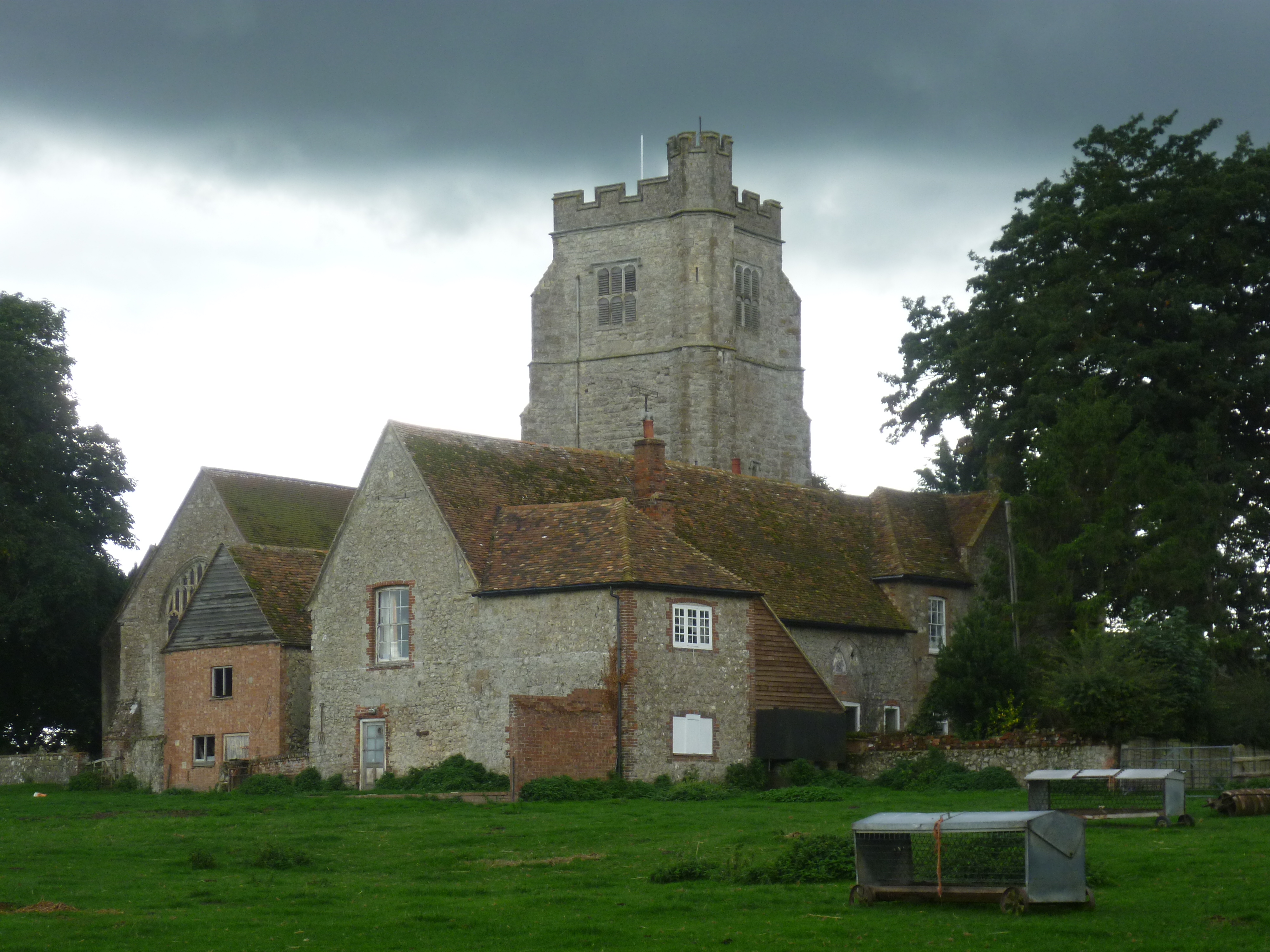
La chiesa parrocchiale di San Martino risale al XII secolo e la sua torre campanaria, del XVI secolo, costituisce un punto di riferimento per la navigazione.
Altri progetti
 Wikimedia Commons contiene immagini o altri file su Aldington
Collegamenti esterni
- (EN) KentGuide's comprehensive page about Aldington, su kentguide.net. URL consultato il 18 gennaio 2014 (archiviato dall'url originale il 6 luglio 2010).
- (EN) Notes on the parish, su saxonshore-kent.gov.uk. URL consultato il 18 gennaio 2014 (archiviato dall'url originale il 2 gennaio 2006).
- (EN) VillageNet, su villagenet.co.uk. URL consultato il 18 gennaio 2014 (archiviato dall'url originale il 2 febbraio 2006).
На других языках
[en] Aldington, Kent
Aldington is a village and civil parish in the Ashford District of Kent, England. The village centre is eight miles (12 km) south-east of the town of Ashford. As with the village centre, set on a steep escarpment above agricultural Romney Marsh and the upper Stour is Aldington Knoll, which was used as a Roman burial barrow and later beacon, it has a panorama towards the English Channel and of low land such as Dungeness. At the 2011 Census the population included Bonnington.- [it] Aldington (Kent)
Текст в блоке "Читать" взят с сайта "Википедия" и доступен по лицензии Creative Commons Attribution-ShareAlike; в отдельных случаях могут действовать дополнительные условия.
Другой контент может иметь иную лицензию. Перед использованием материалов сайта WikiSort.org внимательно изучите правила лицензирования конкретных элементов наполнения сайта.
Другой контент может иметь иную лицензию. Перед использованием материалов сайта WikiSort.org внимательно изучите правила лицензирования конкретных элементов наполнения сайта.
2019-2025
WikiSort.org - проект по пересортировке и дополнению контента Википедии
WikiSort.org - проект по пересортировке и дополнению контента Википедии