world.wikisort.org - Royaume-Uni
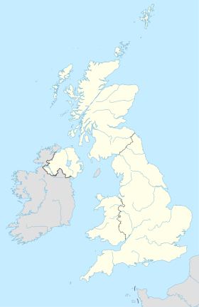
Gerrards Cross est un village du Buckinghamshire, Angleterre. La ville est située dans la ceinture urbaine de Londres à la frontière du Hertfordshire.
| Gerrards Cross | |
| Administration | |
|---|---|
| Pays | |
| Nation | |
| Comté | Buckinghamshire |
| Statut | Village |
| Démographie | |
| Population | 8 000 hab. () |
| Géographie | |
| Coordonnées | 51° 35′ 18″ nord, 0° 33′ 11″ ouest |
| Localisation | |
| modifier |
|
Histoire
L'histoire du village est récente. En effet, Gerrards Cross n'existait pas avant 1859. C'est la réunion de cinq territoires de la paroisse de Chalfont St Peter, Fulmer, Iver, Langley Marish et Upton. Le village tire son nom de la famille Gerrard qui y possédait un manoir au début du XVIIe siècle.
Personnalités liées à la ville
- Paul Beeson (1921-2001), directeur de la photographie, y est mort ;
- Adrian Brunel (1892-1958), réalisateur, scénariste, acteur, monteur et producteur, y est mort ;
- Bruce Frederic Cummings (1889-1919), entomologiste et diariste, y est mort ;
- Finlay Currie (1878-1968), acteur, y est mort ;
- C.V. France (1868-1949), acteur, y est mort ;
- Daniel Jones (1881-1967), phonéticien, y est mort ;
- Constance Maynard (1849-1935), pionnière de l'éducation des femmes, et la première étudiante en philosophie de l'université de Cambridge, y est morte ;
- Kenneth More (1914-1982), acteur, y est né ;
- Alfred Roome (1908-1997), monteur britannique, y est mort ;
- Edmund Rubbra (1901-1986), compositeur anglais, y est mort ;
- Harold Warrender (1903-1953), acteur, y est mort.
Voir aussi
Articles connexes
- Aérodrome de Denham
- Opération Tonnerre
Liens externes
- Portail de l’Angleterre
На других языках
[en] Gerrards Cross
Gerrards Cross is a town and civil parish in south Buckinghamshire, England, separated from the London Borough of Hillingdon at Harefield by Denham, south of Chalfont St Peter and north bordering villages of Fulmer, Hedgerley, Iver Heath and Stoke Poges. It spans foothills of the Chiltern Hills and land on the right bank of the River Misbourne. It is 19.3 miles (31.1 km) west-north-west of Charing Cross, central London. Bulstrode Park Camp was an Iron Age fortified encampment.- [fr] Gerrards Cross
Текст в блоке "Читать" взят с сайта "Википедия" и доступен по лицензии Creative Commons Attribution-ShareAlike; в отдельных случаях могут действовать дополнительные условия.
Другой контент может иметь иную лицензию. Перед использованием материалов сайта WikiSort.org внимательно изучите правила лицензирования конкретных элементов наполнения сайта.
Другой контент может иметь иную лицензию. Перед использованием материалов сайта WikiSort.org внимательно изучите правила лицензирования конкретных элементов наполнения сайта.
2019-2025
WikiSort.org - проект по пересортировке и дополнению контента Википедии
WikiSort.org - проект по пересортировке и дополнению контента Википедии

