world.wikisort.org - United_Kingdom
Woodlands is a small area located in the borough of Hounslow, London between Hounslow and Isleworth. It is an area roughly bounded by the Hounslow Loop railway line and the London Road to the north; the Duke of Northumberland's River and Twickenham Road to the east; and Bridge Road / Worton Road to the south and south-west. It includes roads such as Woodlands Road, Woodland Gardens, Woodlands Grove as well as The Woodlands Tavern public house and St John the Baptist's Church on St John's Road.[1]
This article needs additional citations for verification. (December 2014) |
| Woodlands | |
|---|---|
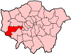
 Woodlands Location within Greater London | |
| Population | 11,408 (Hounslow South ward 2011) |
| London borough |
|
| Ceremonial county | Greater London |
| Region |
|
| Country | England |
| Sovereign state | United Kingdom |
| Post town | ISLEWORTH |
| Postcode district | TW7 |
| Dialling code | 020 |
| Police | Metropolitan |
| Fire | London |
| Ambulance | London |
| UK Parliament |
|
| London Assembly |
|
The estate comprises mostly semi-detached houses built in the 1930s, although there are older buildings too. Before these houses were built the area was used as orchards, hence the name 'Woodlands'.
There is an organisation known as the WERFA (Woodlands Estate Resident Freeholders Association) which has a community hall in the small private park in the centre of Woodland Gardens.
References
- Willey, Russ. Chambers London Gazetter, p 565.
London Borough of Hounslow | ||
|---|---|---|
| Districts |
|  |
| Attractions |
| |
| Parks and open spaces |
| |
| Constituencies |
| |
| Bridges |
| |
| Tube and rail stations |
| |
| Places of worship |
| |
| Other topics |
| |
| ||
This London-related article is a stub. You can help Wikipedia by expanding it. |
This London location article is a stub. You can help Wikipedia by expanding it. |
Другой контент может иметь иную лицензию. Перед использованием материалов сайта WikiSort.org внимательно изучите правила лицензирования конкретных элементов наполнения сайта.
WikiSort.org - проект по пересортировке и дополнению контента Википедии