world.wikisort.org - United_Kingdom
Mill Hill is a suburb in the London Borough of Barnet, England. It is situated around 10 miles (16 km) northwest of Charing Cross. Mill Hill was in the historic county of Middlesex until 1965, when it became part of Greater London. Its population counted 18,451 inhabitants as of 2011.[2]
| Mill Hill | |
|---|---|
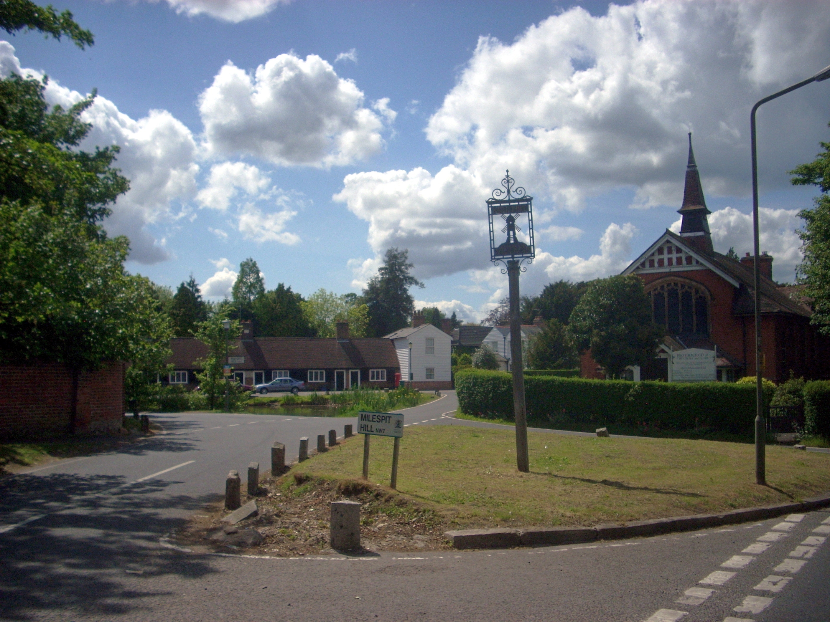 A sign marking Mill Hill Village | |
 Mill Hill Location within Greater London | |
| Population | 18,451 (2011 Census, ward)[1] |
| OS grid reference | TQ225925 |
| • Charing Cross | 9 mi (14.5 km) SSE |
| London borough | |
| Ceremonial county | Greater London |
| Region | |
| Country | England |
| Sovereign state | United Kingdom |
| Post town | LONDON |
| Postcode district | NW7 |
| Dialling code | 020 |
| Police | Metropolitan |
| Fire | London |
| Ambulance | London |
| UK Parliament |
|
| London Assembly |
|
Mill Hill consists of several distinct parts: the original Mill Hill Village; the later-developed Mill Hill Broadway (now the main hub of the area); and Mill Hill East - alongside large swathes of countryside.[3] A further area at the western edge of the suburb, The Hale, is on the borders of Mill Hill and Edgware, and is partly in each.
History

The area's name was first recorded as Myllehill in 1547 and appears to mean "hill with a windmill".[4] However, the workings of the original Mill are in the building adjacent to The Mill Field.

Mill Hill Village is the oldest known inhabited part of the district, a ribbon development along a medieval route called 'The Ridgeway'. It is thought that the name 'Mill Hill' may be derived from a mill on The Ridgeway, built on an area of open ground (now a park) known as The Mill Field. The village is bounded on the north and the south by Green Belt land, and its High Street, at 100 yards, is the shortest in London.
The area's proximity to the city made it popular as a country retreat from the 17th century onwards, and large houses and quaint cottages survive. William Wilberforce (MP, and abolitionist of the slave trade) and Sir Stamford Raffles (founder of colonial Singapore) both briefly resided here, the former being the patron of Mill Hill's first church, Saint Paul's. As late as 1960, five shops existed in the Village (Griffin's sub-Post Office, The Blenheim Steps, Cook & Son (sweets and groceries), Hawes Brothers (grocers) and Vincett's (butchers)) but although the buildings survive, they have all since been converted into private houses, as the retail focus in the area shifted to Mill Hill Broadway. As of February 2011, the only places in Mill Hill Village where money can be spent are The Three Hammers and Adam & Eve pubs and Belmont Farm (which includes the Waffle Café).
Military
Inglis Barracks at Mill Hill East was home to the Middlesex Regiment between 1905 and 1966. The 1941 reopening of the railway station, under wartime conditions, was to allow easy access to the barracks.
Situated along Partingdale Lane is Seafield House. Now converted into a private home, it was originally designed and operated as a secret nuclear bunker to house and protect the 'London North Group' emergency regional government between about 1951 and 1985.
Governance
Mill Hill was part of the ancient civil parish of Hendon within the historic county boundaries of Middlesex. Mill Hill as part of Municipal Borough of Hendon was merged into the London Borough of Barnet in Greater London in 1965.[5] Mill Hill is one of 21 electoral wards in the borough. This ward has 3 out of the 63 seats on the Barnet Council.[6]
Mill Hill was in the parliamentary constituency of Hendon which was created in 1918. This lasted until 1945 when the constituency was split in two, Mill Hill in Hendon North. In 1997, the Hendon constituency was recreated. From then, until he lost his seat to the Conservative candidate, Matthew Offord, at the 2010 general election, Hendon was represented in the House of Commons by Andrew Dismore of the Labour Party.[7]
Geography
Mill Hill's postal address is London NW7 (which also covers Highwood Hill and part of Arkley).
Mill Hill Village

The village is a ribbon development along The Ridgeway. It has green belt either side.
"Partingdale" and "Burtonhole" form a distinct valley north of The Ridgeway. North is Folly Farm and Folly Brook, a tributary of the Dollis Brook, running west to east. Between The Ridgeway and Folly Brook are Burtonhole Farm, a garden centre called Finchley Nurseries, and several sports grounds.
The National Institute for Medical Research, a landmark building, was demolished in 2018 and the site is being developed for new houses and apartments. On 1 April 2015, the NIMR became part of the new Francis Crick Institute[8] and ceased to exist as a separate MRC institute. The site was fully vacated and closed for redevelopment during 2017.
Arrandene Open Space and Featherstone Hill is a large open space which is bordered by Wise Lane, Wills Grove, Milespit Hill and The Ridgeway. While there are many open spaces in the area, Arrandene is unique because of its many open fields, meadows and woodland. The open fields were originally hay meadows which provided feed for the horses pulling carriages north to Barnet and beyond.
On Milespit Hill, is the non-denominational Mill Hill Cemetery, formerly known as the "Paddington District Cemetery". The 1960s pop singer Billy Fury (Ronald Wycherley, 1940–83) is buried there. The cemetery also contains 53 Second World War Commonwealth war graves and a Dutch "Field of Honour", containing the graves of more than 250 servicemen of the Netherlands, many of which have been brought to the cemetery from other United Kingdom burial grounds.
To the southwest of Mill Hill Village is a small suburban district called "Poets' Corner", and to the north an old estate, now a nature reserve, Moat Mount Open Space.

Mill Hill Broadway
The modern-day centre of Mill Hill is at Mill Hill Broadway (previously known as Lawrence Street). This is a suburban district which developed from the 1890s onwards, and especially in the early part of the 20th century, after the arrival of the Midland Railway station in 1868. The Broadway itself is now an important local retail area with numerous shops and cafes and transport links.
Mill Hill East

Parts of the eastern side of Mill Hill have recently undergone redevelopment, with the old gas works replaced by a Waitrose supermarket and housing developments. The small local retail area at Mill Hill East is at "Kelly's Corner" (officially Holders Hill Circus) east of the station. To the south of Mill Hill East are Copthall and Holders Hill.
The United Kingdom / Carl Zeiss / Bausch & Lomb Optical Works was established at the top of Bittacy Hill in 1912 and demolished about 1990, to be replaced by a large building owned by the Jehovah's Witnesses, to complement their nearby Watchtower House built on the site of the former Bittacy House.
Neighbouring areas
Neighbouring areas | ||||||||||||||||
|---|---|---|---|---|---|---|---|---|---|---|---|---|---|---|---|---|
| ||||||||||||||||
Demography
Mill Hill electoral ward of Barnet has a population of 18,451 as of the 2011 UK Census. The census also showed that ethnically, 64% of the population is White (49% White British, 13% Other White, 2% Irish). The largest minorities were the 7% identifying themselves as Indian, 6% as Other Asian, and 6% as Black African. On religion, 39% identified as Christian, 19% Jewish, 14% no religion, 12% Muslim, 5% Hindu, 2% other religion and 8% religion not stated. The most spoken foreign language was Persian/Farsi. The majority of the 6,875 households are tenure owned. The vast majority (4,602) of the properties are in the "whole house or bungalow" category, of which most are semi-detached. 4.1% of economically active people were unemployed. The median age was 35.[9]
Transport

Tube/Rail
Stations in the area are:
- Mill Hill Broadway Station (Thameslink (route))
- Mill Hill East station (Northern line)
The area was also served by another smaller station, Mill Hill (The Hale), opened by the Edgware, Highgate and London Railway in 1867, but passenger services ended in 1939, and freight traffic in 1964. [citation needed]
The branch was opened in 1867 as part of the Edgware, Highgate and London Railway, which also built the attractive Dollis Brook Viaduct to the east of the station. It originally continued west to Edgware and east to the Great Northern main line at Finsbury Park station, following the present Northern line route as far as Highgate. [citation needed]
In 1935, as part of the London Transport New Works Programme, plans were announced to modernise and electrify the railway and transfer it to the London Underground. Work was started, and steam passenger services between Edgware and Finchley Central were withdrawn in September 1939 to facilitate it. However, World War II soon caused the project to be cut short. The Finchley Central – Mill Hill East section had wartime priority (due to the Inglis Barracks) and was completed in 1941, but the plans to complete the modernisation and restart passenger services to Edgware were never resumed and were abandoned in 1950. [citation needed]
Steam freight trains continued to run between Finchley and Edgware until 1964; the track beyond Mill Hill East was lifted the following year. Although partly built over, including by the M1 motorway, most of the old track bed has become a footpath, and decaying 1930s concrete infrastructure, never used, can still be seen. [citation needed]
Buses
London Buses routes serving Mill Hill are 113, 114, 186, 221, 240, 251, 292, 302, 303, 305, 382, 605, 614, 628, 644, 688 and N113.
Road

The A1 and A41 converge as they enter Mill Hill at Fiveways Corner, this section is known as the Watford Way. The dual carriageway passes through Mill Hill, and the routes diverge at Apex Corner (officially Northway Circus). The M1 motorway was built through the western part of Mill Hill in 1967. There is a disused southbound exit slip road which passes under the Watford Way and which covers part of the old railway between Mill Hill East and Edgware Town.
Development
Mill Hill East has been designated by the Mayor of London in his London Plan as a 'proposed area of intensification', in and around the Inglis Barracks site. As a result, Barnet Council designated the 'Mill Hill East Area Action Plan' (AAP) and carried out public consultation events. An at-times noisy 'examination in public',[10] to test the 'soundness' of the council's submitted AAP proposals, was held in October 2008, conducted by the Planning Inspectorate, and the subsequent report broadly agreed with the council's plans.
Representations were made to the Planning Inspectorate to reopen the railway line from Mill Hill East station to the west.[11]
A small victory for local protesters was that the report reaffirmed that a local closed road, Sanders Lane, would not be reopened for traffic, if only because the road was outside the AAP boundary (this had already conceded by the council) and would need separate consideration. The inspector stated in his report of December 2008:[12]
Sanders Lane is outside the AAP boundary. Many of the matters that concern local residents and expressed at the Hearings can be addressed at a later stage.
The amended AAP was formally adopted by the council on 27 January 2009.[13]
Education

Primary schools
- Courtland, a mixed community school[14]
- Deansbrook Infant, mixed community school[14]
- Deansbrook Junior, mixed community school[14]
- Dollis Infant, a mixed community school[14]
- Dollis Junior, a mixed foundation school (now merged with Dollis Infant to form Dollis Primary)[14]
- Fairway, a mixed community school[14]
- Grimsdell, an independent co-educational pre-preparatory school run by Mill Hill School Foundation[15]
- Mathilda Marks Kennedy, a mixed Jewish voluntary aided school[14]
- St. Martin's, an independent co-educational preparatory school[16]
- St. Paul's CE a mixed, voluntary aided school[14]
- St. Vincent's Catholic Primary School[17]
- Etz Chaim Primary School, Free school
- Millbrook Park Primary School
Secondary schools
- Copthall School, a community girls school[18]
- Mill Hill County High School, a mixed foundation school[18]
Independent schools
The Mill Hill School Foundation runs the following schools:[19][20]
- Mill Hill School – an independent boarding and day school for pupils aged 13–18
- Grimsdell – a pre-preparatory day school for pupils aged 3–7
- Belmont School – a day school for pupils aged 7–13
- The Mount School/ Mill Hill International – a mixed day and boarding school for international pupils aged 11–16
- Cobham Hall School – an independent day and boarding school for girls in the English parish of Cobham, Kent[21]
Invention and discovery


In 1749 the botanist Peter Collinson inherited an estate which is now part of Mill Hill School, here he created a botanical garden.[22] The lexicographer James Murray started work on the first Oxford English Dictionary in 1879, whilst teaching at Mill Hill School. He had a building built in the school grounds to house the quotation slips and his small editorial staff. Murray called this building his scriptorium, when the project moved to Oxford the building was used by the school as a reading room.[23]
During the Second World War the Maudsley Hospital moved to the evacuated Mill Hill School as the Mill Hill Emergency Hospital. Here John C. Raven developed a verbal intelligence test called the Mill Hill Vocabulary scale.[24]
University of London Observatory is a teaching astronomical observatory which is part of the Department of Physics and Astronomy at University College London. It is situated on the A41 Watford Way, southeast of The Broadway. The Observatory was opened on 8 October 1929 by the Astronomer Royal Frank Watson Dyson. In 2009, student astronomers at the observatory tracked the extrasolar planet HD 80606 b and for the first time accurately calculated its size.[25]
The National Institute for Medical Research was a large medical research facility situated on the Ridgeway. Researchers at the Institute have, amongst other achievements, developed liquid and gas chromatography, discovered interferon and also discovered the sex determining gene SRY.[26] In 2018 the Medical Research building was demolished to make way for new homes.[27]
Religious sites
There are several religious institutions along the Ridgeway, including:
- The Missionary Institute (which was present on the Ridgeway until 2007)
- Holcombe House (part of the institute)
- the motherhouse of the British Province of the Daughters of Charity of Saint Vincent de Paul
- until 2007, Saint Joseph's College, a large seminary.
- The Jehovah's Witnesses have had a centre since 1958, and they redeveloped the Carl Zeiss optical works to become the International Bible Students' Association in 1988.
- The Brotherhood of the Cross and Star, an African church next to the Village Pond at the junction of Milespit Hill, High Street and The Ridgeway, occupying the former Methodist Church.
- Mill Hill Synagogue is located near Mill Hill Broadway station. The Synagogue joined the United Synagogue as an affiliated synagogue in 1950.
- John Keble Church, Mill Hill
Public services
Veolia Water Central Limited formerly Three Valleys Water supplies Mill Hill's water.[28] EDF Energy Networks is the Distribution network operator licensed to distribute electricity from the transmission grid to homes and businesses in Mill Hill. On Partingdale Lane there is a large electrical station, built in 1961. The station is served by very high-voltage cables underground along Totteridge Valley. The proposed above-ground pylons and cables were rejected after a high-profile residents' campaign.
British Gas had a large gasworks at Mill Hill East with two gasometers, now replaced with housing and shops including a Waitrose supermarket.
Parks and recreation


In 1923 Hendon Urban District Council brought part of Daws Farm thought to be named after Thomas Daws and turned it into Mill Hill Park. This was then transferred to Barnet Council in 1965 which now manages the park. In the park there are football pitches, cricket pitch, tennis courts, basketball court, a children's play area, outdoor gym, cafe and toilet block. The same building also houses Mill Hill Bowls Club with two pitches.[29]
Arrandene Open Space is a green space that sits next to Mill Hill Park separated by Wise Lane.[30]
Notable people
The racing driver Graham Hill lived at Mill Hill for much of his adult life, along with his son Damon Hill. Their house in Parkside has a blue plaque. The botanist Peter Collinson and the English traveller Celia Fiennes both lived here. The playwright and novelist Michael Frayn was born in Mill Hill. Actor Patrick McGoohan lived on The Ridgeway with his wife and three daughters. Fellow actor Patrick Troughton, best known as the second Doctor from Doctor Who, was born in Mill Hill and lived in Shakespeare Road.[31] Other actors John Slater, Ian Carmichael (Nan Clark's Lane) and Graham Crowden (Hammers Lane) also lived locally. The founder of Singapore Sir Stamford Raffles, the abolitionist William Wilberforce, and the parliamentarian John Wilkes all lived locally. Pop singer Paul Young has lived at Hyver Hall, and songwriter Mitch Murray lived in Sunnyfield for many years. Pop singer Rachel Stevens from S Club 7 currently lives in Mill Hill. In addition, pop group Girls Aloud also resided at nearby Princess Park Manor.[32] Actress Angela Lansbury lived with her parents at 7 Weymouth Avenue for the first half of the 1930s. Bandleader Edmundo Ros lived for many years in Page Street at Edritt House, named after himself and his wife. Athlete Julian Goater grew up in Grants Close.
Sport
Old Cholmeleians Sports Ground is on Hendon Wood Lane, and provides facilities for football and cricket. It is the home base for Old Cholmeleians Cricket Club.[33]
The local rugby club is Mill Hill Rugby Football Club established in 1937 with 2 men's teams. The 1st XV currently compete in Herts Middlesex 2 and the 2nd XV are in the Herts and Middlesex Merit leagues.
Mill Hill darts team, the current[when?] Middlesex Superleague champions, are based at Mill Hill Services Club.[34]
References
- "Barnet Ward population 2011". Neighbourhood Statistics. Office for National Statistics. Archived from the original on 24 January 2017. Retrieved 19 October 2016.
- "Barnet Ward population 2011". Neighbourhood Statistics. Office for National Statistics. Archived from the original on 24 January 2017. Retrieved 19 October 2016.
- "Mill Hill Conservation Area - Character Appraisal Statement - Adopted (April 2008)" (PDF). London Borough of Barnet.
- Mill, A. D. (2004). A Dictionary of London Place-names. Oxford University Press. p. 152. ISBN 0-19-860957-4.
- Baker, TFT (1976). "'Hendon: Local government', A History of the County of Middlesex". British History Online. Retrieved 4 January 2010.
- "Elected Representatives". Barnet Council. 21 October 2009. Archived from the original on 11 October 2009. Retrieved 4 January 2010.
- "Hendon". Guardian News and Media Limited. Retrieved 4 January 2010.
- "A new name for UKCMRI". crick.ac.uk. The Francis Crick Institute. 25 May 2011. Retrieved 3 November 2011.
- Services, Good Stuff IT. "Mill Hill - UK Census Data 2011". UK Census Data.
- Public AAP hearing, 13-17 October 2008 Archived 7 June 2011 at the Wayback Machine
- The Times Archived 25 September 2009 at the Wayback Machine Comment on Nwllr light-rail proposal
- "Report of AAP Examination, 2 December 2008" (PDF). barnet.gov.uk. Archived from the original (PDF) on 7 June 2011. Planning Inspectorate
- Mill Hill East Area Action Plan Archived 7 June 2011 at the Wayback Machine
- "Find a Primary or Nursery School". LB Barnet. Archived from the original on 7 June 2011. Retrieved 18 May 2009.
- "Grimsdell, Mill Hill Pre-Preparatory School". Mill Hill School Foundation. Retrieved 18 May 2009.
- Wilson, A. "St. Martin's School". St. Martin's School. Retrieved 18 May 2009.
- "St. Vincent's Catholic Primary School". St Vincent's Catholic Primary School. Retrieved 31 October 2010.
- "Find a Secondary School". LB Barnet. Archived from the original on 7 June 2011. Retrieved 18 May 2009.
- "Our School | Private Education in London". Mill Hill Schools. Retrieved 7 April 2021.
- "Belmont | Preparatory School, London | Mill Hill School". Mill Hill Schools. Retrieved 7 April 2021.
- "Two Leading Independent Schools Announce Merger". Mill Hill Schools. 24 February 2021. Retrieved 7 April 2021.
- R. W. Burchfield, ed. (September 2004). "Collinson, Peter (1694–1768)". Oxford Dictionary of National Biography. Oxford University Press.
- R. W. Burchfield, ed. (September 2004). "Murray, Sir James Augustus Henry (1837–1915)". Oxford Dictionary of National Biography. Oxford University Press.
- Andrew M. Colman, ed. (2009). "Mill Hill Vocabulary scale". A Dictionary of Psychology. Oxford University Press.
- Henderson, Mark (21 April 2009). "Student astronomers see far beyond the bright lights of London". The Times. London. Retrieved 20 January 2010.
- "About us:Scientific achievements". National Institute for Medical Research. Archived from the original on 23 October 2014. Retrieved 26 October 2010.
- Jones, Nick (9 April 2018). "Demolition eats away at local landmark". The Barnet Society. Retrieved 3 July 2018.
- "Our supply area". Veolia Water. Archived from the original on 9 August 2011. Retrieved 1 October 2009.
- "Mill Hill Park (Directories)". barnet.gov.uk. Barnet Council. Retrieved 26 November 2017.
- "Arrandene Open Space (Directories)". barnet.gov.uk. Barnet Council. Retrieved 26 November 2017.
- Westthorp, Alex (9 April 2014). "Doctor Who: the film careers of Patrick Troughton & Tom Baker". Den of Geek. Retrieved 3 July 2018.
- Hibbert, Christopher; Ben Weinreb; John Keay; Julia Keay (2008). The London Encyclopaedia (3rd ed.). Pan Macmillan. p. 550. ISBN 978-1-4050-4924-5.
- Old Cholmeleians Cricket Club. Retrieved 16 June 2019
- "Rugby Team in London - Greater London - Mill Hill RFC". Rugby Team in London - Greater London - Mill Hill RFC.
External links
 Media related to Mill Hill, London at Wikimedia Commons
- Mill Hill Preservation Society
- Mill Hill Residents Association
- Mill Hill Facebook Group
| Districts |
|   | ||||
|---|---|---|---|---|---|---|
| Attractions |
| |||||
| Parks and open spaces |
| |||||
| Constituencies |
| |||||
| Tube and rail stations | ||||||
| Other topics |
| |||||
| ||||||
Authority control | |
|---|---|
| General |
|
| Other |
|
Другой контент может иметь иную лицензию. Перед использованием материалов сайта WikiSort.org внимательно изучите правила лицензирования конкретных элементов наполнения сайта.
WikiSort.org - проект по пересортировке и дополнению контента Википедии