world.wikisort.org - United_Kingdom
Waterside is a village in East Ayrshire, Scotland, situated about five miles north of Galston on the Craufurdland Water in the Parish of Fenwick. It lies a few miles north of Moscow on the A719 and had a population of 141 in the Census of 2001.
| Waterside | |
|---|---|
 Waterside village showing the old 1823 school to the right | |
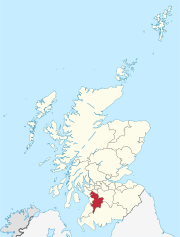
 Waterside Location within East Ayrshire | |
| Population | 141 (Census 2001) |
| Language | English |
| OS grid reference | NS485435 |
| Council area |
|
| Lieutenancy area |
|
| Country | Scotland |
| Sovereign state | United Kingdom |
| Post town | Kilmarnock |
| Postcode district | KA3 |
| Dialling code | 01560 |
| Police | Scotland |
| Fire | Scottish |
| Ambulance | Scottish |
| UK Parliament |
|
| Scottish Parliament |
|
History
The mill
Previously known as Hareshaw Mill this old carding mill dates from 1784 and has gone through a number of uses,[1] even hosting a bookshop at one point. The 1856 OS map records the location of the weir, sluice, and lade that diverted and carried water to the mill wheel from the Craufurdland Water.[2] By 1910 the OS maps show that the wollen mill was no longer in use as a mill. Part of the mill became a private dwelling.
Although built as a carding mill, Waterside Mill was later also used for weaving. The wheelpit of the mill still survives. In 1910 the building became a creamery, and then a dairy under the management of the Fenwick Farming Co-operative. Waterside village grew up because of the jobs created by the mill.[3]
The village and district

The flat topped bungalows at 28 to 30 Main Street were designed by Sam Brunton and built using new prefabrication techniques in 1943 from gyproc.[1] Hareshawmuir Lodge was originally built as an Edwardian shooting lodge, however it has been much modified.[1] It was the property of the Earl of Glasgow in 1867 and had been so since 1687. The tract of land in this areas was also known as Harelaw or Hartshaw.[4] Amlaird lies on the A719 and is a water filtration plant that treats water from the Lochgoin Reservoir, created in 1910 by the Kilmarnock Corporation from the ancient Loch Goyne.[5]
The OS map of 1856 shows that whinstone and sandstone quarries were located downstream of the mill. The old smithy, now a private dwelling, lies near the Brunton bungalows.[2] The village had a post office located at the site of the schoolhouse building that survives today as a private dwelling. In 1856 the school is shown as being located at the east side of the crossroads between Laigh and High Arness farms.[2] In 1895 the school is shown on the OS map as being close to the old post office at the site of the present community centre.[6] The present community centre was built as a school in 1823 following public subscription and the permission of George, 4th Earl of Glasgow.[1]
The 1895 OS map shows that the post office was at this time located on the west side of the main street, a few houses up from Waterside Bridge.[7]
By 1910 the OS maps show that a creamery had been established near the old woolen mill. In 1968 the primary school is still recorded, as is the creamery and a sawmill.[8] The primary school is still shown in the 1980s, however the creamery is not recorded.[9] The sawmill closed and the site is now a small housing estate.
Micro-history
On the south side of the Hareshawmuir Water are the remains of a small fort, lying close to the farm of Langdyke. It was surrounded by a turf and stone wall and sits at the point where a whin dyke crosses the burn.[5][10]
Dunton Cove is a cave on the east bank of the Craufurdland Water just below the confluence of the Dunton and Calf Fauld waters which was used as a temporary hiding place in the 17th century, the time of the Covenanters known as the 'Killing Times'.[5]
The Carlin Stone, a glacial erratic boulder, lies beside the Hareshawmuir Water near Craigends.[5]
Between 1905 and 1928 records were kept at Hareshawmuir (600 ft above sea level) of the arrival of summer migrants such as wheatear, swallow, cuckoo, corncrake, dunlin, spotted flycatcher, etc.[11]
References
- Notes
- Close, Page 126
- 6 inch OS Map Retrieved : 2012-08-03
- British Listed Buildings Retrieved : 2012-08-03
- Dobie, Page 212
- Love, Page 105
- 1895 6 inch OS Map Retrieved : 2012-08-03
- 25 inch OS Map Retrieved : 2012-08-03
- OS Map of 1968 Retrieved : 2012-08-03
- OS Map of 1980s Retrieved : 2012-08-03
- Smith, Page 96
- Paton, Page XVI to XVII
- Sources
- Close, Robert (1992). Ayrshire and Arran: An Illustrated Architectural Guide. Pub. Roy Inc Arch Scot. ISBN 1873190-06-9.
- Dobie, James D. (ed Dobie, J.S.) (1876). Cunninghame, Topographized by Timothy Pont 1604–1608, with continuations and illustrative notices. Glasgow: John Tweed.
- Love, Dane (2003). Ayrshire : Discovering a County. Ayr : Fort Publishing. ISBN 0-9544461-1-9.
- Paton, E. Richmond and Pike, Oliver G. (1929). The Birds of Ayrshire. London : H.F. & G. Witherby.
- Smith, John (1895). Prehistoric Man in Ayrshire. London : Elliot Stock.
External links
East Ayrshire | ||
|---|---|---|
Administrative centre: Kilmarnock, East Ayrshire Council Headquarters, London Road, KA3 7BU Council structure: Chief Executive: Eddie Fraser; Provost of the Council Cllr Barry Douglas; Leader of the Council Cllr Douglas Reid | ||
| Settlements |
|  |
| Secondary schools |
| |
| Members of the UK Parliament |
| |
| Members of the Scottish Parliament |
| |
| Places of interest |
| |
| Economy |
| |
| See also |
| |
Neighbouring council areas: South Ayrshire, North Ayrshire, Dumfries and Galloway, East Renfrewshire, South Lanarkshire | ||
Другой контент может иметь иную лицензию. Перед использованием материалов сайта WikiSort.org внимательно изучите правила лицензирования конкретных элементов наполнения сайта.
WikiSort.org - проект по пересортировке и дополнению контента Википедии