world.wikisort.org - United_Kingdom
Sibbertoft is a village and civil parish in West Northamptonshire in England. At the time of the 2001 census, the parish's population (including Sulby) was 343 people,[1] increasing to 462 at the 2011 Census.[2]
| Sibbertoft | |
|---|---|
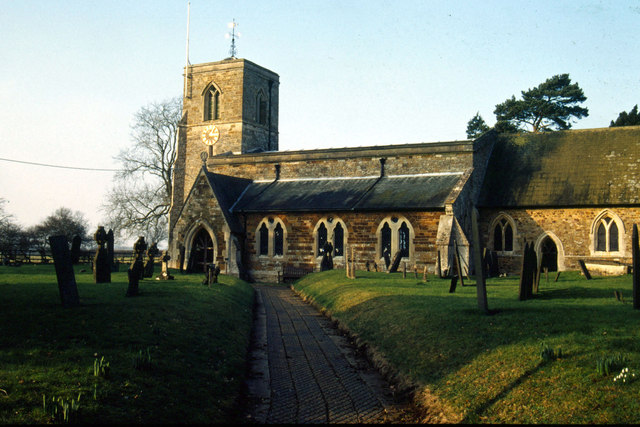 St Helen's Church, Sibbertoft | |
 Sibbertoft Location within Northamptonshire | |
| Population | 462 (2011) |
| OS grid reference | SP6882 |
| Unitary authority | |
| Ceremonial county | |
| Region | |
| Country | England |
| Sovereign state | United Kingdom |
| Post town | Market Harborough |
| Postcode district | LE16 |
| Dialling code | 01858 |
| Police | Northamptonshire |
| Fire | Northamptonshire |
| Ambulance | East Midlands |
| UK Parliament |
|
The village's name means 'curtilage of Sigebeorht' or 'curtilage of Sigbjorn'.[3]
Facilities in the village include a pub, church, recreation ground and the Sibbertoft Reading Room which is in effect the village hall.[4]
Notable buildings and monuments
The Historic England website contains details of the listed buildings in the parish of Sibbertoft. All of them are Grade II apart from the parish church, which is Grade II*.[5]
The listed buildings are:
- St Helen's Church, Church Street
- Two chest tombs and a pair of headstones in the churchyard
- The Springs, 7 Berkeley Street
- The Old School, Church Street, 1846 by Edmund Francis Law[6]
- 41 Welland Rise
There is also a scheduled monument in the parish, a motte and bailey castle known as Castle Yard.[7]
Geography
The source of the River Welland is in the parish and it issues as a spring at Spring Croft, Church Street. Sibbertoft sits astride one of the principal watersheds in England[8] and the plateau of land towards Naseby contains the sources of four rivers flowing west, south and east.
Coombe Hill Hollow, north of the village, is a Site of Special Scientific Interest.
History
There is evidence of Iron Age and Roman settlements within the civil parish.[7] Sibbertoft as a village is mentioned in the Domesday Book, under the ownership of tenant-in-chief Count Robert of Mortain, half-brother of William the Conqueror.[9]
Notable residents
- Miles Joseph Berkeley (1803 – 1889), vicar of Sibbertoft, cryptogamist and a founder of plant pathology
- Sir Edward Saunders (died 1576), Chief Justice of the Queen's Bench
- Lawrence Saunders (1519 – 1555), Marian Protestant martyr (brother of the above)
References
- Office for National Statistics: Sibbertoft CP: Parish headcounts. Retrieved 19 November 2009
- "Civil Parish population 2011". Neighbourhood Statistics. Office for Nationqal Statistics. Retrieved 9 July 2016.
- "Key to English Place-names".
- Sibbertoft Reading Room Retrieved 10 April 2011
- "Historic England – The List". Retrieved 29 September 2015.
- Pevsner, Northamptonshire, Addenda p530
- "Sibbertoft | British History Online". www.british-history.ac.uk. Retrieved 16 September 2021.
- "Sibbertoft Village Design Statement". Daventrydc.gov.uk. Daventry District Council. Retrieved 25 November 2018.
- "Sibbertoft | Domesday Book". opendomesday.org. Retrieved 16 September 2021.
External links
- Map sources for Sibbertoft
- Village website

This Northamptonshire location article is a stub. You can help Wikipedia by expanding it. |
Другой контент может иметь иную лицензию. Перед использованием материалов сайта WikiSort.org внимательно изучите правила лицензирования конкретных элементов наполнения сайта.
WikiSort.org - проект по пересортировке и дополнению контента Википедии