world.wikisort.org - United_Kingdom
Northway is a suburban area in northeast Oxford, England, just inside the Oxford ring road. It is close to Headington Hill and with it forms a ward in Oxford. It mainly consists of social housing built by Oxford City Council in the 1950s, though many houses and apartments are now in private ownership.[1]
| Northway | |
|---|---|
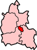
 Northway Location within Oxfordshire | |
| OS grid reference | SP538081 |
| Civil parish |
|
| District |
|
| Shire county |
|
| Region |
|
| Country | England |
| Sovereign state | United Kingdom |
| Post town | Oxford |
| Postcode district | OX3 |
| Dialling code | 01865 |
| Police | Thames Valley |
| Fire | Oxfordshire |
| Ambulance | South Central |
| UK Parliament |
|
There is a Community Centre in Dora Carr Close[2] and a Sports Centre in Maltfield Road.[3] There is a Northway Evangelical Church.[4]
To the southwest is Headley Way and to the northwest is Marsh Lane. To the northeast is the Northern Bypass of the ring road. To the southeast is the John Radcliffe Hospital, the main hospital in Oxford.
References
The City of Oxford | ||
|---|---|---|
| ||
| Wards, suburbs, neighbourhoods and districts |
|  |
| Civil parishes |
| |
| Former district and borough |
| |
| Former constituencies |
| |
| ||
This Oxfordshire location article is a stub. You can help Wikipedia by expanding it. |
Текст в блоке "Читать" взят с сайта "Википедия" и доступен по лицензии Creative Commons Attribution-ShareAlike; в отдельных случаях могут действовать дополнительные условия.
Другой контент может иметь иную лицензию. Перед использованием материалов сайта WikiSort.org внимательно изучите правила лицензирования конкретных элементов наполнения сайта.
Другой контент может иметь иную лицензию. Перед использованием материалов сайта WikiSort.org внимательно изучите правила лицензирования конкретных элементов наполнения сайта.
2019-2025
WikiSort.org - проект по пересортировке и дополнению контента Википедии
WikiSort.org - проект по пересортировке и дополнению контента Википедии