world.wikisort.org - United_Kingdom
Murcott is a village between the River Ray and Otmoor in the civil parish of Fencott and Murcott, about 4 miles (6.4 km) south of Bicester in Oxfordshire, England.
| Murcott | |
|---|---|
 | |
 Murcott Location within Oxfordshire | |
| OS grid reference | SP584158 |
| Civil parish |
|
| District |
|
| Shire county |
|
| Region |
|
| Country | England |
| Sovereign state | United Kingdom |
| Post town | Kidlington |
| Postcode district | OX5 |
| Dialling code | 01865 |
| Police | Thames Valley |
| Fire | Oxfordshire |
| Ambulance | South Central |
| UK Parliament |
|
| Website | Fencott and Murcott Parish Council |
History
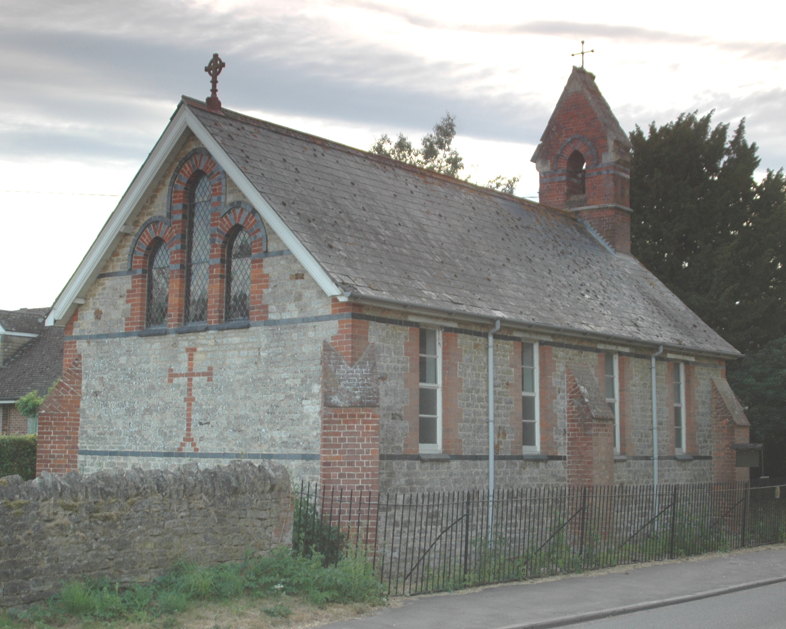
In 1542 the Crown granted almost all of the land at Murcott to the Dean and Chapter of Westminster Abbey.[1] They retained it until the end of the 19th century, when it passed to the Ecclesiastical Commissioners.[1] Murcott Mission Room was built in 1895 to a plain Early English design by local Gothic Revival architect A. Mardon Mowbray.[2] The Mission Room is a Church of England chapel, part of the Benefice of the Ray Valley.[3] The Nut Tree Inn public house is a mid-18th century thatched building.[1] It is a gastropub and in 2009 was awarded a Michelin Star.[4] Murcott used to have a second pub, the Marlake House, but this had closed by 1939.[1]
References
Sources
- Lobel, Mary D, ed. (1959). A History of the County of Oxford, Volume 6. Victoria County History. pp. 80–92.
- Sherwood, Jennifer; Pevsner, Nikolaus (1974). Oxfordshire. The Buildings of England. Harmondsworth: Penguin Books. p. 713. ISBN 0-14-071045-0.
External links
![]() Media related to Murcott, Oxfordshire at Wikimedia Commons
Media related to Murcott, Oxfordshire at Wikimedia Commons
The District of Cherwell | ||
|---|---|---|
| ||
| Towns |
|  |
| Large villages | ||
| Other civil parishes (component villages and hamlets) |
| |
| Former districts and boroughs |
| |
| Former constituencies |
| |
| ||
This Oxfordshire location article is a stub. You can help Wikipedia by expanding it. |
Другой контент может иметь иную лицензию. Перед использованием материалов сайта WikiSort.org внимательно изучите правила лицензирования конкретных элементов наполнения сайта.
WikiSort.org - проект по пересортировке и дополнению контента Википедии