world.wikisort.org - United_Kingdom
Llanfairfechan ("Little St Mary's Parish") is a town and community in the Conwy County Borough, Wales. It is known as a seaside resort and had a population at the 2001 Census of 3,755,[2] reducing to 3,637 at the 2011 Census. The history of the area dates back to at least Roman times, as demonstrated by the discovery of a large second century milestone, which is now preserved in the British Museum.[3]
| Llanfairfechan | |
|---|---|
 A view over Llanfairfechan | |
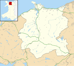 Llanfairfechan Location within Conwy | |
| Population | 3,637 (2011)[1] |
| OS grid reference | SH683747 |
| Community |
|
| Principal area |
|
| Ceremonial county |
|
| Country | Wales |
| Sovereign state | United Kingdom |
| Post town | LLANFAIRFECHAN |
| Postcode district | LL33 |
| Dialling code | 01248 |
| Police | North Wales |
| Fire | North Wales |
| Ambulance | Welsh |
| UK Parliament |
|
| Senedd Cymru – Welsh Parliament |
|
Political boundary
It was in Gwynedd from 1972 to 1996, and prior to that was in Caernarfonshire. For ceremonial and electoral boundary purposes it was transferred from the preserved county of Gwynedd to that of Clwyd in 2003. [citation needed]For electoral purposes, the community of Llanfairfechan consists of three electoral wards, Bryn, Lafan and Pandy.
Transport connections
The town lies on the north coast on the route of the A55 road, between Penmaenmawr and Bangor. It has a railway station on the North Wales Coast Line. It, however, is in the unusual situation where there is only one public road that connects it with the remainder of the Great British road network, which is the A55 road North Wales Expressway.
Local interest and trivia
Morfa Madryn, the salt marsh area immediately west of the town on the shore of Traeth Lafan, is a local authority-managed nature reserve of outstanding beauty and a favourite haunt of bird watchers. The site is home to cormorants and shags. The rare little egret can also be spotted. It is also not far from Aber Falls.
Llanfairfechan is also home to Bryn y Neuadd Hospital, a learning disability facility, a mental health unit (Carreg Fawr) and a medium-secure unit (Tŷ Llywelyn). The site, Bryn Y Neuadd, is also home to the control centres for both the Emergency and Non-Emergency Ambulance services for the north.
Llanfairfechan was judged North Wales Calor Village of the Year for 2009 in the competition run by Calor Gas UK[4]
The earlier Llanfairfechan Golf Club was founded in 1909. This club continued until the early 1950s. There is still a golf club operating in the town under the same name.[5]
The town is also referred to by the younger generation as the 'TDLA' which means 'The Double LA'. This nickname is derived from the towns first three letters 'Lla-nfairfechan' and came into use around the early 2000s.
Welsh language
According to the 2011 Census, 45.3% of the population of the town can speak Welsh.[6] 66.2% of the town's population who were born in Wales noted that they could speak the language.[7]
The two schools situated in Llanfairfechan, Ysgol Pant-y-Rhedyn and Ysgol Babanod Llanfairfechan, are categorized as being predominantly English-medium schools but with significant use of Welsh.[8][9]
Town twinning
In 2011, the process of town-twinning between Llanfairfechan and Pleumeleuc was completed over the first weekend of June. A number of events were held over the weekend, including trips to local attractions and guided tours around Llanfairfechan itself.[10] In April 2012, 25 Llanfairfechan teenagers visited Pleumeleuc.
Climate
| Climate data for Llanfairfechan 40m amsl (1981–2010) | |||||||||||||
|---|---|---|---|---|---|---|---|---|---|---|---|---|---|
| Month | Jan | Feb | Mar | Apr | May | Jun | Jul | Aug | Sep | Oct | Nov | Dec | Year |
| Average high °C (°F) | 9.0 (48.2) |
8.7 (47.7) |
10.3 (50.5) |
12.2 (54.0) |
15.0 (59.0) |
17.6 (63.7) |
19.5 (67.1) |
19.4 (66.9) |
17.5 (63.5) |
14.5 (58.1) |
11.5 (52.7) |
9.4 (48.9) |
13.7 (56.7) |
| Daily mean °C (°F) | 6.2 (43.2) |
5.9 (42.6) |
7.4 (45.3) |
9.0 (48.2) |
11.6 (52.9) |
14.2 (57.6) |
16.1 (61.0) |
16.1 (61.0) |
14.4 (57.9) |
11.6 (52.9) |
8.8 (47.8) |
6.6 (43.9) |
10.7 (51.2) |
| Average low °C (°F) | 3.4 (38.1) |
3.0 (37.4) |
4.4 (39.9) |
5.8 (42.4) |
8.2 (46.8) |
10.8 (51.4) |
12.7 (54.9) |
12.8 (55.0) |
11.3 (52.3) |
8.7 (47.7) |
6.1 (43.0) |
3.7 (38.7) |
7.6 (45.6) |
| Average rainfall mm (inches) | 113.4 (4.46) |
77.8 (3.06) |
86.4 (3.40) |
62.9 (2.48) |
60.8 (2.39) |
65.5 (2.58) |
58.7 (2.31) |
84.7 (3.33) |
97.7 (3.85) |
125.7 (4.95) |
135.1 (5.32) |
131.0 (5.16) |
1,099.7 (43.29) |
| Average rainy days (≥ 1.0 mm) | 14.7 | 11.8 | 12.5 | 11.0 | 11.1 | 9.9 | 9.7 | 11.8 | 12.0 | 14.9 | 16.3 | 15.0 | 150.7 |
| Mean monthly sunshine hours | 41.6 | 68.7 | 104.1 | 159.8 | 213.5 | 181.5 | 185.8 | 170.8 | 133.0 | 97.3 | 49.3 | 37.6 | 1,443 |
| Source: Met Office[11] | |||||||||||||
Gallery
 Colourised Photochrom print (circa the late 19th century) of seafront and Penmaenmawr mountain
 A similar view in 1989 during more overcast weather
 The town in 2007
 The beach
 Christ Church (Church in Wales)
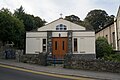 St Mary of the Angels Catholic Church


References
- "Community population 2011". Retrieved 14 May 2015.
- 2001 Census: Llanfairfechan, Office for National Statistics, retrieved 19 March 2009
- British Museum Highlights
- "Llanfairfechan crowned N.Wales finest village". Retrieved 23 June 2011.
- “Llanfairfechan Golf Club”, “Golf’s Missing Links”.
- "Community Council Profiles - Llanfairfechan" (PDF). Snowdonia National Park. Snowdonia National Park. 2011. Retrieved 9 November 2016.
- "LC2206WA (Welsh language skills by country of birth by age) - Nomis - Official Labour Market Statistics". www.nomisweb.co.uk. Retrieved 23 January 2018.
- "Ysgol Babanod Llanfairfechan". My Local School. Welsh Government. Retrieved 9 November 2016.
- "Ysgol Pant Y Rhedyn". mylocalschool.wales.gov.uk. Retrieved 23 January 2018.
- "Programme of events for town twinning visit". Retrieved 23 June 2011.
- "Llanfairfechan Climate Period: 1981–2010". Met Office. Retrieved 6 November 2018.
External links
- https://catholicchurchllanfairfechan.webs.com/
- https://www.parishcommunity.org/
- http://www.llandudno-catholic-church.org.uk/
- A Vision of Britain Through Time
- British Listed Buildings
- Genuki
- Geograph
- Llanfairfechan Town Council website
- Llanfairfechan's Community Web Portal
- Office for National Statistics
Conwy County Borough | ||
|---|---|---|
| Principal settlements |
|  |
| Other towns and villages |
| |
| Communities |
| |
| Rivers | ||
| Castles and forts |
| |
| Headlands |
| |
| Topics |
| |
Authority control | |
|---|---|
| General | |
| National libraries | |
| Other |
|
Другой контент может иметь иную лицензию. Перед использованием материалов сайта WikiSort.org внимательно изучите правила лицензирования конкретных элементов наполнения сайта.
WikiSort.org - проект по пересортировке и дополнению контента Википедии